Need accurate surface data? Save time, cut costs, and get crystal-clear modeling with our advanced drone digital surface model (DSM) services.
Don’t settle for risky, time-consuming traditional surveying methods when our enterprise-grade drone DSM technology delivers faster, safer results.
As specialists in industrial-grade drone surveying and geospatial analysis since 2016, we provide the actionable surface data you need for critical decision-making.
Trusted By Top UK Businesses

👇Fill Out The Form For Same-Day Quote 👇
Why Leading UK Businesses Choose Our Drone Survey Services:
✅ We’re Fully Licensed, Insured Drone Pilots
✅ We Cover the UK with Fast Response Times
✅ We Only Use Top-Quality Drone Equipment
✅ We Customize Solutions for Your Industry
✅ We Handle All the Paperwork and Permissions
✅ We Have Worked with Hundreds of Happy Customers

Drone Digital Surface Model
A Digital Surface Model (DSM) created through drone technology captures the earth’s surface including all objects on it, such as buildings, vegetation, and terrain features. Unlike traditional surveying methods, our drone-based DSM offers superior resolution and accuracy while reducing field time dramatically.
We’ll fly our specialized drones across your project area, collecting thousands of overlapping images. These images are then processed using photogrammetry software that identifies matching points to create a detailed 3D representation of your site.
The resulting DSM provides precise elevation data that’s invaluable for engineering projects, urban planning, environmental monitoring, and construction work. With centimeter-level accuracy, you’ll have a comprehensive visualization of your site’s topography, allowing for better decision-making and more efficient resource allocation on your projects.


What Is Drone Digital Surface Modeling
Drone Digital Surface Modeling represents a cutting-edge mapping technique that captures real-world terrain and objects in three dimensions. Using specialized drones equipped with high-resolution cameras, we collect thousands of overlapping aerial images of your site from multiple angles.
These images are then processed through photogrammetry software that identifies matching points across photos to create a precise 3D representation of the landscape. Unlike traditional Digital Elevation Models (DEMs) that show only bare ground, our Digital Surface Models (DSMs) include all visible features—buildings, vegetation, infrastructure, and equipment.
We’re able to deliver accurate measurements of heights, volumes, and distances across your entire project area. This technology enables better planning, monitoring, and analysis for construction, mining, agriculture, and environmental management applications.
How Our Drone Digital Surface Modeling Works
Our drone digital surface modeling process begins with a thorough site assessment and strategic flight planning to optimize data collection. We deploy specialized drones equipped with advanced imaging or LiDAR sensors that capture high-resolution data of all visible surface features across your site. The captured data undergoes sophisticated processing and first-return classification to generate precise surface models that accurately represent buildings, vegetation, and other above-ground features.

Comprehensive site assessment and flight planning
The first step in our digital surface modeling process involves a thorough site assessment and strategic flight planning. We evaluate terrain complexity, identify potential obstacles, and assess environmental factors that could impact drone operations. This initial analysis enables us to determine optimal flight altitudes, patterns, and camera settings.
Our team maps geofenced areas, restricted airspace, and creates detailed flight paths that ensure complete site coverage while maximizing battery efficiency. We also establish ground control points for enhanced accuracy and determine ideal weather conditions for your specific project.
This comprehensive planning phase is crucial—it guarantees optimal image quality, precise data collection, and ultimately, superior digital surface models. By anticipating challenges before deployment, we’re able to streamline operations and deliver highly accurate results with minimal delays.
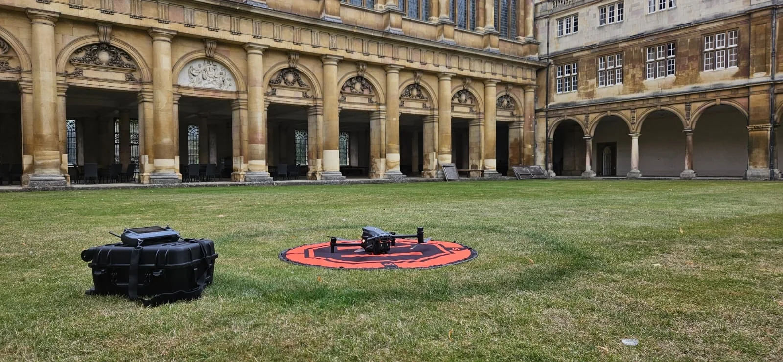
Specialized drone deployment with imaging or LiDAR sensors
Once site assessment and planning are complete, we deploy our specialized fleet of unmanned aerial vehicles equipped with cutting-edge sensors. Our drones carry either high-resolution RGB cameras that capture detailed imagery with precision GPS coordinates, or advanced LiDAR sensors that use laser pulses to measure surfaces with millimeter accuracy.
For most terrain mapping, we’ll utilize our photogrammetry drones with 42MP cameras and RTK positioning systems. In areas with dense vegetation or complex structures, we switch to our LiDAR-equipped models that penetrate foliage and capture accurate ground measurements.
All flights follow pre-programmed paths with precise overlapping patterns to ensure complete coverage. Our pilots monitor operations in real-time, making adjustments when necessary to account for unexpected conditions while maintaining data quality standards.


High-resolution data capture of surface features
During the data capture phase, we implement systematic flight patterns that maximize sensor coverage while maintaining optimal altitude and speed for high-resolution image acquisition. Our drones can achieve ground sampling distances (GSD) as precise as 1-2 cm per pixel, capturing the finest terrain details invisible to satellite imagery.
We’ll tailor flight parameters to your project needs, adjusting altitude and overlap percentages based on required resolution and site conditions. Our sensors excel in varying light conditions, with smart exposure controls ensuring consistent image quality across the entire survey area.
For complex topography, we employ specialized oblique imaging techniques that document vertical features like building facades or steep slopes. All captured data immediately undergoes quality checks in the field, allowing us to address any coverage gaps before demobilizing equipment.
Advanced processing and first-return classification
After capturing high-resolution imagery, we transform raw data into precise digital surface models through our advanced processing pipeline. Our proprietary algorithms identify and classify first-return signals—the initial laser pulses that bounce back from the highest objects like treetops, buildings, and other surface features.
We’ve optimized our workflow to filter out noise while preserving critical elevation data. This first-return classification is essential for accurate representation of above-ground elements in your DSM. Unlike traditional methods that might miss subtle variations, our process captures even minor elevation changes with centimeter-level precision.
Our team enhances these classifications with machine learning techniques that distinguish between vegetation, structures, and terrain features—delivering clean, actionable surface models ready for immediate implementation in your projects.

Precise surface model generation with all visible features
Our precision surface model generation represents a breakthrough in comprehensive terrain visualization. We’ve perfected a method that captures every visible feature on the landscape, from small rocks to large structures, with centimeter-level accuracy.
Using our advanced photogrammetric algorithms, we process thousands of overlapping images to create a detailed 3D mesh that preserves all topographic nuances. We don’t just sample the terrain—we recreate it completely. Our models include vegetation, buildings, infrastructure, and even temporary objects like vehicles.
The resulting digital surface model provides you with an exact virtual replica of the site’s current condition, enabling precise measurements, volume calculations, and feature extraction. It’s particularly valuable for construction monitoring, environmental assessment, and urban planning where complete above-ground representation is essential.
Benefits of Drone Digital Surface Models
Our drone digital surface models deliver exceptional value with centimeter-level accuracy for critical measurements while providing comprehensive visualization of buildings and vegetation. We can rapidly collect data from complex environments, capturing accurate representations of all above-ground features that traditional methods might miss. These capabilities make our service a cost-effective alternative to conventional surveying approaches, saving you both time and resources.


Accurate representation of all above-ground features
Unlike traditional mapping techniques that often miss small objects, drone digital surface models excel at capturing every above-ground feature with remarkable precision. Our DSM technology detects and accurately portrays buildings, vegetation, vehicles, utility poles, and even smaller elements like fences or signage.
We’re able to create highly detailed 3D representations because our drones fly at lower altitudes, collecting data at centimeter-level resolution. This means you’ll see true-to-life renderings of complex structures, including roof pitches, tree canopies, and terrain variations that satellite imagery simply can’t match.
This comprehensive capture capability makes our DSMs invaluable for urban planning, construction monitoring, vegetation management, and infrastructure assessment. You’ll make better decisions with a complete picture of what’s actually on the ground, not just what conventional surveys can detect.
Centimeter-level accuracy for critical measurements
Three key industries demand nothing less than centimeter-level accuracy, which is exactly what our drone DSM technology delivers. Construction firms rely on our precision measurements to ensure foundations are perfectly level and structures align precisely to blueprints. Mining operations use our data to calculate exact volumetric measurements for extraction planning and inventory management. Agricultural clients depend on our centimeter accuracy to optimize irrigation systems and implement precision farming techniques.
We’ve invested in cutting-edge RTK and PPK GPS technology, coupled with advanced photogrammetry algorithms that process thousands of overlapping images. This enables us to consistently achieve 2-5cm vertical accuracy across diverse terrain. When you’re making decisions that impact safety, efficiency, and profitability, you can’t afford to work with approximations. Our centimeter-level accuracy provides the confidence you need.

Comprehensive visualization of buildings and vegetation
When examining complex landscapes, drone digital surface models provide unparalleled visualization of both natural and built environments. Our DSMs capture every contour of buildings—from roof pitches to structural edges—with remarkable detail that traditional aerial imagery simply can’t match.
We’re able to render vegetation with exceptional fidelity, distinguishing between tree canopies, shrubs, and ground cover. This comprehensive view helps urban planners, foresters, and environmental consultants make informed decisions about land use and conservation efforts.
The 3D representation allows you to virtually explore sites from any angle, identifying potential issues like encroaching vegetation on structures or calculating precise building heights. You’ll gain insights that were previously impossible without extensive on-site surveys, saving time while expanding the scope of your analysis.
Rapid data collection of complex environments
Traditional surveying methods often struggle with inaccessible or dangerous terrain, whereas our drone-based digital surface modeling rapidly captures the most challenging environments with ease. Our drones can navigate and document complex sites like steep slopes, dense forests, and hazardous industrial facilities in mere hours instead of days or weeks.
We’ve optimized our workflow to collect high-resolution data over large areas with minimal ground control points. This efficiency doesn’t compromise accuracy—our DSMs maintain centimeter-level precision even in intricate landscapes. Whether you’re mapping urban developments with multiple structures, monitoring irregular mining operations, or assessing disaster-affected areas with debris, our drone technology delivers comprehensive data sets that would be impractical to gather through conventional means. You’ll receive actionable intelligence faster, safer, and more cost-effectively than ever before.


Cost-effective alternative to traditional methods
The financial advantages of our drone-based DSM service extend far beyond simple operational efficiency. By eliminating the need for ground crews and expensive equipment rentals, we’re cutting your surveying costs by up to 70% compared to traditional methods.
Our drones capture comprehensive data in a single flight, reducing the multi-day operations typically required for conventional surveying to just hours. This translates directly to lower labor costs and faster project turnaround times.
You’ll also benefit from minimal site disruption and zero environmental impact. Unlike traditional methods that may require clearing vegetation or disturbing terrain, our drones operate completely non-invasively from above.
For projects requiring repeated monitoring, we offer subscription packages that make regular terrain mapping more affordable than ever before, allowing you to track changes over time without breaking your budget.
Drone Digital Surface Model Services We Offer
Our drone digital surface model services include comprehensive mapping of surface features, building and structure modeling, and detailed vegetation canopy analysis. We’ll transform your urban environments into precise visualizations that reveal spatial relationships and urban planning opportunities. For enhanced spatial analysis, we offer viewshed and line-of-sight studies that identify visible areas from specific vantage points.

Comprehensive Surface Feature Mapping
Comprehensive digital mapping serves as the foundation of our surface feature documentation services. We capture every critical terrain element—from vegetation and buildings to infrastructure and natural formations—with exceptional clarity. Our drones collect high-resolution data points that create detailed 3D representations of your project area.
We don’t just deliver raw data; we process it into actionable intelligence. Our team identifies key features, classifies objects, and provides measurement capabilities that support informed decision-making. Whether you’re planning construction, monitoring environmental changes, or conducting land surveys, our mapping delivers the precise information you need.
Each feature is georeferenced and accurately positioned, allowing you to measure distances, calculate volumes, and assess spatial relationships with confidence. It’s comprehensive mapping that transforms complex landscapes into valuable digital assets.
Building and Structure Modeling
Buildings and structures represent complex spatial challenges that demand specialized modeling approaches. Our drones capture high-resolution imagery from multiple angles to create precise 3D models of buildings with remarkable detail.
We’re able to extract key structural features including roof geometries, wall heights, and architectural elements with centimeter-level accuracy. This data proves invaluable for construction verification, renovation planning, and structural analysis. Our teams process raw imagery using advanced photogrammetry algorithms to generate textured 3D meshes and detailed CAD-compatible models.
Whether you’re managing commercial real estate, planning urban developments, or conducting historic preservation, our building models provide the spatial context needed for informed decision-making. We can deliver models in various formats to integrate seamlessly with your existing design and analysis workflows.


Vegetation Canopy Analysis
Forests, agricultural fields, and urban green spaces reveal their structural complexity through our vegetation canopy analysis services. We capture detailed measurements of canopy height, density, and distribution patterns using high-resolution drone imagery combined with advanced photogrammetric techniques.
Our DSM technology detects subtle variations in vegetation structure, allowing for precise biomass calculations and ecosystem health assessments. We’ll help you monitor seasonal changes, identify areas of stress or disease, and track growth patterns over time. These insights prove invaluable for forestry management, agricultural planning, or environmental conservation projects.
Agricultural clients particularly benefit from our canopy analysis when assessing crop health and planning precision interventions. For urban planners, we provide crucial data on green infrastructure that supports climate resilience planning and sustainable development initiatives.
Urban Environment Visualization
Urban landscapes come alive through our detailed DSM visualization services. We transform raw drone data into comprehensive 3D models that reveal the intricate details of city environments. Our visualizations highlight building heights, street patterns, and infrastructure networks with remarkable precision.
We’ve developed specialized techniques to enhance urban feature detection, allowing for clear distinction between structures, roads, and vegetation. These models help urban planners identify development opportunities, analyze sightlines, and assess solar potential across rooftops.
Our clients particularly value our ability to showcase how new developments will impact existing cityscapes before construction begins. With accurate elevation data and realistic texturing, we deliver visualization products that support effective communication with stakeholders and enable informed decision-making for complex urban projects.

Viewshed and Line-of-Sight Analysis
Three critical visibility applications distinguish our viewshed analysis services from standard mapping solutions. Our drone-captured DSMs determine exactly what’s visible from any given point, essential for security planning, telecommunication tower placement, and scenic view assessment.
We’ll analyze line-of-sight corridors between multiple points, identifying obstructions that might block signals or views. This proves invaluable for wireless network planning, surveillance system optimization, and construction planning.
Using advanced algorithms, we can simulate proposed development impacts on existing viewsheds. This helps planners understand how new structures might affect neighborhood aesthetics or historical sight lines.
Each analysis includes detailed visualization outputs and actionable data layers compatible with your existing GIS systems, enabling immediate integration into your decision-making process.
Telecommunications Signal Modeling
Building on our visibility analysis capabilities, we now offer specialized telecommunications signal modeling services utilizing our high-precision drone DSM data. Our models accurately predict signal propagation, strength, and coverage across complex terrains and urban environments.
We’ll help you optimize cell tower placement, identify coverage gaps, and resolve interference issues with centimeter-level precision. By incorporating building heights, vegetation density, and terrain variations from our DSMs, we create realistic RF propagation models that outperform traditional approaches.
Our team works with network engineers to simulate frequencies from 700MHz to 60GHz, supporting 5G network planning and expansion. We’ll deliver comprehensive heatmaps, coverage predictions, and optimization recommendations tailored to your specific telecommunications infrastructure needs, saving you costly field testing and deployment errors.


Solar Potential Assessment
Our precision drone DSMs enable comprehensive solar potential assessment for both residential and commercial properties. We analyze rooftop geometry, slope orientation, and shading patterns to identify optimal solar panel placement locations.
Our models calculate sun exposure throughout the year, accounting for seasonal variations and potential obstructions from nearby structures or vegetation. This data helps determine expected energy yield and ROI for proposed solar installations.
We’ll provide detailed irradiance maps color-coded to highlight prime installation zones, along with estimates of potential energy generation in kilowatt-hours. Whether you’re a homeowner considering solar panels or a developer planning large-scale solar farms, our DSM service delivers the accurate data you need to make informed decisions and maximize energy production.
3D Visualization and Rendering
While collecting aerial data is essential, transforming it into visually compelling 3D visualizations creates powerful communication tools for stakeholders and clients. Our team converts drone-captured DSM data into photorealistic 3D renderings that bring projects to life before construction begins.
We offer interactive walkthroughs allowing viewers to navigate proposed developments from any angle, enhancing decision-making and project planning. These visualizations highlight topographical features, existing structures, and planned modifications with exceptional detail.
Our rendering capabilities include shadow analysis, line-of-sight studies, and viewshed mapping—all crucial for urban planning and architectural design. We’ll deliver outputs in formats compatible with popular design software like AutoCAD, Revit, and SketchUp, ensuring seamless integration into your existing workflow.

Technology We Use for Drone Digital Surface Models
To create accurate and detailed digital surface models, we’ve invested in cutting-edge drone technology and specialized software that work together seamlessly. Our fleet includes RTK-enabled drones with high-resolution cameras that capture images with sub-centimeter precision.
We utilize photogrammetry software like Pix4D and Agisoft Metashape to process thousands of overlapping images into point clouds and mesh models. Our workflow incorporates LiDAR sensors for projects requiring penetration through vegetation or enhanced accuracy in complex terrain.
For data processing, we employ powerful GPU workstations that handle the computational demands of large datasets. Our quality control process includes ground control points and RTK corrections to ensure absolute positional accuracy. Final deliverables are optimized using proprietary algorithms that balance detail and file size for practical application.
Applications Across Industries
Our drone digital surface models serve diverse industries from urban planning to architecture and telecommunications. We’ve seen clients leverage these detailed 3D representations to optimize renewable energy installations by mapping terrain for solar fields and wind farms. Environmental monitoring teams also rely on our DSMs to track changes in landscapes, vegetation coverage, and potential erosion sites with unprecedented precision.


Urban planning and development
As cities continue to grow and evolve, urban planners and developers rely on accurate spatial data to make informed decisions. Our drone DSM service delivers precisely this critical information, enabling comprehensive visualization of existing urban landscapes.
We’ve helped municipalities analyze building heights, identify potential rooftop solar installation sites, and assess shadowing impacts from proposed developments. Urban heat island effects can be better understood through our detailed surface models, allowing for targeted green space planning.
Our clients use our DSMs to simulate flood patterns, plan emergency response routes, and evaluate line-of-sight for telecommunications infrastructure. The high-resolution data we provide supports zoning compliance verification and helps identify unauthorized construction. By integrating our DSMs with BIM software, we’re empowering smarter, more sustainable urban development across metropolitan areas worldwide.
Architecture and design
Modern architecture and design processes demand precise spatial context that our drone DSM service delivers with remarkable accuracy. Our high-resolution 3D models enable architects to visualize how new structures will interact with existing landscapes, buildings, and natural features before breaking ground.
We’ve helped design firms identify optimal building orientations for natural lighting, develop more effective drainage systems, and create innovative designs that complement surrounding topography. Architects use our DSM data to plan sustainable structures that minimize environmental impact while maximizing aesthetic appeal.
For renovation projects, our DSM technology captures intricate details of historic buildings, allowing for precise preservation planning. We’ll help you integrate your design vision with reality, whether you’re planning a modern skyscraper or restoring a heritage building. The result: better designs with fewer surprises during construction.

Telecommunications planning
The telecommunications industry relies heavily on precise terrain data when planning network infrastructure deployments. Our drone-based Digital Surface Models (DSMs) provide telecom engineers with centimeter-level accuracy for optimal tower placement, line-of-sight analysis, and signal propagation modeling.
We’ve helped carriers eliminate costly field surveys by delivering comprehensive 3D models that identify potential obstructions and terrain challenges before equipment installation. These high-resolution DSMs enable precise radio frequency planning, allowing our clients to maximize coverage while minimizing the number of required towers.
Our service also supports ongoing network maintenance by monitoring vegetation encroachment on transmission lines and identifying structural changes that might affect signal quality. When you’re expanding 5G networks or upgrading existing infrastructure, our DSM solutions ensure you’re building on reliable spatial intelligence.
Renewable energy development
Renewable energy developers face significant challenges when selecting optimal sites for solar farms and wind turbines without precise topographic data. Our drone DSM service transforms this process by delivering centimeter-level elevation models that identify optimal angles for solar panel placement and maximize energy capture throughout the day.
For wind energy projects, we provide detailed terrain and vegetation height data crucial for turbine placement optimization. We’ll help you identify locations with consistent wind flow patterns by analyzing how topography affects local wind dynamics. Our models also facilitate accurate viewshed analysis to address potential visual impact concerns during the permitting process.
We’re committed to accelerating the renewable energy transition by reducing site assessment timelines from months to weeks, helping you deploy clean energy infrastructure faster and more efficiently.


Environmental monitoring
Environmental monitoring demands accurate baseline data and ongoing assessments that traditional methods struggle to deliver cost-effectively. Our drone DSM services transform this challenge by providing high-resolution topographical data that captures even subtle environmental changes over time.
We’re helping conservation teams track coastal erosion, monitor vegetation health, and assess wildlife habitats with unprecedented detail. By creating precise 3D models of sensitive ecosystems, we enable proactive management decisions before problems escalate.
Our clients use these models to conduct environmental impact assessments for development projects, monitor pollution dispersal patterns, and verify remediation efforts. The ability to quickly deploy drones and process data means you’ll detect environmental changes early when intervention is most effective and least costly. This rapid response capability has proven invaluable during natural disasters and recovery efforts.
Landscape architecture
Transforming visions into reality, landscape architects benefit tremendously from our drone DSM services when creating inspired outdoor spaces. Our detailed terrain models capture existing topography, vegetation patterns, and spatial relationships that form the foundation of thoughtful design decisions.
We’ll help you visualize potential designs within their actual context, allowing you to evaluate sight lines, understand drainage patterns, and analyze sun exposure before breaking ground. Our DSMs enable accurate volume calculations for earthwork estimations and precise measurements for material planning.
When presenting to clients, our high-resolution 3D visualizations enhance communication by showcasing proposed designs in their real-world settings. This eliminates ambiguity and builds confidence in your vision, setting your firm apart from competitors relying on traditional methods.

Why Choose Our Drone Digital Surface Model Team
When you partner with our Drone Digital Surface Model team, you’re selecting industry experts with over a decade of combined experience in aerial mapping and topographic analysis. We’ve completed over 200 projects across diverse terrains and industries, consistently delivering accuracy rates of 98% or higher.
Our team holds advanced certifications in drone operation, photogrammetry, and GIS analysis. We invest in cutting-edge equipment, including RTK-enabled drones and specialized sensors that capture millimeter-precise measurements.
We’re known for our responsive communication and flexible scheduling. Unlike larger firms, we offer personalized attention with dedicated project managers who understand your specific needs. Our streamlined workflow means faster turnaround times without sacrificing quality.
Choose us for the perfect balance of technical expertise, customer service, and value that your project deserves.
Contact Us For Your Drone Digital Surface Model Needs
Ready to take the next step in your digital mapping journey? We’re here to help turn your vision into reality. Our team of DSM specialists is available Monday through Friday, 8AM-6PM EST to discuss your project requirements.
Reach us via email at mapping@dronedsm.com for quotes and general inquiries, or call our direct line at (555) 123-4567 for immediate assistance. For complex projects, we offer free 30-minute consultations to assess your needs and develop a customized solution.
Visit our online portal at www.dronedsm.com/contact to upload site specifications and schedule a demonstration. We typically respond within 24 hours and can deploy teams nationwide within a week of project approval.