Need accurate terrain mapping? Save time, cut costs, and get crystal-clear data with our advanced drone topographical land survey services.
Don’t settle for risky, time-consuming traditional surveys when our enterprise-grade drone technology delivers faster, safer topographical results.
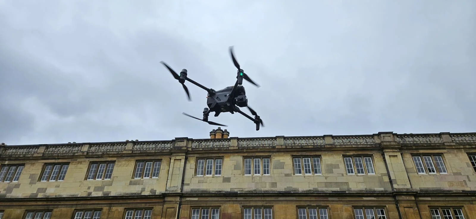
As specialists in industrial-grade drone surveying and terrain mapping since 2016, we provide the actionable topographical data you need for critical decision-making.
Used By Top UK Businesses

👇Fill Out The Form For Same-Day Quote 👇
Why Leading UK Businesses Choose Our Drone Survey Services:
✅ We’re Fully Licensed, Insured Drone Pilots
✅ We Cover the UK with Fast Response Times
✅ We Only Use Top-Quality Drone Equipment
✅ We Customize Solutions for Your Industry
✅ We Handle All the Paperwork and Permissions
✅ We Have Worked with Hundreds of Happy Customers


What Is Drone Topographical Land Surveying
A drone topographical survey is a method of mapping the surface of the land using an unmanned aerial vehicle (UAV) equipped with high-resolution cameras and GPS. The drone captures overlapping aerial images, which are processed using photogrammetry software to create accurate 2D maps and 3D models. These maps show details such as terrain elevations, contours, vegetation, buildings, and other features.
Compared to traditional surveying methods, drone surveys are much faster, safer, and often more cost-effective. They are especially useful for covering large or difficult-to-access areas without disrupting the site.
This type of survey is widely used in construction, civil engineering, land development, and environmental monitoring.

How Our Drone Topographical Land Surveys Work
Our drone topographical land survey process encompasses five critical phases from initial site assessment through final terrain modeling. We deploy survey-grade drones to systematically capture aerial data, incorporating ground control points for exceptional accuracy. The captured information undergoes advanced processing to produce precise contour maps and feature identification that meets industry standards.

Comprehensive site assessment and survey planning
Before any drone takes flight, we conduct a thorough site assessment and develop a customized survey plan tailored to your project’s specific requirements. This crucial first step involves analyzing terrain complexity, identifying potential obstacles, and determining optimal flight paths for maximum data accuracy.
Our team evaluates environmental conditions, including weather patterns and nearby infrastructure that might affect drone operations. We’ll establish ground control points for georeferencing and determine the ideal flight altitude and camera settings based on your desired resolution and coverage area.
We’ll also verify all necessary permits and regulatory compliance for your location. This methodical planning ensures we capture precise, comprehensive data efficiently while minimizing risks and avoiding costly resurveys. Our detailed flight plans incorporate redundancy to guarantee complete coverage of your project area.
Specialized drone deployment with survey-grade equipment
When it comes to gathering precise topographical data, we deploy our fleet of specialized survey drones equipped with industry-leading technology. Our aircraft feature RTK (Real-Time Kinematic) GPS systems that achieve centimeter-level accuracy, eliminating the need for extensive ground control points.
We’ve invested in high-resolution cameras and LiDAR sensors that capture detailed imagery even in challenging terrain. These sensors collect millions of data points during each flight, creating dense point clouds that form the foundation of accurate topographical models.
Our pilots are CAA-certified professionals who operate the drones following predetermined flight paths. We carefully select optimal flight altitudes and speeds to maximize data quality while ensuring complete coverage of your site. The result is comprehensive, survey-grade data collection that’s faster and more cost-effective than traditional ground-based methods.


Systematic aerial data capture with ground control points
To ensure maximum accuracy across your entire survey site, we implement a systematic approach that combines aerial data capture with strategically placed ground control points (GCPs).
We begin by mapping your site and establishing a grid pattern for our flight paths. This ensures comprehensive coverage with appropriate overlap between images. Before drone deployment, our technicians place high-visibility GCPs at precise locations, which we survey using RTK GPS equipment for centimeter-level accuracy.
During flight, our drones capture hundreds of high-resolution images following pre-programmed routes. The on-board sensors record exact coordinates for each photo, while simultaneously collecting LiDAR or photogrammetric data depending on your project requirements.
This methodical process creates a robust dataset where every captured point has verified spatial accuracy, eliminating the distortions common in traditional aerial surveys.
Advanced processing and terrain modeling
After collecting comprehensive aerial data, our expert technicians transform the raw imagery and point clouds into highly accurate terrain models through our advanced processing workflow. We employ photogrammetry software that stitches hundreds of overlapping images together while integrating GPS data to create orthomosaic maps with centimeter-level precision.
Our processing includes rigorous quality checks to eliminate distortions and artifacts. We generate several deliverables from this data: Digital Elevation Models (DEMs), 3D mesh models, contour maps, and volumetric calculations. These outputs provide you with comprehensive terrain visualization from multiple perspectives.
We’ll customize the data resolution and format to match your specific project requirements, whether you need CAD-compatible files for engineering design or GIS layers for environmental analysis.

Precise contour and feature mapping
Our precision contour mapping forms the backbone of comprehensive site analysis, transforming processed terrain data into actionable topographical information. We generate detailed contour lines at customizable intervals—from 50cm to 5m—depending on your project requirements and terrain complexity.
Our drones capture and identify critical terrain features with centimeter-level accuracy, including drainage patterns, slope changes, and natural boundaries. We’ll highlight existing structures, utilities, and vegetation that impact development decisions.
Every feature is meticulously cataloged with accurate elevation data and georeferenced coordinates, making integration with CAD and GIS systems seamless. We deliver these contour maps in industry-standard formats that work with your existing software tools.
This precise mapping gives engineers, architects, and planners the foundation they need for confident decision-making throughout the project lifecycle, from initial concept through final construction.
Benefits of Drone Topographical Land Surveys
Our drone topographical land surveys deliver centimeter-level accuracy while collecting data from large areas in a fraction of the time required by traditional methods. We’ll provide you with comprehensive documentation of terrain features in multiple deliverable formats tailored to your specific application needs. You’ll save significantly on project costs through our efficient, tech-forward approach that eliminates the labor-intensive aspects of conventional surveying.


Centimeter-level accuracy for precise measurements
Drone topographical surveys deliver remarkable centimeter-level accuracy that traditional methods struggle to match. Our drones use RTK (Real-Time Kinematic) GPS systems that precisely track positioning within 1-3 centimeters both horizontally and vertically—essential for high-precision engineering and design projects.
We achieve this accuracy through overlapping flight patterns and advanced photogrammetry software that processes hundreds of images to create dense point clouds. Each surveyed point contains exact coordinates and elevation data, allowing for incredibly detailed terrain modeling.
This precision is vital when calculating volumes for mining operations, planning precise drainage systems, or designing infrastructure on challenging terrains. Unlike traditional surveys, which might sample points every few feet, our drone surveys capture millions of data points, creating comprehensive digital twins of your property with accuracy you can trust.
Rapid data collection of extensive areas
While traditional surveying methods might require weeks to map large properties, modern aerial drone technology can capture comprehensive data across hundreds of acres in just a few hours. This dramatic reduction in field time translates directly to cost savings and faster project turnaround for our clients.
We’ve successfully mapped sites exceeding 500 acres in a single day, collecting millions of data points that would be impractical to gather using ground-based methods. Our drones systematically cover terrain that’s difficult to access, including steep slopes, wetlands, and densely vegetated areas.
The efficiency doesn’t compromise quality—we’re actually gathering more detailed information than conventional surveys. This means you’ll receive complete topographical data faster than ever before, allowing your projects to move forward without unnecessary delays.

Comprehensive documentation of terrain and features
When it comes to land development planning, accuracy and completeness of terrain data are non-negotiable requirements. Our drone surveys deliver exactly that by capturing every contour, depression, and elevation change across your property.
We don’t just document the obvious—our equipment detects subtle terrain variations often missed by ground surveys. Each flight creates a comprehensive record of all natural and man-made features: vegetation boundaries, drainage patterns, existing structures, utilities, and access points.
This detailed terrain documentation provides you with clear insights for addressing slope stability, water runoff, and optimal building placement. You’ll receive precisely georeferenced data that integrates seamlessly with CAD and GIS platforms, making it immediately valuable for your engineering team and simplifying compliance with regulatory requirements.
Multiple deliverable formats for different applications
Our comprehensive data collection extends into versatile delivery options tailored to your specific project needs. We deliver 3D digital terrain models (DTMs) that provide precise elevation data for engineering projects, alongside georeferenced orthomosaic maps offering detailed aerial perspectives with measurement capabilities.
For planning teams, we provide CAD-compatible files that integrate seamlessly with existing design software. GIS specialists benefit from our shapefiles and geodatabases that enable advanced spatial analysis. We also generate contour maps with customizable intervals for improved visualization of elevation changes.
When you need to communicate findings visually, our high-resolution images and videos present compelling views of surveyed areas. For clients requiring traditional documentation, we deliver PDF reports with integrated annotations, measurements, and analysis – perfect for sharing with stakeholders or regulatory submissions.


Cost-effective alternative to traditional methods
Although traditional surveying methods have served the industry well for decades, drone topographical surveys provide significant cost advantages while delivering superior results. We’ve found that our drone services reduce project costs by 30-50% compared to conventional ground-based surveys.
This cost efficiency comes from dramatically reduced field time—what once took days or weeks can now be completed in hours. We require fewer personnel on site, eliminating the need for multiple survey crews across difficult terrain. You’ll also save on equipment costs and benefit from faster turnaround times, allowing your projects to progress more quickly.
The enhanced accuracy and comprehensive data collection further maximize your investment, as you’ll rarely need supplementary surveys to fill information gaps that ground methods might miss.
Drone Topographical Land Survey Services We Offer
Our comprehensive drone topographical survey services include detailed contour generation, terrain modeling, and elevation profiling with cross-sections to capture every landscape nuance. We specialize in watershed and drainage analysis that identifies potential water flow issues before they impact your project. For construction planning, we’ll map your site with precision accuracy, providing the foundational data needed to make informed development decisions.

Detailed Contour Generation
Precision mapping reaches new heights with our detailed contour generation service. We create highly accurate elevation models with contour intervals as precise as 1-foot, allowing you to visualize your terrain’s topography with exceptional clarity.
Our drones capture thousands of data points across your property, which our specialized software processes into smooth, accurate contour lines. These detailed maps reveal subtle terrain changes that traditional surveys often miss, giving you critical insights for planning drainage systems, building foundations, or estimating earthwork volumes.
We deliver contour data in multiple formats compatible with CAD, GIS, and other design software. Whether you’re developing a residential subdivision, planning an agricultural drainage system, or assessing a mining site, our contour maps provide the foundation for informed decision-making and precise project execution.
Terrain Analysis and Modeling
Terrain analysis and modeling transforms raw survey data into actionable insights for your project needs. We utilize sophisticated algorithms to analyze elevation variations, slope gradients, and aspect orientations across your entire site. This detailed analysis identifies potential drainage issues, erosion-prone areas, and optimal building locations.
Our modeling capabilities extend to volumetric calculations for cut-and-fill operations, allowing precise estimation of earthwork requirements before breaking ground. We’ll create 3D terrain models that can be imported directly into CAD and BIM software, streamlining your design workflow.
When you need to understand complex terrain interactions, we provide advanced simulations for watershed analysis, viewshed assessment, and solar exposure studies. These sophisticated models help you make informed decisions that maximize site potential while minimizing development risks.


Elevation Profiling and Cross-Sections
When planning infrastructure or development projects, elevation profiles and cross-sections provide critical vertical perspectives that complement traditional plan views. Our drone surveys capture precise elevation data that we transform into detailed profile visualizations along any specified path.
We’ll deliver cross-sectional views that reveal the contours of valleys, hills, and water features on your property. These profiles are essential for road design, pipeline routes, drainage planning, and earthwork calculations. They help you visualize cut and fill requirements, identify potential problem areas, and optimize construction approaches.
Our elevation profiles include accurate height measurements, slope gradients, and distance markers. We can customize profile spacing and orientation to match your project’s specific needs, giving you the vertical insights necessary for informed decision-making and successful project execution.
Watershed and Drainage Analysis
Understanding how water moves across your property is essential for effective land management. Our drone survey technology provides comprehensive watershed and drainage analysis to identify water flow patterns, potential flooding risks, and natural collection points.
We’ll map surface runoff trajectories, delineate watershed boundaries, and locate optimal positions for retention ponds or drainage infrastructure. This data helps you prevent erosion, manage stormwater effectively, and comply with environmental regulations.
By combining high-resolution elevation data with specialized hydrological modeling software, we deliver actionable insights about your property’s water dynamics. Our analysis includes identifying upstream sources, calculating flow accumulation, and determining discharge points where water exits your land.
Don’t let unexpected water issues damage your property or development plans. Our watershed analysis gives you the knowledge to work with nature, not against it.

Construction Site Planning
Before breaking ground on any construction project, accurate site planning is essential for avoiding costly delays and ensuring optimal design integration. Our drone surveys provide comprehensive 3D models and precise elevation data that give your construction team a complete picture of the site’s existing conditions.
We’ll help you identify potential challenges like unstable soil areas, drainage issues, or access constraints before they become expensive problems. Our high-resolution aerial imagery and millimeter-accurate measurements allow for precise placement of buildings, utilities, and infrastructure.
With our drone topographical data, you can optimize cut and fill calculations, reducing material costs and minimizing environmental impact. The digital terrain models we deliver integrate seamlessly with CAD and BIM software, streamlining your design workflow from concept to completion.
Land Development Support
Land developers face unique challenges that require comprehensive geospatial data throughout every project phase. Our drone survey services deliver the critical insights needed to transform raw land into successful developments.
We support your entire development cycle by providing detailed topographic surveys that identify terrain features, drainage patterns, and existing vegetation. This data helps you optimize site layouts, minimize earthwork costs, and preserve natural features where desired.
Our surveys also identify potential challenges before they become expensive problems. We’ll help you assess environmental constraints, plan for infrastructure integration, and create visual representations for stakeholders and permitting processes.


Property Boundary Visualization
Clear property boundaries serve as the foundation for successful land development projects. Our drone technology transforms traditional boundary surveys into detailed visual representations that eliminate ambiguity and prevent costly disputes.
We overlay precise boundary data onto high-resolution aerial imagery, creating comprehensive visualizations that clearly delineate property lines, easements, and setbacks. These visualizations help you identify encroachments, verify fence placements, and understand site constraints before breaking ground.
For complex properties with challenging terrain or limited accessibility, our drone surveys provide accurate boundary context without extensive ground crews. We’ll deliver boundary data in various formats compatible with CAD and GIS systems, ensuring seamless integration with your existing project documentation and design workflows.
Volumetric Calculations
Precise volumetric calculations transform earthwork estimation from guesswork to science. Our drone surveys capture millions of data points to create detailed 3D models of your site, allowing us to measure stockpiles, cut and fill volumes, and excavation requirements with remarkable accuracy.
We’ll provide you with comprehensive reports showing exact quantities of materials needed or moved, eliminating costly overages or shortages. This data proves invaluable for construction planning, mining operations, and land development projects where material quantification directly impacts your bottom line.
The efficiency of drone-based volumetric calculations saves you significant time and money compared to traditional methods. With weekly or monthly surveys, we can track progress over time, helping you manage resources effectively and keep your project on schedule and within budget.

Technology We Use for Drone Topographical Land Surveys
To conduct our drone topographical land surveys, we employ cutting-edge equipment that delivers exceptional accuracy and efficiency. Our fleet includes RTK-enabled drones with 42MP cameras that capture high-resolution imagery with positional accuracy of 1-3cm.
We’ve invested in LiDAR sensors for penetrating vegetation and creating bare-earth models in densely forested areas. Our drones are equipped with multispectral sensors that collect data across various light wavelengths, providing insights beyond what’s visible to the human eye.
For processing, we use industry-leading photogrammetry software that transforms thousands of images into precise 3D models and point clouds. This technology stack ensures we’re delivering the most detailed and accurate topographical surveys possible for your projects.
Applications Across Land Development
Our drone topographical survey services transform land development across multiple sectors including residential planning, commercial site preparation, and infrastructure development. We provide critical data for environmental assessments that identify sensitive areas and support sustainable development decisions. Agricultural clients leverage our precise elevation models to optimize irrigation systems, plan crop rotations, and implement effective soil conservation measures.


Residential development planning
When planning residential developments, drone topographical surveys provide a significant advantage by capturing comprehensive terrain data that guides optimal land use decisions. We identify natural drainage patterns, elevation changes, and existing vegetation to help developers place homes, roads, and utilities in the most efficient locations.
Our surveys enable precise lot configuration that maximizes property values while preserving desirable landscape features. We’ll pinpoint areas susceptible to erosion or flooding, allowing engineers to implement appropriate mitigation strategies before construction begins.
For phased developments, we create accurate baseline documentation that tracks changes throughout the project lifecycle. This proves invaluable during planning commission reviews and public hearings, where detailed topographical models help stakeholders visualize the proposed community. With our drone surveys, you’ll make informed decisions that balance development goals with environmental stewardship.
Commercial site preparation
Commercial site preparation demands exacting precision that our drone topographical surveys deliver with unparalleled efficiency. We help contractors identify optimal building locations, excavation boundaries, and access routes before breaking ground, saving valuable time and resources.
Our drones capture detailed elevation data crucial for earthwork calculations, helping you determine exact cut-and-fill volumes and associated costs. This precision prevents expensive surprises during construction.
We’ll identify drainage patterns and potential water management issues that could affect your commercial development. Our surveys also locate existing utilities and infrastructure that might impact your site design.
For multi-phase commercial projects, we provide ongoing monitoring to track progress against plans, ensuring your development stays on schedule and within budget. We’ll deliver the comprehensive data you need for confident commercial site preparation.

Infrastructure and utility planning
Effective infrastructure and utility planning hinges on accurate topographical data that our drone surveys deliver with remarkable precision. We provide essential insights for optimal placement of utility lines, drainage systems, and access roads while identifying potential obstacles before groundbreaking occurs.
Our drone surveys map existing utility corridors and identify ideal routes for new installations, minimizing disruption and costs. We’ll help you visualize elevation changes that impact water flow, allowing for strategic stormwater management solutions and gravity-fed systems that reduce long-term operational expenses.
The high-resolution 3D models we create enable engineers to simulate various infrastructure configurations virtually before committing resources. This proactive approach prevents costly mid-project redesigns and ensures compliance with regulatory requirements while maximizing land use efficiency.
Environmental assessment
Environmental assessments gain unprecedented accuracy and efficiency through our drone topographical survey services. We capture detailed data on vegetation cover, erosion patterns, and sensitive habitats that traditional ground surveys might miss or disturb. Our high-resolution imagery helps identify protected species locations and ecological boundaries with precision.
We’re particularly effective at monitoring environmental changes over time through repeat surveys. This temporal data proves invaluable for impact assessments, restoration projects, and compliance reporting. By identifying microclimates and drainage patterns, we help clients develop more sustainable development plans that minimize ecological disruption.
Our non-invasive approach means we can survey fragile ecosystems without causing damage, while delivering comprehensive datasets that support evidence-based environmental decision-making and regulatory approval processes.


Agricultural land management
Farmers and agricultural businesses transform their operations with our drone topographical surveying capabilities. Our detailed elevation maps identify optimal irrigation placement, preventing water waste and reducing costs. We’ll help you detect drainage issues before they damage crops, ensuring soil health remains at peak condition.
With centimeter-level accuracy, our drones capture data that enables precise variable-rate application of fertilizers and pesticides. We can identify variations in crop health through multispectral imaging, allowing for targeted interventions before problems spread.
Our 3D models also assist with land use planning, helping you maximize productive acreage and implement effective erosion control measures. We’ll deliver actionable insights that improve yields, conserve resources, and increase your farm’s sustainability and profitability.
Recreation and park planning
When designing recreational spaces and parks, our drone topographical surveys provide the foundation for creating exceptional public amenities. We capture precise elevation data that helps planners identify optimal locations for playgrounds, sports fields, walking trails, and water features.
Our detailed 3D models reveal natural drainage patterns critical for sustainable park design that prevents flooding and erosion. We’ll help you visualize how visitors will experience the landscape from different vantage points, ensuring scenic views are maximized.
For existing parks needing renovation, we’ll map current usage patterns and identify opportunities for improvement. Our data supports ADA compliance planning by accurately measuring slopes and identifying accessible routes. We’re committed to helping communities create inclusive, environmentally sound recreational spaces that residents will enjoy for generations.

Why Choose Our Drone Topographical Land Survey Team
With decades of combined experience in topographical surveying and GIS mapping, our drone survey team delivers unmatched precision and efficiency for your land assessment needs. We’re certified by the CAA and equipped with cutting-edge LiDAR and photogrammetry technology that captures data with centimeter-level accuracy.
Our technicians specialize in complex terrain analysis and have completed projects across diverse environments—from urban developments to remote wilderness areas. We don’t just collect data; we transform it into actionable insights through our proprietary processing software.
We’re committed to fast turnaround times without sacrificing quality. Most projects are delivered within days, not weeks. When you work with us, you’ll get responsive communication, competitive pricing, and customized solutions tailored to your specific project requirements.
Contact Us For Your Drone Topographical Land Survey Needs
Ready to elevate your land survey project with cutting-edge drone technology? We’re here to make the process simple and straightforward. Reach out to our team of certified drone surveyors today to discuss your specific requirements.
Call us at +44 7368 537499 or email Jamie@skykam.co.uk for a free consultation and quote. You can also visit our website for more information about our services and to submit your project details.
We serve clients throughout the UK and typically respond within 24 hours. Our team will assess your needs, provide transparent pricing, and schedule your survey at your convenience. Don’t let outdated survey methods hold your project back—contact us now.