Need a drone survey? Save time, cut costs, and get crystal-clear data with our advanced drone surveying services.
Don’t settle for risky, time-consuming traditional surveys when our enterprise-grade drone services deliver faster, safer results.
As specialists in industrial-grade surveying and inspection since 2016, we provide the actionable data you need for critical decision-making.
Used By Top UK Businesses

👇Fill Out The Form For Same-Day Drone Survey Quote 👇
Why Leading UK Businesses Choose Our Drone Survey Services:
✅ We’re Fully Licensed, Insured Drone Pilots
✅ We Cover the UK with Fast Response Times
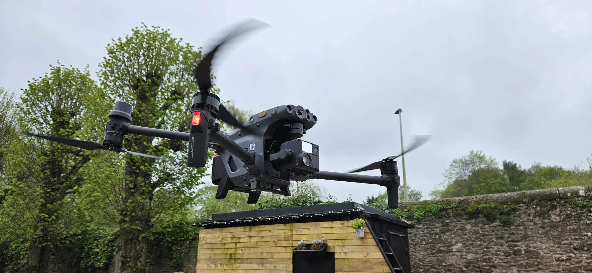
✅ We Only Use Top-Quality Drone Equipment
✅ We Customize Solutions for Your Industry
✅ We Handle All the Paperwork and Permissions
✅ We Have Worked with Hundreds of Happy Customers


What Is A Drone Survey?
A drone survey combines aerial photography with advanced mapping software to create detailed 2D and 3D models of land, buildings, or infrastructure. We use state-of-the-art drones equipped with high-resolution cameras and GPS technology to capture comprehensive aerial data of your site.
Our drones systematically fly over the target area, taking hundreds of overlapping photos from various angles and altitudes. These images are then processed through specialized photogrammetry software that stitches them together, creating accurate digital representations of your property.
The result includes precise measurements, volumetric calculations, and topographic information.
We can deliver various outputs from our drone surveys, including orthomosaic maps, digital elevation models, contour maps, and point clouds.
These deliverables help you make informed decisions about your project while saving time and reducing costs compared to traditional surveying methods.
How Our Drone Surveys Work
We begin with systematic data capture using our advanced drone fleet to collect high-resolution imagery and measurements of your site. Our expert team processes the collected data through specialized software to create detailed maps, 3D models, and precise measurements.
We then analyze these outputs and apply them to deliver actionable insights that address your specific surveying needs.


Data Capture
Professional drone surveys begin with systematic data capture using advanced UAV technology and specialized flight patterns. We use high-resolution cameras and LiDAR sensors to collect detailed aerial imagery and precise measurements of your site.
Our drones follow pre-programmed flight paths at specific altitudes and speeds, ensuring complete coverage with optimal overlap between images. We’ll capture both nadir (straight down) and oblique angles to document every aspect of your property.
During the flight, we constantly monitor weather conditions, battery levels, and data quality to maintain survey accuracy.
We’re able to collect millions of data points in a single flight, creating a comprehensive digital record of your site’s current conditions. This raw data forms the foundation for our subsequent analysis and deliverables that you’ll receive.

Data Processing
Raw data collected during flight operations transforms into actionable insights through our sophisticated processing pipeline. We first upload the captured imagery to our cloud servers, where powerful photogrammetry software stitches the photos together to create detailed orthomosaics and 3D models.
Our quality control team then reviews the processed data, checking for accuracy and completeness. We apply specialized algorithms to extract key measurements, identify features, and generate detailed drone topographic survey maps.
Using advanced machine learning techniques, we’re able to detect and classify objects, measure distances, and calculate volumes with high precision.
Finally, we format the data into client-specific deliverables, whether that’s CAD files, volumetric reports, or interactive web-based maps. We’ll provide you with exactly what you need to make informed decisions about your project.


Analysis and Application
Once processed, your drone survey data opens up powerful analytical possibilities across multiple industries. We’ll help you extract actionable insights through detailed terrain analysis, volumetric calculations, and structural inspections. Our specialized software identifies patterns, anomalies, and changes over time that may not be visible to the naked eye.
We apply this analysis to solve real-world challenges in construction, agriculture, mining, and infrastructure maintenance.
For construction sites, we track progress and verify earthwork volumes. In agriculture, we assess crop health and optimize irrigation.
Mining operations benefit from accurate stockpile measurements and pit monitoring. We’ll also customize the analysis to meet your specific needs, whether it’s detecting infrastructure defects or monitoring environmental changes.
The insights we deliver empower you to make data-driven decisions with confidence.

Skykam Offers A Wide Range Of Drone Survey Services
We offer an extensive range of professional drone survey services to meet your specific project needs. Our specialized services include aerial mapping for precise topographical data, detailed roof inspections, thermal imaging for energy assessments, comprehensive construction site monitoring, and LiDAR mapping for accurate 3D modeling.
Whether you’re planning a construction project, need property documentation, or require detailed site analysis, we’ll match you with the right drone survey solution.

Drone Aerial Mapping
Professional aerial mapping services transform raw drone data into detailed geospatial insights for your project needs. We use advanced photogrammetry software to create precise orthomosaic maps, digital elevation models (DEMs), and 3D point clouds from drone imagery.
Our mapping deliverables include accurate drone topographic surveys, volumetric calculations, and contour maps that help you make informed decisions.
We’ll process your data to generate high-resolution maps with centimeter-level accuracy, perfect for construction planning, earthwork monitoring, and land development projects.
We can export your mapping data in various formats compatible with CAD and GIS software. Whether you need to track site progress, measure stockpiles, or plan infrastructure, our aerial mapping services provide the spatial data you need to streamline your workflow and enhance project outcomes.


Drone Roof Surveys
Modern roof inspections reach new heights with our specialized drone roof survey capabilities. We provide detailed assessments of your roof’s condition without the risks and costs of traditional ladder access methods.
Our drones capture high-resolution images and thermal scans of your entire roofing system, identifying issues like damaged tiles, water pooling, heat loss, and structural weaknesses.
We’ll spot problems that aren’t visible from ground level, including blocked gutters, deteriorating flashing, and compromised seals.
We deliver comprehensive reports with annotated photos and precise measurements, helping you make informed decisions about maintenance and repairs.
Whether you need routine inspections, insurance documentation, or pre-purchase surveys, our drone roof inspections offer a safe, efficient solution that saves time and money while providing superior results.

Drone Thermal Surveys
Beyond standard visual inspections, thermal imaging takes building surveys to another level. Our thermal drone surveys detect heat signatures that reveal hidden issues in buildings, helping identify energy loss, moisture intrusion, and electrical faults.
We use advanced infrared cameras mounted on our drones to create detailed thermal maps of your property.


We’ll identify poorly insulated areas, water damage beneath surfaces, overheating electrical components, and structural defects that aren’t visible to the naked eye. Our thermal imaging technology works effectively on roofs, walls, solar panels, and industrial equipment.
Once we complete the survey, we provide you with comprehensive thermal reports highlighting problem areas and recommended solutions.
These insights help you address issues before they become costly repairs and improve your building’s energy efficiency.
Drone Construction Surveys
We deploy our drones regularly over your construction sites to capture detailed aerial survey data, creating accurate records of project advancement. Our high-resolution imagery and 3D mapping help you monitor timelines, verify contractor work, and identify potential issues early.
We’ll provide you with precise measurements of stockpiles, cut-and-fill volumes, and site topography through photogrammetry. Using our drone technology, we can generate detailed orthomosaic maps and point clouds that integrate seamlessly with BIM software.
This data helps you make informed decisions about resource allocation and project scheduling.
You’ll receive regular progress reports with side-by-side comparisons, ensuring your project stays on track and within budget while maintaining full documentation for stakeholders and compliance requirements.

Drone LiDAR Mapping
Our aerial LiDAR mapping capabilities penetrate dense vegetation and complex terrain to deliver unmatched accuracy in aerial surveying. We’ve equipped our drones with LiDAR sensors that capture millions of data points per second, creating detailed 3D point clouds of your project site.
We process this high-resolution data to generate precise digital terrain models (DTMs), contour maps, and volumetric calculations. Our drone LiDAR technology excels in challenging environments where traditional photogrammetry falls short, including forested areas, urban corridors, and industrial facilities.
Whether you need topographic mapping for site planning, as-built documentation, or environmental monitoring, we’ll provide you with georeferenced data that meets or exceeds industry accuracy standards. We’re committed to delivering actionable insights through our comprehensive LiDAR mapping solutions.
Environmental Monitoring
When environmental conditions need precise monitoring, we deploy specialized drones equipped with multispectral sensors and thermal imaging technology to assess ecosystem health, track wildlife populations, and detect changes in vegetation patterns.
We regularly conduct aerial surveys to identify invasive species, monitor erosion patterns, and evaluate water quality in remote areas.
Our drones capture high-resolution data that helps environmental scientists and land managers make informed decisions about conservation efforts and resource management. We’ll identify areas of concern like deforestation, pollution sources, or habitat degradation before they become critical issues.
Using thermal imaging, we can also detect underground water leaks and monitor temperature variations in sensitive ecosystems. This comprehensive environmental monitoring service provides crucial data for environmental impact assessments and long-term ecological studies.


Drone Topographical Survey
High-precision drone topographical surveys leverage our drone fleet to create detailed 3D terrain maps and elevation models. We’ll capture your site’s exact contours, slopes, and features with centimeter-level accuracy using photogrammetry and LiDAR technology.
Our drones systematically map large areas quickly, generating point clouds and digital surface models that we transform into actionable data.
We’ll provide you with comprehensive elevation profiles, contour maps, and volumetric calculations essential for engineering, construction, and land development projects.
We’re equipped to survey challenging terrains where traditional methods prove difficult or dangerous. Our deliverables include georeferenced orthomosaics, digital terrain models (DTM), and digital surface models (DSM) – all precisely aligned with existing survey control points.
Count on us for the accurate topographical data you need for informed decision-making.

Drone Stockpile Surveys
Through automated drone flights and advanced volumetric analytics, we measure stockpile volumes with unprecedented speed and accuracy.
Our drones capture detailed point clouds and high-resolution imagery of material stockpiles, enabling precise calculations of volume, density, and mass.
We’ll help you track inventory changes, optimize storage management, and reduce material losses across your sites. Whether you’re managing aggregates, minerals, coal, or other bulk materials, we deliver accurate measurements without the safety risks of manual surveys.
Our stockpile analytics include cut-and-fill calculations, 3D modeling, and detailed reporting to support your operational decisions.
You’ll receive comprehensive data on stockpile quantities, helping you maintain optimal inventory levels and make informed purchasing decisions. We can schedule regular surveys to monitor material movement and verify contractor quantities.


Drone Infrastructure Inspections
Our advanced drone infrastructure inspections access hard-to-reach areas safely and efficiently. We inspect bridges, towers, buildings, power lines, and industrial facilities without putting workers at risk or disrupting operations.
Our drones capture high-resolution images and video footage of structural defects, corrosion, cracks, and other potential issues. We’ll provide you with detailed reports that include thermal imaging to detect heat loss, moisture intrusion, and electrical hotspots.
We’re experts at navigating tight spaces and complex structures while maintaining strict compliance with FAA regulations. Our drone pilots are certified professionals who understand both aviation requirements and infrastructure assessment needs.
We’ll help you reduce inspection costs, minimize downtime, and maintain comprehensive documentation of your assets’ condition for preventive maintenance planning.
Drone Property Surveys
Beyond inspecting infrastructure, we excel at comprehensive property surveys that give landowners, developers, and real estate professionals a complete aerial perspective of their sites. Our drones capture high-resolution imagery and precise measurements of property boundaries, topographical features, and existing structures.
We’ll provide you with detailed orthomosaic maps, 3D models, and volumetric calculations that help you make informed decisions about land development, property transactions, or site planning. Our advanced drone technology can survey large parcels in a fraction of the time required by traditional ground-based methods.
Whether you need accurate elevation data, property line verification, or detailed site documentation for real estate listings, we deliver survey-grade results that meet professional standards. Each property survey includes georeferenced data compatible with popular GIS and CAD software platforms.


Benefits Of Our Aerial Drone Surveys
We’re excited to share how drone surveys revolutionize traditional surveying methods through increased efficiency, enhanced safety, and significant cost savings. Our drone technology delivers higher accuracy and precision than conventional surveying techniques, while completing projects in a fraction of the time. We’ll collect comprehensive data sets that provide you with detailed insights for informed decision-making, making drone surveys an invaluable investment for your projects.
Increased Efficiency and Speed
Compared to traditional surveying methods, drone surveys dramatically reduce the time needed to collect and process site data. Our drones can survey large areas in minutes that would take days to measure on foot, allowing us to deliver results faster and more cost-effectively.
We’re able to capture thousands of data points per second, creating detailed topographic maps and 3D models with exceptional accuracy. This rapid data collection means we can complete projects in a fraction of the time, helping you meet tight deadlines and make quicker decisions.
Our streamlined workflow means you’ll receive processed data within 24-48 hours of the flight. We’ve automated many post-processing steps, ensuring consistent quality while eliminating time-consuming manual work. This efficiency translates to faster project completion and reduced labor costs for your business.

Improved Safety
By keeping surveyors off dangerous terrain and away from hazardous conditions, drone surveys significantly reduce workplace safety risks. Our drones can access steep slopes, unstable ground, and contaminated areas without putting human lives at risk. We’re able to collect comprehensive data from a safe distance while maintaining high accuracy standards.
We’ve eliminated the need for surveyors to climb onto rooftops, traverse rocky terrain, or enter active construction sites. Our drones can inspect tall structures, power lines, and industrial facilities while operators remain safely on the ground. They’re particularly valuable in post-disaster scenarios, where traditional surveys might expose personnel to unstable buildings or hazardous materials.
Through drone technology, we’re transforming survey work into a safer, more controlled process without compromising the quality of our deliverables.
Enhanced Cost-Effectiveness
While safety remains a top priority, the financial advantages of drone surveying make it an increasingly attractive option for businesses. We’ve found that our drone surveys typically cost 60% less than traditional ground-based methods, primarily due to reduced labor and equipment requirements.
Our drones can survey large areas in a fraction of the time, cutting project durations from weeks to days. We don’t need to rent expensive heavy machinery or deploy large survey teams, which significantly reduces operational costs. These savings are passed directly to our clients.
We’re also eliminating indirect costs associated with traditional surveying. There’s no need for traffic control, site shutdown, or special access equipment. Plus, our digital deliverables reduce post-processing time and allow for easy data sharing across project teams.

Higher Accuracy and Precision
Thanks to advanced GPS technology and high-resolution imaging sensors, our drone surveys consistently deliver accuracy levels within 1-2 centimeters. We use the latest RTK (Real-Time Kinematic) positioning systems and photogrammetry software to ensure exceptional data precision in every project.
Our drones capture thousands of detailed images from multiple angles, creating comprehensive point clouds and 3D models that far exceed traditional survey methods. We’re able to measure volumes, distances, and elevations with remarkable precision, even in challenging terrain or hard-to-reach areas.
We’ve also implemented automated flight paths and specialized calibration procedures to eliminate human error. This means you’ll receive highly reliable data for your decision-making process. When you need detailed topographic maps, stockpile measurements, or site documentation, our drone surveys provide the accuracy you can trust.
Comprehensive Data Collection
Our drone surveys collect far more data points than traditional methods, delivering a complete picture of your project site. We capture millions of georeferenced data points in a single flight, creating detailed 3D models and topographic maps that reveal every surface contour and feature.
We’ll provide you with comprehensive datasets that include high-resolution orthomosaic imagery, digital elevation models, and volumetric calculations. These rich data layers enable you to analyze vegetation health, detect structural issues, and measure stockpile volumes with remarkable detail. You’ll also receive thermal imaging data to identify temperature variations and potential problem areas.

Our Team Are All GVC Licenced Drone Surveyors
Every member of the team holds a General Visual Line of Sight Certificate (GVC), demonstrating our expertise and legal compliance in drone operations. We’ve undergone rigorous training and testing to earn this essential qualification, which enables us to conduct professional drone surveys across diverse environments and conditions.
Our GVC certification means we’re well-versed in critical areas like air law, meteorology, flight planning, and risk assessment. We understand complex airspace regulations and maintain strict safety protocols during every mission. When you work with us, you’re partnering with professionals who can navigate challenging survey requirements while adhering to the latest Civil Aviation Authority (CAA) guidelines.
We regularly update our knowledge and skills to stay current with evolving drone technology and regulations, ensuring we deliver reliable, compliant survey services.
UK Drone Regulatory Compliance We Follow
Building on our GVC certifications, we maintain strict adherence to comprehensive UK drone regulations and standards. We’re fully registered with the Civil Aviation Authority (CAA) and carry required operator IDs on all our equipment. Our compliance includes following stringent rules on flight distances, heights, and restricted zones.
We’ve implemented rigorous safety protocols that exceed CAA minimums, including pre-flight risk assessments, weather monitoring, and detailed flight planning. Our insurance coverage meets all legal requirements for commercial drone operations, and we regularly update our operational procedures to align with new regulations.
We’re committed to protecting privacy and data security, following GDPR guidelines for all captured imagery. Our team stays current with evolving drone legislation through continuous professional development and industry updates.


Traditional Surveys vs. Drone Surveys
When comparing traditional surveying methods to drone-based solutions, the differences in efficiency and cost savings become immediately apparent.
| Feature | Traditional Surveys | Drone Surveys |
|---|---|---|
| Speed | Days or weeks to complete | Hours to complete (up to 10x faster) |
| Cost | Higher labor and equipment costs | 40-60% cost savings |
| Crew Size | Multiple crew members required | Minimal personnel needed |
| Accessibility | Limited to accessible areas | Can access difficult or dangerous locations |
| Data Capture | Selective measurements | Millions of data points per flight |
| Precision | Varies based on method | Centimeter-level accuracy |
| Output | Basic measurements and maps | High-resolution images, 3D models, topographic maps |
| Safety | Higher risk for personnel | Reduced human risk exposure |
| Site Disruption | Often requires temporary closures | Minimal impact on ongoing operations |
| Comprehensive Coverage | Focus on specific areas | Complete site coverage in single operation |
When you choose our drone survey services, you’re not just getting faster results – you’re investing in superior data quality and actionable insights. Our enterprise-grade UAVs capture comprehensive aerial data that traditional methods simply cannot match, revealing issues that would otherwise remain hidden.
This detailed perspective allows for more informed decision-making, better resource allocation, and improved project outcomes. Plus, with our team handling all permissions, paperwork, and technical aspects, you can focus on what matters most: using the valuable data we provide to drive your project forward.
The combination of reduced costs, enhanced safety, minimal site disruption, and superior data makes drone surveying the clear choice for forward-thinking businesses across the UK.
What Sets Us Apart from Aerial Surveying Competitors
Through years of specialized experience in drone surveying, we’ve developed proprietary workflows and technologies that distinguish us in the market. Our certified pilots undergo rigorous training beyond standard CAA requirements, ensuring superior data collection and safety protocols.
We’re the only provider in the region using advanced LiDAR-equipped drones combined with our custom post-processing software, delivering accuracy within 1cm. Our rapid 24-hour turnaround for most projects outpaces competitors’ typical 3-5 day windows. Additionally, we maintain a fleet of backup drones and redundant systems, guaranteeing uninterrupted service.
What truly sets us apart is our dedicated project manager who stays with you from initial consultation through final delivery, providing clear communication and expertise every step of the way.

Contact Us For Drone Services
We’re committed to delivering unmatched drone survey excellence through our GVC-licensed team, cutting-edge technology, and strict regulatory compliance. By choosing our services, you’ll benefit from faster turnaround times, reduced costs, and superior data accuracy compared to traditional methods. We’ll continue pushing the boundaries of aerial surveying to provide you with the most comprehensive, reliable, and innovative solutions for your mapping needs.