Need accurate terrain data? Save time, cut costs, and get crystal-clear insights with our advanced drone LiDAR mapping & survey services.
Don’t settle for risky, time-consuming traditional surveys when our enterprise-grade drone LiDAR technology delivers faster, safer high-precision results.
As specialists in industrial-grade laser scanning and penetrative mapping since 2016, we provide the actionable point cloud data you need for critical modeling decision-making
Used By Top UK Businesses

👇Fill Out The Form For Same-Day Drone Survey Quote 👇
Why Leading UK Businesses Choose Our Drone Survey Services:
✅ We’re Fully Licensed, Insured Drone Pilots
✅ We Cover the UK with Fast Response Times
✅ We Only Use Top-Quality Drone Equipment
✅ We Customize Solutions for Your Industry
✅ We Handle All the Paperwork and Permissions
✅ We Have Worked with Hundreds of Happy Customers


What Is A Drone LiDAR Survey?
A drone LiDAR survey uses unmanned aerial vehicles (UAVs) equipped with LiDAR sensors to collect precise 3D data of the earth’s surface and structures. LiDAR (Light Detection and Ranging) works by emitting thousands of laser pulses per second toward the ground and measuring how long it takes for them to return.
This creates a point cloud, a detailed 3D representation of the terrain, vegetation, and built environments. Unlike traditional photogrammetry, LiDAR can penetrate dense vegetation to capture ground levels beneath trees, making it ideal for forestry, topographic mapping, and infrastructure projects.
Drone LiDAR surveys are faster, safer, and more cost-effective than manual surveys, especially in difficult or large areas. The high-resolution data helps engineers, surveyors, and planners make accurate decisions for construction, mining, environmental monitoring, and more.

How Our Drone LiDAR Surveys Work
Our drone LiDAR survey process begins with a comprehensive site assessment and flight planning to ensure optimal data capture efficiency. We then deploy our advanced drone fleet equipped with precision LiDAR sensors to collect aerial data, which our specialists process into detailed point clouds and digital terrain models.
Initial site assessment and flight planning
Before any drone survey takes flight, thorough site assessment and flight planning are essential components of our LiDAR survey process. We begin by analyzing satellite imagery and topographic maps to identify potential obstacles, restricted airspace, and optimal flight paths.
Our team then conducts an on-site evaluation to assess ground conditions, verify access points, and identify any hazards not visible in preliminary data. We’ll determine the ideal altitude, flight speed, and scan density required to achieve your project’s accuracy requirements.
We use specialized flight planning software to calculate precise flight lines with appropriate overlap, ensuring complete coverage of your area of interest. Weather conditions, seasonal vegetation, and solar angles are factored into our scheduling to maximize data quality. This meticulous planning phase is crucial for ensuring efficient operations and high-quality LiDAR deliverables.

Aerial data collection with LiDAR sensors
With a well-executed flight plan in place, we move to the heart of our survey process. Our drones, equipped with state-of-the-art LiDAR sensors, capture millions of data points per second as they traverse your site according to predetermined flight paths. These sensors emit laser pulses that bounce off surfaces and return to the drone, measuring distances with centimeter-level accuracy.
We maintain optimal flying altitude and speed to ensure consistent point density across the survey area. Our pilots monitor real-time data feeds to verify quality while the drone simultaneously records GPS coordinates for each measurement.
The LiDAR system penetrates vegetation to create accurate ground models even in densely forested areas. We typically complete multiple overlapping flight paths to eliminate data gaps and ensure comprehensive coverage of your entire project site.
Processing of point cloud data
Once the drone completes its mission, the raw point cloud data undergoes rigorous processing to transform millions of individual measurements into valuable insights. Our specialized software filters noise, classifies points, and generates accurate 3D models of your site.
We’ll calibrate and align multiple scans to create a unified dataset with centimeter-level precision. During this phase, we’ll correct for any atmospheric interference or sensor variations that might affect accuracy.
The refined data is then classified by surface type—vegetation, structures, ground, and water bodies—creating distinct layers that you can analyze separately. We’ll deliver the processed data in industry-standard formats compatible with CAD, GIS, and BIM software, allowing you to integrate our results seamlessly into your existing workflows.

Creation of detailed terrain models
From the processed point cloud data, we generate highly accurate Digital Terrain Models (DTMs) and Digital Surface Models (DSMs) that reveal both the bare earth and above-ground features of your site.
Our terrain models offer resolution down to 5cm, capturing even subtle topographic variations that traditional surveys might miss. We’ll customize the model outputs to match your specific project needs, whether you’re planning infrastructure, analyzing flood risks, or monitoring environmental changes.
These models integrate seamlessly with CAD and GIS software, allowing your team to immediately begin design work. We can deliver the data in various formats including GeoTIFF, DXF, and LAS files. We’ll also provide contour maps at your requested intervals, volumetric calculations, and cross-sectional analysis to give you comprehensive insights into your terrain’s characteristics.
Comprehensive analysis and reporting
After collecting and processing your LiDAR data, we transform it into actionable intelligence through our comprehensive analysis and reporting services. Our team of specialists interprets the point cloud data to extract critical insights about your terrain, structures, and vegetation.
We deliver clear, customized reports that highlight key findings relevant to your project objectives. These include volumetric calculations, contour mapping, structural assessments, and vegetation analysis. Each report contains annotated visualizations that make complex data easy to understand.
We’ll walk you through the findings during a detailed presentation, answering questions and providing recommendations for your next steps. Our reports are compatible with industry-standard software, enabling seamless integration with your existing workflows and facilitating informed decision-making across your organization.

Benefits of Drone LiDAR Surveys
Our drone LiDAR surveys deliver exceptional benefits that traditional mapping methods simply can’t match. We’ve engineered our systems to penetrate dense vegetation for accurate ground mapping, achieve centimeter-level precision, and collect comprehensive 3D data across large areas in minimal time. Whether operating day or night, our LiDAR technology provides the detailed spatial information you need for multiple applications, from infrastructure assessment to environmental monitoring.
Penetration of vegetation for true ground mapping
When dense vegetation covers a landscape, traditional aerial surveys often fail to capture accurate ground data, leaving surveyors with incomplete or misleading topographic information. Our drone LiDAR technology solves this problem by emitting multiple laser pulses that penetrate through vegetation canopies, reaching the actual ground surface below.
Unlike photogrammetry or conventional surveys, our LiDAR systems can distinguish between vegetation and ground returns, effectively “seeing through” dense foliage, brush, and tree cover. We’re able to create highly accurate digital terrain models (DTMs) that reveal the true ground topography hidden beneath vegetation. This capability is invaluable for forestry management, flood modeling, archaeological surveys, and construction projects in wooded areas. We’ll deliver precise bare-earth models with centimeter-level accuracy, regardless of vegetation density, saving you time and resources on supplementary ground surveys.
Centimeter-level accuracy for critical measurements
Precision is the cornerstone of every successful survey project, and our drone LiDAR technology delivers centimeter-level accuracy that traditional methods simply can’t match. When your project demands exact measurements, every millimeter matters.
Our systems achieve horizontal accuracies of 2-5 cm and vertical accuracies within 3-7 cm, depending on flight parameters and ground control. This precision is crucial for engineering design, volumetric calculations, and infrastructure monitoring where measurement errors can lead to costly mistakes.
We’ve optimized our workflow with RTK/PPK GPS integration and rigorous calibration protocols to ensure consistent results. Unlike conventional surveys that might interpolate between sparse data points, our dense point clouds capture reality with exceptional fidelity, allowing you to make confident decisions based on truly accurate spatial information.
Rapid data collection of large areas
The breathtaking efficiency of drone LiDAR technology transforms large-scale surveying projects from weeks-long endeavors into single-day operations. We’ve routinely mapped 500+ acre sites in under 8 hours, capturing millions of precise data points that would take ground crews several weeks to collect.
Our drones fly methodical patterns at optimal altitudes, ensuring complete coverage while maintaining accuracy. Unlike traditional methods requiring multiple setups and line-of-sight constraints, we collect continuous data across diverse terrains—from dense forests to steep hillsides—without interruption.
This efficiency doesn’t just save time; it dramatically reduces labor costs. Projects that once required teams of surveyors can now be completed with just our two-person drone crew, delivering comprehensive datasets quickly while minimizing disruption to your operations.
Day or night operational capability
Unlike passive photogrammetry methods that depend on sunlight, our advanced drone LiDAR systems operate effectively in any lighting condition, including complete darkness. This 24/7 operational capability significantly extends your surveying window and accelerates project timelines.
We’ll schedule surveys during off-peak hours to minimize disruption at busy sites like highways, construction zones, or industrial facilities. Night operations also benefit from reduced wind conditions, enhancing data accuracy and flight stability.
For time-sensitive projects with tight deadlines, we don’t waste daylight hours. Our teams can work around the clock if needed, capturing precise LiDAR data while conventional survey methods would be grounded.
This flexibility doesn’t compromise data quality—LiDAR pulses perform identically day or night, delivering consistent, high-resolution point clouds regardless of ambient lighting.
Comprehensive 3D data for multiple applications
Versatility defines our drone LiDAR survey outputs, providing rich 3D datasets that serve numerous industries simultaneously. Our comprehensive point clouds deliver millimeter-precise measurements that transform into valuable deliverables tailored to your specific needs.
From a single drone LiDAR survey, we’ll generate topographic maps, volumetric calculations, digital terrain models, and full 3D visualizations. Engineers can extract precise measurements for infrastructure planning, while environmental scientists analyze vegetation density and distribution. Urban planners use our data for smart city development, and construction firms monitor progress and verify as-builts.
We’ve designed our data processing workflow to maximize the utility of each scan, ensuring you’ll receive information that integrates seamlessly with CAD, GIS, and BIM platforms. You’re not just getting data—you’re gaining actionable insights for informed decision-making.

Drone LiDAR Survey Services We Offer
Our comprehensive drone LiDAR survey services include specialized topographic mapping, volumetric calculations, and corridor mapping. We’ve developed expertise in flood risk assessment that helps clients identify vulnerable areas and implement mitigation strategies. Additionally, we offer cutting-edge forest canopy analysis that provides valuable data for environmental research and sustainable resource management.
Topographic Mapping and Modeling
Precise terrain representation forms the foundation of successful engineering projects, environmental planning, and land management—all made possible through our topographic mapping and modeling services. Our drone LiDAR technology captures millions of data points to create detailed digital terrain models (DTMs) and digital surface models (DSMs) with centimeter-level accuracy.
We’ll deliver comprehensive contour maps, 3D models, and elevation profiles that reveal subtle terrain features often missed by traditional surveying methods. These high-resolution deliverables allow you to analyze slopes, calculate earthwork volumes, and plan infrastructure with confidence.
Our topographic surveys efficiently cover large or difficult-to-access areas, providing the spatial intelligence you need for informed decision-making. Whether you’re designing roads, planning developments, or conducting watershed analyses, our mapping capabilities ensure you start with precise terrain data.
Volumetric Calculations
Accurate volumetric calculations form the cornerstone of effective resource management and project planning. Our drone LiDAR systems capture millions of precise data points that enable us to determine exact volumes of stockpiles, excavations, and terrain features with centimeter-level accuracy.
We’re able to quickly calculate volumes for mining operations, construction sites, and quarries without disrupting ongoing work. Unlike traditional surveying methods, our drone LiDAR captures comprehensive measurements in a single flight, eliminating estimation errors and providing reliable data for inventory management, production monitoring, and billing verification.
Our volumetric calculation service includes detailed reports with cut/fill analysis, 3D visualizations, and comparative analytics for tracking changes over time—delivering the insights you need to optimize operations and reduce costly miscalculations.
Corridor and Linear Infrastructure Mapping
When mapping extensive linear assets such as roads, railways, and pipelines, drone LiDAR technology offers unparalleled efficiency and detail compared to traditional ground-based methods. Our aerial approach captures comprehensive data along entire corridors without the safety risks of sending personnel into hazardous areas.
We’re experts at efficiently mapping transmission lines, highways, and utility networks with centimeter-level accuracy. Our drones can collect data across kilometers of infrastructure in a single day, identifying clearance issues, encroachment zones, and structural irregularities that might be missed by conventional surveys.
The high-density point clouds we deliver allow for precise measurements of overhead lines, terrain profiles, and adjacent vegetation—critical information for maintenance planning, expansion projects, and compliance monitoring. We’ll help you visualize your entire infrastructure network in detailed 3D.
Flood Risk Assessment
Climate change and increased urban development have amplified flooding risks worldwide, making detailed topographic data essential for effective mitigation planning. Our drone LiDAR surveys provide the high-resolution elevation models needed to identify flood-prone areas with centimeter-level accuracy.
We’ll map your terrain’s natural drainage patterns, depressions, and water flow paths to create comprehensive hydrological models. Using these precise digital elevation models, we can simulate various rainfall scenarios and predict potential inundation zones. This data helps engineers design effective drainage systems, authorities establish evacuation routes, and planners develop smarter zoning regulations.
Our flood risk assessments don’t just identify vulnerabilities—they provide the foundation for resilient infrastructure planning that protects communities and valuable assets from increasingly unpredictable weather patterns.

Forest Canopy Analysis
Our advanced drone LiDAR technology penetrates dense forest canopies to reveal what traditional aerial surveys can’t capture. We provide detailed 3D structural models of forest ecosystems, measuring tree height, crown diameter, and density with centimeter-level accuracy.
This precision enables foresters to calculate biomass volumes, identify disease patterns, and monitor growth rates over time. We’ve helped researchers track biodiversity changes and timber companies optimize selective harvesting strategies.
Our forest canopy analysis delivers critical metrics like Leaf Area Index (LAI) and vertical foliage distribution profiles that inform wildfire risk assessments and carbon sequestration studies. The extensive point cloud data we collect can identify gaps in the canopy, understory vegetation characteristics, and even individual species classification when combined with our multispectral imaging capabilities.
Archaeological Feature Detection
While traditional archaeological methods struggle to identify hidden structures beneath vegetation and soil, drone LiDAR technology revolutionizes site exploration by penetrating these barriers with remarkable precision. Our specialized archaeological surveys reveal ancient settlements, burial mounds, and forgotten infrastructure invisible to the naked eye.
We’ve helped researchers document Mayan ruins beneath dense jungle canopy, map prehistoric earthworks in overgrown fields, and identify Roman settlements hidden for centuries. Our high-resolution data captures subtle topographical variations as small as 5cm, enabling archaeologists to detect walls, roads, and building foundations with unprecedented clarity.
Our team processes the point cloud data into detailed 3D models and contour maps, making previously invisible history visible and accessible for both academic research and heritage preservation efforts.

BIM and Digital Twin Creation
As modern construction and facility management demand increasingly sophisticated digital models, our drone LiDAR technology provides the perfect foundation for Building Information Modeling (BIM) and digital twin creation. We capture highly accurate point cloud data that seamlessly integrates with your BIM software, creating intelligent 3D representations of physical spaces.
Our LiDAR systems collect millions of precise measurements that reveal structural details, MEP systems, and architectural elements with centimeter-level accuracy. We’ll deliver comprehensive datasets that enable your team to develop detailed digital twins – virtual replicas that mirror real-world assets in real-time.
These dynamic models facilitate better decision-making, predictive maintenance, and operational optimization throughout your facility’s lifecycle. By leveraging our drone LiDAR surveys, you’ll transform physical infrastructure into intelligent digital assets that drive efficiency and innovation.
Urban Environment Modeling
When cities need comprehensive digital representations for smart urban planning, our drone LiDAR systems deliver unmatched environmental modeling capabilities. We capture intricate details of urban landscapes, including buildings, transportation networks, vegetation, and utility infrastructure in a single unified dataset.
Our urban models provide city planners with accurate spatial relationships between structures, helping identify development opportunities and constraints. We’ll extract building footprints, roof survey measurements, and facade details while precisely mapping street furniture, traffic signals, and pedestrian pathways.
These high-resolution urban models support microclimate analysis, flood simulation, noise propagation studies, and viewshed assessments. They’re also invaluable for solar panel potential mapping, cellular network planning, and autonomous vehicle testing—making your city smarter, more efficient, and better prepared for future growth.

Technology We Use for LiDAR Surveys
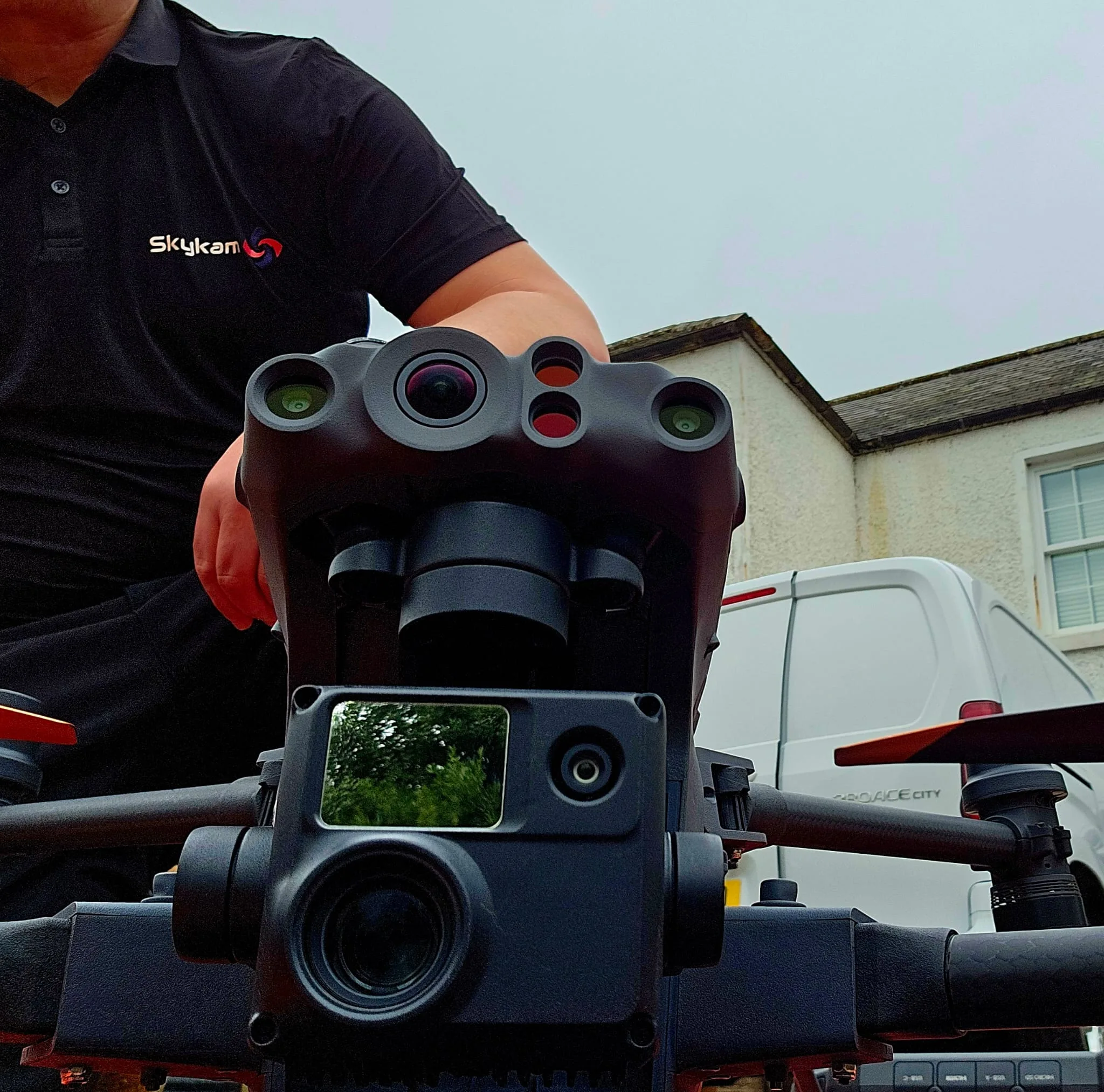
Our drone LiDAR survey technology combines cutting-edge hardware and software to deliver exceptional precision and efficiency. We employ industry-leading LiDAR sensors capable of collecting up to 600,000 points per second with accuracy within 2-3 centimeters, mounted on agile UAV platforms with flight times exceeding 30 minutes.
For reliable data collection, we use sophisticated inertial measurement units (IMUs) and RTK GPS for precise positioning. Our post-processing workflow leverages proprietary algorithms to filter, classify, and analyze point clouds, producing deliverables tailored to client specifications.
We’ve invested in systems that operate effectively in diverse environments, from dense urban corridors to remote terrain. Our equipment is calibrated regularly and updated as technology advances, ensuring you receive the highest quality data possible.
Applications Across Industries
Our LiDAR survey capabilities extend across multiple industries, delivering precise data for critical applications. We’re helping construction teams model development sites, transportation authorities map infrastructure, mining operations calculate volume measurements, forestry professionals assess vegetation, and archaeological researchers document historical sites. These versatile applications demonstrate why drone LiDAR has become an essential tool for professionals seeking accurate terrain and object visualization.

Construction and development
In the rapidly evolving construction sector, drone LiDAR technology has revolutionized site planning and development workflows. Our surveys provide precise terrain models, volumetric calculations, and structural analyses that dramatically reduce planning time and costly errors.
We’ve helped developers track earthwork progress, calculate cut-and-fill volumes, and monitor material stockpiles with centimeter-level accuracy. This data enables real-time decision-making and helps maintain project timelines.
Our LiDAR systems can penetrate vegetation to reveal ground conditions beneath, identifying potential hazards before breaking ground. For existing structures, we capture comprehensive as-built documentation to facilitate renovations or expansions.
Transportation and infrastructure
Transportation networks and critical infrastructure benefit enormously from drone LiDAR’s ability to capture comprehensive data without disrupting operations. We regularly perform corridor mapping for highways, railways, and utility lines, delivering precise digital twins that highlight potential hazards and maintenance needs.
Our LiDAR solutions allow transit authorities to analyze bridge clearances, detect overhead obstructions, and evaluate drainage patterns—all while traffic continues to flow. We’ve helped infrastructure managers identify subtle ground deformation threatening pipeline integrity and mapped complex interchange projects to verify construction accuracy.
For airport administrators, we offer runway surface analysis that pinpoints irregularities down to millimeter precision. When you need to assess the structural health of aging transportation assets or plan expansions, our drone LiDAR surveys provide the detailed spatial intelligence needed for confident decision-making.
Mining and quarrying
Mining operations and quarry sites face unique volumetric calculation challenges that drone LiDAR resolves with unparalleled efficiency. We deliver accurate stockpile measurements and pit volumetrics without disrupting your daily operations or putting personnel at risk.
Our drone LiDAR technology penetrates vegetation to capture precise terrain models beneath ground cover, revealing geological features that might otherwise remain hidden. This capability proves invaluable for planning expansions, monitoring environmental impact, and ensuring regulatory compliance.
We’ll help you make informed decisions with comprehensive data on material extraction rates, enabling optimized production schedules and resource management. The detailed 3D models we create also enhance safety by identifying potential hazards like unstable slopes or drainage issues before they become problematic. Trust us to transform your mining or quarrying operation with data-driven insights.

Forestry and land management
Forestry professionals and land managers benefit from LiDAR’s unique ability to penetrate through dense canopy cover, revealing detailed forest structure that traditional photogrammetry simply cannot capture. Our drone LiDAR systems can efficiently map vast woodland areas, providing accurate tree height measurements, canopy density analysis, and understory vegetation assessment.
We’ve helped clients create comprehensive forest inventories, identify diseased trees, and plan selective harvesting operations. Land managers particularly value our terrain models that show gradients, water flow patterns, and potential erosion sites—even in heavily forested areas.
For conservation projects, we deliver precision data for habitat assessment, biomass calculations, and carbon sequestration studies. Our surveys also support wildfire management by identifying fuel loads and creating detailed evacuation route maps in remote areas.
Archaeological research
When archaeologists face the challenge of surveying large sites without disturbing sensitive cultural remains, our drone LiDAR technology provides an ideal solution. We’ve helped teams reveal hidden structures beneath dense vegetation and document ancient settlements that aren’t visible to the naked eye.
Our high-resolution LiDAR can detect subtle elevation changes of just a few centimeters, identifying walls, roads, and agricultural features that have been buried for centuries. We’ve worked with researchers at UNESCO World Heritage sites and university teams discovering previously unknown structures at Maya, Roman, and medieval sites.
The digital terrain models we deliver become valuable research assets, allowing for precise measurements and virtual explorations without excavation costs or risks. We’ll help preserve history while uncovering it.
Utilities and energy
Utilities and energy companies across the globe have revolutionized their inspection protocols by incorporating our drone LiDAR technology. We’ve helped these organizations map transmission lines, substations, and pipeline corridors with unprecedented accuracy and efficiency.
Our LiDAR systems detect encroaching vegetation, identify structural defects in towers, and create detailed digital twins of infrastructure assets. This allows maintenance teams to prioritize critical repairs and prevent costly outages before they occur.
We’re particularly proud of our thermal integration capabilities, which combine LiDAR data with drone thermal imaging to identify hotspots in electrical equipment. This dual-sensing approach has helped our clients reduce inspection costs by up to 70% while improving worker safety by keeping personnel away from high-voltage environments.

Why Choose Our Drone LiDAR Survey Team
Our certified professionals bring over 20 years of combined experience to every LiDAR mapping project we undertake. We’ve successfully completed hundreds of aerial surveys across diverse industries, ensuring you receive unmatched expertise regardless of your project’s complexity.
We’re equipped with cutting-edge hardware that captures data at densities up to 100 points per square meter, far exceeding industry standards. Our proprietary processing workflows transform raw point clouds into actionable intelligence within 48-72 hours—significantly faster than traditional survey methods.
We maintain comprehensive insurance coverage and hold all required FAA certifications for commercial drone operations. Our team stays current with the latest technological developments through ongoing professional education. When you work with us, you’re partnering with specialists who deliver superior results, maintain strict confidentiality, and meet even the tightest deadlines.

Contact Us For Your Drone LiDAR Survey Needs
Ready to experience the superior accuracy and vegetation penetration capabilities of drone LiDAR technology? Our specialized aerial LiDAR mapping services provide detailed terrain models, accurate measurements through dense foliage, and comprehensive point cloud data sets for your most demanding projects.
Reach out today through our dedicated LiDAR survey line at +44 7368 537499 or email us at Jamie@skykam.co.uk. We’ll respond within 24 hours to arrange your free consultation.
When contacting us, please share details about your project site, required accuracy levels, and specific deliverables needed. This information helps us configure our LiDAR equipment and flight parameters for optimal results in your environment. We serve engineers, developers, forestry managers, and utility companies throughout the UK with efficient data collection even in challenging terrains.
Let’s work together to unlock the full potential of your project with industry-leading drone services for LiDAR survey technology that sees what traditional photogrammetry cannot.