Need accurate forest data? Save time, cut costs, and get crystal-clear insights with our advanced drone forestry mapping services.
Don’t settle for risky, time-consuming traditional surveys when our enterprise-grade drone technology delivers faster, safer forest analysis results.
As specialists in industrial-grade forestry assessment and canopy mapping since 2016, we provide the actionable sylviculture data you need for critical forest management decision-making.
Used By Top UK Businesses

👇Fill Out The Form For Same-Day Drone Survey Quote 👇
Why Leading UK Businesses Choose Our Drone Survey Services:
✅ We’re Fully Licensed, Insured Drone Pilots
✅ We Cover the UK with Fast Response Times
✅ We Only Use Top-Quality Drone Equipment
✅ We Customize Solutions for Your Industry
✅ We Handle All the Paperwork and Permissions
✅ We Have Worked with Hundreds of Happy Customers

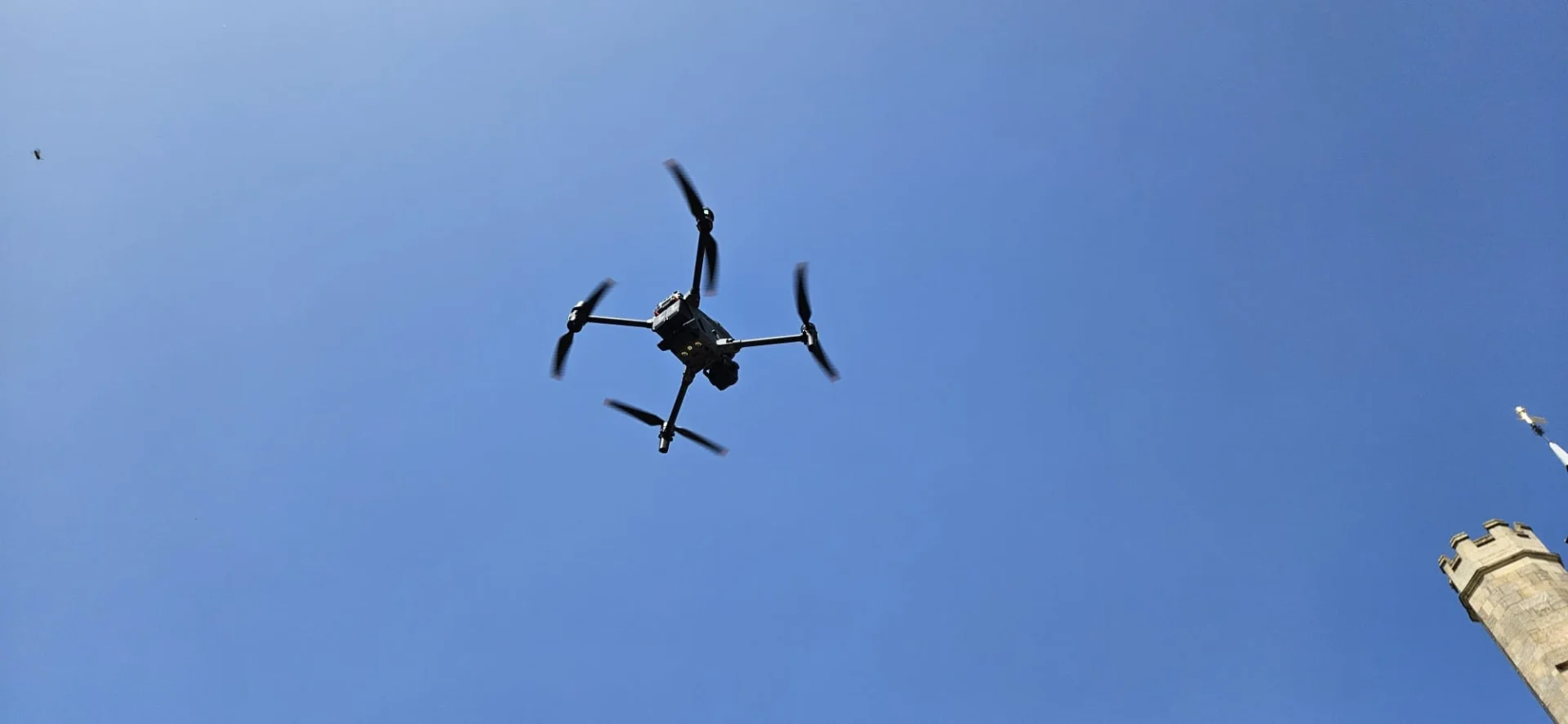
Drone Forestry Mapping
While traditional forestry mapping requires boots on the ground and countless hours of manual surveying, drone forestry mapping revolutionizes the process by collecting comprehensive data from above. Our drones capture high-resolution imagery that’s processed into detailed 3D models, topographic maps, and vegetation analysis reports.
We’ve optimized our flight patterns to cover large areas efficiently while maintaining accuracy that rivals ground surveys. Using specialized sensors, we can identify tree species, measure heights and densities, and detect signs of disease or infestation before they’re visible to the naked eye.
The data we collect integrates seamlessly with forestry management software, allowing for informed decision-making about harvesting, conservation, and fire prevention strategies. It’s a faster, safer, and more cost-effective approach to forest inventory and planning.


What Is Drone Forestry Mapping
Drone forestry mapping represents a cutting-edge approach to forest management that leverages unmanned aerial vehicles equipped with specialized sensors and cameras. These drones collect high-resolution imagery and data from above the forest canopy, providing us with detailed insights that would be impossible to gather through ground-based methods alone.
We use this technology to create precise 3D models, topographic maps, and vegetation health assessments of forested areas. Our drones can efficiently survey hundreds of acres in a single day, identifying tree species, measuring heights, detecting diseases, and monitoring overall forest health. This comprehensive data helps landowners, forestry companies, and conservation organizations make informed decisions about resource management, harvest planning, fire prevention, and ecological restoration efforts.
How Our Drone Forestry Mapping Works
Our drone forestry mapping process begins with thorough flight planning and assessment before deploying multiple sensors to capture comprehensive aerial data. We transform this raw information through advanced processing techniques into detailed forest inventories and health assessments that identify potential issues. The final reports we deliver contain actionable insights that empower forest managers to make informed decisions about resource management and conservation efforts.


Comprehensive flight planning and assessment
Before any drone takes flight, we conduct meticulous flight planning and assessment to ensure optimal data collection and safety. Our team analyzes topographical maps, weather forecasts, and satellite imagery to identify potential obstacles and determine the ideal flight path.
We consider seasonal variations in vegetation density, sun angle, and lighting conditions that might affect image quality. Each mission includes calculating precise flight parameters—altitude, speed, and camera settings—to achieve the required image resolution and overlap for accurate 3D modeling.
Our software generates automated flight paths that maximize battery efficiency while ensuring complete coverage of your forest area. We’ll also secure necessary permits, perform risk assessments, and establish emergency protocols for each site. This comprehensive planning process eliminates surprises and guarantees we capture the high-quality data your forestry management requires.
Multi-sensor data acquisition flights
When your forestry mapping mission begins, our specially equipped drones take to the skies carrying multiple advanced sensors simultaneously. These include high-resolution RGB cameras, multispectral sensors, LiDAR, and thermal imaging devices—all capturing different data layers in a single flight.
We’ve optimized our flight patterns to ensure complete coverage while maximizing battery efficiency. Our drones systematically traverse your forest property, collecting comprehensive data about canopy structure, tree health, species distribution, and terrain features.
During flight, we monitor real-time data feeds to verify quality and adjust parameters if needed. The multi-sensor approach eliminates the need for repeated flights, reducing costs and time while producing a rich, integrated dataset that reveals your forest’s characteristics from numerous perspectives.


Advanced data processing and analysis
Once we’ve collected the raw data from our multi-sensor drone flights, sophisticated processing algorithms transform these diverse inputs into actionable forestry intelligence. Our software creates detailed 3D models, vegetation indices, and forest health metrics through photogrammetry and machine learning techniques.
We don’t just deliver raw data—we provide meaningful analysis. Our team identifies tree species, measures heights and diameters, calculates timber volumes, and detects signs of disease or pest infestation. We’ll highlight areas requiring immediate attention through customized reporting dashboards that visualize complex information through intuitive maps and charts.
This analysis helps you make data-driven decisions about harvest planning, conservation efforts, fire risk management, and sustainable forestry practices. We’re committed to turning complex forest data into clear, practical insights that improve your operational efficiency.
Forest inventory and health assessment
Our comprehensive forest inventory and health assessment forms the cornerstone of sustainable forest management. We use our drones to capture high-resolution imagery that identifies tree species, measures heights and diameters, and calculates biomass with remarkable accuracy.
Our technology detects early signs of disease, pest infestations, and stress through multispectral imaging that reveals issues invisible to the naked eye. We’ll spot chlorophyll changes, abnormal heat signatures, and structural weaknesses before they become catastrophic.
Each tree in your forest gets individually documented in our database, creating a digital twin of your woodland ecosystem. We’ll track growth rates, monitor canopy development, and identify potential hazards like leaning trees. This precise inventory helps you make data-driven decisions about harvesting schedules, conservation priorities, and intervention strategies when problems emerge.


Detailed reporting with actionable insights
After collecting comprehensive forestry data, we transform it into clear, actionable reporting that empowers your decision-making. Our reports include customized maps highlighting tree density, species distribution, and health indicators with color-coded visualizations that instantly identify problem areas.
We don’t just deliver data—we provide context. Each report includes trend analysis comparing current conditions with historical benchmarks, helping you spot emerging issues before they become critical. You’ll receive prioritized recommendations for resource allocation, from identifying optimal harvesting zones to pinpointing areas requiring immediate intervention for disease control.
Our digital dashboards allow you to filter and explore the data yourself, while our forestry experts remain available to interpret findings and answer questions about implementing our recommendations.
Benefits of Drone Forestry Mapping
Our drone forestry mapping service delivers substantial benefits for forest managers, including cost-effective alternatives to traditional surveys and high-resolution imaging of previously inaccessible areas. We provide rapid assessment of large forest tracts while capturing precise measurements of tree metrics that inform critical management decisions. Regular monitoring through our drone technology ensures you’ll have continuous data to support sustainable forest management practices and track changes over time.


Cost-effective alternative to traditional surveys
While traditional forestry surveys often require substantial investments in personnel, equipment, and time, drone mapping services dramatically reduce these costs while delivering superior results. We’ve found that our drone solutions typically cost 40-60% less than conventional ground-based or manned aircraft surveys.
Our drones can map hundreds of acres per day with minimal staff—just one pilot and an analyst. There’s no need for extensive ground crews trekking through difficult terrain or expensive helicopter rentals. The quick deployment and efficient data collection process means you’ll receive actionable information faster, reducing project timelines by weeks.
We also offer flexible pricing models to match your budget constraints, from one-time mapping projects to ongoing monitoring subscriptions. You’ll only pay for what you need, making professional forest management accessible regardless of your operation’s size.
High-resolution imaging of inaccessible areas
Designed specifically to overcome terrain limitations, our drone mapping services capture stunning high-resolution imagery of areas typically inaccessible to traditional survey methods. We fly over steep slopes, dense vegetation, and waterways that would otherwise require dangerous and time-consuming expeditions.
Our drones are equipped with advanced 4K cameras and LiDAR sensors that penetrate canopy layers to reveal detailed forest structure. We’re able to identify individual trees, monitor growth patterns, and detect early signs of disease or infestation—all from above. The centimeter-level accuracy we provide gives you reliable data for making critical management decisions.
When steep ravines or hazardous conditions prevent ground surveys, we’re there with aerial solutions that don’t compromise on image quality or data precision.


Rapid assessment of large forest tracts
Surveying extensive forest properties traditionally requires weeks of fieldwork, but our drone technology slashes this timeframe to mere days. Our drones can cover up to 500 acres per flight, capturing comprehensive data that would take ground teams weeks to collect.
We’re able to quickly assess forest health, identify areas of concern, and deliver actionable reports within 72 hours of completing flights. This rapid turnaround enables timely decision-making for forest management, fire prevention, and conservation efforts.
When you need a complete forest inventory for timber valuation or carbon credit assessment, we’ll deliver precise measurements of canopy height, density, and species composition across your entire property. This efficiency doesn’t just save time—it significantly reduces costs while providing more comprehensive data than conventional methods.
Precise measurement of tree metrics
Our advanced drone technology captures tree metrics with unprecedented accuracy down to the centimeter level. We can precisely measure tree heights, crown diameters, and stem volumes that would be nearly impossible to gather manually with the same precision. This data helps you make informed decisions about timber harvesting, growth rates, and overall forest health.
Unlike traditional methods that rely on statistical sampling, we’re able to assess every individual tree in your forest. Our specialized LiDAR and multispectral sensors detect subtle variations in tree species, identify stress indicators before they’re visible to the human eye, and track growth patterns over time. You’ll receive detailed 3D models and actionable reports that quantify your forest’s biomass and carbon sequestration potential with remarkable accuracy.


Regular monitoring for informed management
Regular monitoring of your forest assets transforms reactive management into proactive stewardship, allowing you to address small issues before they become costly problems. Our drones capture consistent data over time, creating a dynamic record of your forest’s development.
We’ll establish a tailored monitoring schedule—monthly, quarterly, or annual—depending on your management goals. Each flight builds your forest’s digital timeline, revealing subtle changes in canopy health, growth patterns, and potential threats like disease outbreaks or invasive species.
This temporal data lets you make evidence-based decisions quickly. You’ll see how your forest responds to management interventions, weather events, or seasonal changes. Instead of guessing about forest conditions between infrequent ground surveys, you’ll have continuous visibility into your valuable resources, maximizing both ecological health and economic returns.
Drone Forestry Mapping Services We Offer
Our comprehensive drone forestry mapping services include precise Forest Inventory Assessment and detailed Tree Health Monitoring to track vegetation conditions. We provide critical Fire Risk Analysis that identifies vulnerable areas and potential hazards before they become threats. Our Harvest Planning Support uses high-resolution aerial data to optimize timber extraction routes, maximize yields, and minimize environmental impact.


Forest Inventory Assessment
Precise forest inventory assessment forms the cornerstone of effective forestry management. Our drone-based inventory assessments deliver accurate data on tree counts, species distribution, height measurements, and canopy density across your entire property.
We’ll analyze the collected imagery to identify individual trees and calculate timber volumes with remarkable precision. Using advanced LiDAR and multispectral sensors, we can detect tree health issues, estimate biomass, and identify potential harvest areas.
Unlike traditional ground surveys, our drones capture comprehensive data in a fraction of the time, reducing costs while increasing accuracy. You’ll receive detailed reports with GIS-compatible data, inventories organized by stand, and actionable insights for immediate implementation.
Whether you’re planning harvests, monitoring growth, or conducting valuations, our forest inventory assessments provide the reliable data you need.
Tree Health Monitoring
Early detection of forest health issues can save landowners thousands in potential losses. Our drones capture multispectral imagery that reveals invisible signs of stress, disease, and pest infestations before they become visible to the naked eye.
We’ll identify areas requiring immediate intervention through specialized vegetation indices that highlight struggling trees. Our thermal imaging detects moisture stress and bark beetle infestations, while high-resolution photos document visible symptoms like canopy thinning or discoloration.
After each flight, you’ll receive detailed health assessment maps marking problem zones and recommended treatment plans. We can schedule regular monitoring flights to track treatment effectiveness and catch new issues early. This proactive approach prevents small problems from becoming catastrophic, protecting your forest investment and maintaining ecosystem health.


Fire Risk Analysis
As wildfire threats continue to intensify across forested regions, comprehensive fire risk assessment has become essential for responsible land management. Our drones map critical fire risk factors by identifying dead vegetation, measuring fuel loads, and detecting drought-stressed areas that pose ignition hazards.
We analyze topography to pinpoint potential fire acceleration zones, such as steep slopes and wind tunnels. Our thermal sensors detect hidden hotspots, while moisture content assessments identify dangerously dry forest sections. We deliver color-coded risk maps and detailed reports highlighting vulnerable areas requiring immediate intervention.
These actionable insights allow you to prioritize fuel reduction efforts, create effective firebreaks, and develop targeted emergency response plans. We’ll help you transition from reactive firefighting to proactive fire prevention—protecting your forest investment and surrounding communities.
Harvest Planning Support
Successful timber harvesting requires detailed planning that balances economic yields with environmental sustainability. Our drone mapping services provide the critical data you need to optimize your harvest operations.
We’ll deliver high-resolution stand maps that identify prime cutting areas, tree height variations, and density distributions. Using LiDAR and multispectral imaging, we calculate precise timber volumes and quality assessments before a single tree is felled.
Our 3D terrain models help you plan optimal skid trails, landing areas, and access roads while minimizing soil disruption and erosion risks. We’ll identify sensitive habitats requiring protection and flag potential hazards for crew safety.
With our seasonal comparative analysis, you can track regrowth and plan future harvests based on actual regeneration patterns rather than estimates.

Technology We Use for Forestry Mapping
The advanced drone technology we employ transforms traditional forestry mapping into a precise science. Our fleet features multi-rotor and fixed-wing drones equipped with LiDAR sensors, multispectral cameras, and RTK GPS systems that achieve sub-centimeter accuracy.
We’ve integrated specialized forestry software that processes raw data into actionable insights. Our AI algorithms identify individual tree species, measure heights, and calculate biomass volumes automatically. The thermal imaging capabilities help detect disease outbreaks before they’re visible to the naked eye.
All our equipment meets FAA regulations and operates in challenging terrain. We’ve optimized battery management systems to extend flight times up to 5 hours for comprehensive coverage of large properties. The data we collect integrates seamlessly with existing GIS platforms, ensuring you can access and utilize your forest information efficiently.
Types of Forestry Applications We Support
Our drone forestry services cover five essential application areas including commercial timber management and conservation of protected lands. We’ve developed specialized mapping protocols for urban forest management and tracking reforestation progress with high precision. After wildfires, our assessment capabilities help stakeholders quickly quantify damage and plan recovery efforts.


Commercial timber management
When managing commercial timber operations, precise inventory assessment and planning can mean the difference between profit and loss. Our drone mapping services deliver accurate stand density measurements, tree height calculations, and volume estimates to optimize your harvesting decisions.
We’ll help you identify mature stands ready for harvest while monitoring regeneration areas with high-resolution imagery that reveals growth patterns invisible from the ground. Our customized timber maps include canopy coverage analysis, species identification, and disease detection to protect your investment.
Time-series comparisons allow you to track growth rates and make data-driven decisions about thinning operations and harvest scheduling. With our drone forestry solutions, you’ll reduce ground survey costs while gaining more comprehensive data for sustainable timber management that maximizes both yield and long-term forest health.
Conservation and protected areas
Protecting biodiversity hotspots and wildlife habitats requires advanced monitoring capabilities that traditional ground surveys simply can’t match. Our drone mapping services provide conservation organizations and park managers with detailed ecological assessments at a fraction of the cost of conventional methods.
We help track habitat changes, monitor endangered species, and detect illegal activities like poaching or unauthorized logging within protected boundaries. Our specialized vegetation indices identify invasive species encroachment, while thermal imaging can locate wildlife populations in dense canopies.
We’ve partnered with numerous conservation projects to establish baseline ecosystem data and track restoration progress over time. The high-resolution datasets we deliver enable evidence-based decision making for habitat preservation, wildlife corridor planning, and resource allocation—essential tools for today’s conservation challenges.


Urban forest management
Cities face unique challenges in maintaining their green infrastructure, as urban trees require different management approaches than their woodland counterparts. Our drone mapping service helps urban foresters inventory trees, assess health conditions, and identify priority maintenance areas across city landscapes.
We identify optimal planting locations for new trees to maximize cooling effects, improve air quality, and create connected green corridors. Our thermal imaging capabilities detect heat islands where additional tree cover would benefit community health and reduce energy costs.
Reforestation monitoring
Tracking the success of reforestation efforts requires consistent and accurate monitoring throughout the restoration process. Our drones capture detailed imagery to assess seedling survival rates, growth patterns, and ecosystem recovery with minimal site disturbance.
We’ll help you identify areas where replanting may be necessary and detect early signs of disease or pest infestation before they compromise your project. Our time-series analysis lets you visualize forest regeneration progress over months and years, providing quantifiable metrics for stakeholders and funding partners.
Whether you’re managing post-wildfire recovery, commercial reforestation, or habitat restoration initiatives, we deliver actionable insights to optimize your restoration strategies. Our custom reporting tools make it easy to demonstrate compliance with environmental regulations while maximizing the return on your reforestation investment.


Wildfire damage assessment
When wildfires ravage forest ecosystems, our drone technology provides rapid and comprehensive damage assessment capabilities that traditional ground surveys cannot match. Our drones capture detailed aerial imagery to quantify burn severity across large areas, helping forestry managers prioritize recovery efforts.
We’re able to deploy our drones immediately after fires are contained, collecting critical data on vegetation loss, soil exposure, and watershed impacts. Our thermal imaging identifies lingering hotspots that might reignite, while multispectral sensors assess surviving vegetation health.
The data we collect supports insurance claims, environmental impact studies, and recovery planning. We’ll deliver actionable maps and 3D models that show burn severity patterns, helping you make informed decisions about rehabilitation strategies and resource allocation for affected forest areas.
Invasive species tracking
Invasive plant and animal species pose significant threats to forest ecosystems, which is why we’ve developed specialized drone mapping protocols to identify and monitor these unwanted intruders. Our drones capture multispectral imagery that distinguishes invasive plants from native vegetation based on unique spectral signatures.
We’re able to track the spread of problematic species like kudzu, Japanese knotweed, and emerald ash borer infestations with remarkable precision. This early detection allows for rapid intervention before these species overwhelm native habitats.
Our quarterly monitoring flights provide forestry managers with progression maps showing containment success or needed reinforcement areas. We’ll help you develop targeted treatment strategies based on infestation patterns and density measurements – saving you time, resources, and protecting your forest’s biodiversity and economic value.

Why Choose Our Drone Forestry Mapping Team
Our experienced team stands apart in the forestry mapping industry because we’ve mastered the perfect balance of technological innovation and practical forestry knowledge. With over 15 years of combined experience, we bring specialized expertise in ecology, GIS mapping, and drone technology to every project.
We’re certified by the International Forest Monitoring Association and maintain a 98% accuracy rate in our surveys. Our customized approach means we don’t just collect data—we deliver actionable insights tailored to your specific forest management goals.
Unlike competitors who use generic solutions, we’ve developed proprietary software that processes imagery 40% faster while identifying up to 50 distinct tree species. Our team completes projects on time and within budget, with responsive support throughout the entire process.
Contact Us For Your Drone Forestry Mapping Needs
Ready to gain unprecedented insights into your forest resources? Our specialized drone forestry mapping services provide detailed canopy analysis, tree health assessment, and precise inventory data to optimize your forest management decisions.
Reach out today through our dedicated forestry line at +44 7368 537499 or email us at Jamie@skykam.co.uk. We’ll respond within 24 hours to schedule your free consultation.
When contacting us, please share details about your woodland area, specific management challenges, and particular data requirements. This information helps us customize our mapping approach to deliver exactly what you need. We serve forestry clients throughout the UK and can adapt our survey timing to your management cycles and seasonal considerations.
Let’s work together to enhance your sustainable forestry practices through precise, data-driven insights from our advanced drone mapping technology.