Need precise golf course data? Save time, cut costs, and get crystal-clear insights with our advanced drone golf course mapping services.
Don’t settle for risky, time-consuming traditional surveys when our enterprise-grade drone technology delivers faster, safer golf course analysis results.
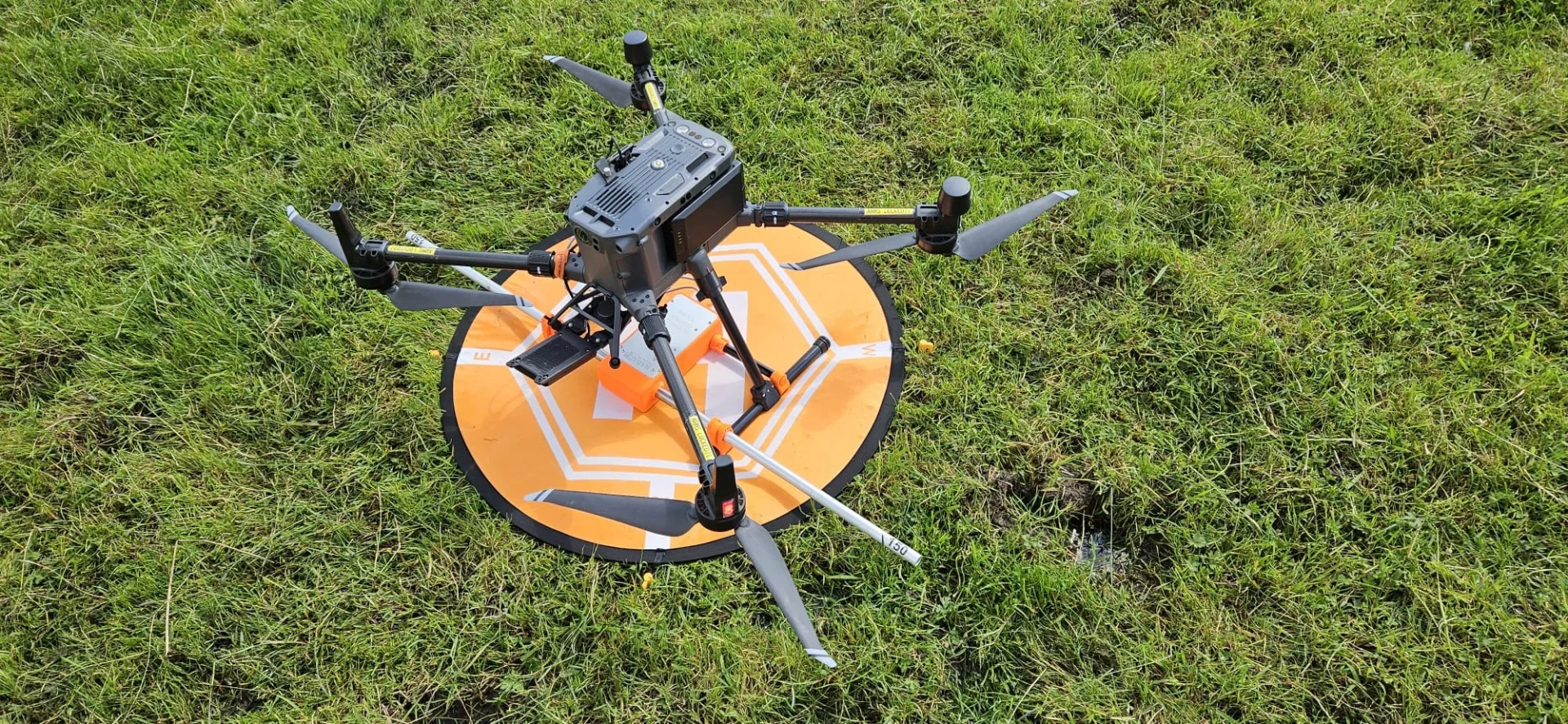
As specialists in industrial-grade course surveying and landscape assessment since 2016, we provide the actionable mapping data you need for critical golf course management decision-making.
Used By Top UK Businesses

👇Fill Out The Form For Same-Day Drone Survey Quote 👇
Why Leading UK Businesses Choose Our Drone Survey Services:
✅ We’re Fully Licensed, Insured Drone Pilots
✅ We Cover the UK with Fast Response Times
✅ We Only Use Top-Quality Drone Equipment
✅ We Customize Solutions for Your Industry
✅ We Handle All the Paperwork and Permissions
✅ We Have Worked with Hundreds of Happy Customers

Drone Golf Course Mapping and Management
While traditional course mapping methods rely on ground-based measurements, drone technology has revolutionized how we capture and analyze golf course data. Our drones fly systematically over your entire course, capturing high-resolution images from multiple angles that we transform into detailed 3D models.
We’ll provide you with comprehensive aerial maps showing precise measurements of fairways, greens, hazards, and elevation changes. This data allows superintendents to make informed decisions about irrigation, drainage, and maintenance schedules.
Our mapping service identifies problem areas before they become visible from the ground, saving you time and resources. We’ll also help you track seasonal changes, monitor construction projects, and visualize potential course improvements. With regularly updated maps, you’ll maintain optimal playing conditions while managing resources efficiently.


What Is Drone Golf Course Mapping and Management
Transformation is at the heart of drone golf course mapping and management—a technological approach that combines aerial imaging with data analysis to revolutionize how courses are maintained and improved. Our service deploys high-resolution cameras mounted on UAVs to capture comprehensive aerial views of your entire course.
We’ll fly systematic grid patterns over your property, collecting detailed images that we stitch together into precise orthomosaic maps. These maps provide exact measurements of fairways, greens, bunkers, and hazards—all viewable from any angle. The resulting data enables informed decisions about irrigation needs, turf health, renovation projects, and design changes.
Unlike traditional surveying methods, our drone mapping doesn’t disrupt play and delivers results in days rather than weeks, giving you actionable intelligence to enhance your course.
How Our Drone Golf Course Mapping Works
Our drone golf course mapping begins with a thorough course assessment and strategic flight planning to ensure complete coverage. We deploy specialized drones equipped with high-resolution cameras that systematically collect data on all course features, from fairways to hazards. After capture, we process this raw data using advanced software to create precision maps and detailed management reports that highlight opportunities for course improvement.

Comprehensive course assessment and flight planning
Before we launch our drones into the sky, we conduct a thorough assessment of your golf course to develop a customized flight plan. We’ll analyze your course layout, identifying key features such as greens, fairways, hazards, and elevation changes that require detailed mapping.
Our team examines local airspace restrictions, weather patterns, and potential obstacles that could affect flight safety. We’ll determine optimal flight altitudes, camera angles, and flight paths to ensure complete coverage while maximizing image resolution.
The assessment includes establishing ground control points for precise georeferencing and determining the best time of day for flight to capture ideal lighting conditions. We’ll discuss any specific areas you’d like us to focus on, such as problematic drainage zones or areas planned for renovation. This preparation ensures we capture every critical detail of your golf course.
Specialized drone deployment with high-resolution cameras
When it comes to capturing your golf course’s intricate details, we deploy state-of-the-art commercial drones equipped with 42-megapixel cameras and precision GPS systems. Our drones fly at optimal altitudes between 250-400 feet, capturing images with ground resolution as fine as 1 cm per pixel.
We utilize both fixed-wing and quadcopter drones depending on your course’s specific needs. Fixed-wing models excel at covering expansive fairways efficiently, while our quadcopters perform detailed inspections of challenging terrain features, bunkers, and greens.
Each flight mission follows pre-programmed paths with 75% overlap between images, ensuring seamless stitching during post-processing. Our pilots monitor real-time feeds throughout the mission, making adjustments for wind conditions or capturing additional angles of architectural features when needed.


Systematic data collection of course features
The systematic mapping process begins once our drones are airborne, carefully collecting multi-layered data about every feature on your golf course. We capture detailed information on fairways, greens, bunkers, water hazards, trees, and cart paths through precise flight patterns that ensure complete coverage.
Our drones employ GPS tracking to record exact coordinates while capturing data on elevation changes, vegetation health, and drainage patterns. We don’t just collect visual imagery—we gather functional data that helps you understand your course’s true characteristics and maintenance needs.
Each flight follows predefined protocols to ensure consistency, with multiple passes at different altitudes to maximize data accuracy. This methodical approach produces comprehensive data sets that form the foundation for our detailed mapping and analysis services.
Advanced processing for precision mapping
After gathering extensive course data, we transform these raw inputs into precision maps through our advanced processing pipeline. Our proprietary software combines photogrammetry techniques with AI algorithms to create highly accurate 3D models accurate to within 2-3 centimeters.
We meticulously process each dataset through multiple stages: geo-referencing, point cloud generation, mesh creation, and texture mapping. This allows us to highlight subtle elevation changes, calculate precise distances, and identify drainage patterns that aren’t visible to the naked eye.
The final outputs include contour maps, flyover animations, and interactive 3D models that can be integrated directly into your course management software. Course architects and superintendents can use these tools to visualize renovation projects, optimize maintenance schedules, and enhance player experiences without costly field surveys.

Detailed course management reporting
Beyond creating visual assets, our mapping service delivers actionable intelligence through comprehensive reports tailored to your specific management needs. We translate complex data into clear insights that help you make informed decisions about course maintenance and improvements.
Our reports include detailed vegetation health analyses, irrigation efficiency metrics, and drainage evaluations that pinpoint problem areas requiring attention. You’ll receive precise measurements of fairways, greens, and hazards, along with volumetric calculations for bunkers and water features.
We provide customizable reporting dashboards that let you track changes over time, compare conditions across seasons, and measure the effectiveness of your maintenance strategies. Whether you’re planning renovations, optimizing resource allocation, or demonstrating environmental stewardship, our detailed reports give you the data-driven foundation to execute with confidence.
Benefits of Drone Golf Course Mapping
Our drone mapping technology delivers unprecedented precision in measuring course features, documenting irrigation systems, and identifying early signs of turf health issues. We’ll provide you with visual planning tools that make course improvement decisions clearer and more strategic than ever before. You’ll find our drone mapping services offer a cost-effective alternative to traditional mapping methods while delivering superior results.


Precise measurement of course features and distances
When traditional course measurements fall short, our drone mapping technology delivers centimeter-level accuracy for every feature on your golf course. We precisely document fairway widths, bunker dimensions, green contours, and hazard locations that simply can’t be captured with ground-based methods.
You’ll receive exact distances between any points on the course—from tee boxes to landing areas, and from fairway positions to pin placements. This precision helps golfers make better club selections and strategize their gameplay effectively. Course architects and superintendents benefit too, with accurate measurements for renovation planning and maintenance operations.
Our drones collect millions of data points in a single flight, creating comprehensive digital models that surpass the accuracy of GPS handheld devices by up to 20 times. We transform raw measurements into actionable insights for your facility.
Comprehensive documentation of irrigation systems
Managing irrigation systems becomes dramatically simplified with drone mapping technology that reveals your complete water infrastructure from above. Our drones capture detailed imagery of sprinkler heads, valves, pumps, and water lines that might otherwise remain hidden from view.
We’ll provide you with precise GPS locations of all irrigation components, helping your maintenance team quickly find and repair issues without extensive searching. This comprehensive documentation allows you to identify inefficient watering patterns, detect leaks before they cause extensive damage, and optimize your irrigation scheduling.

Early detection of turf health issues
Monitoring your course with aerial technology enables superintendents to identify turf diseases, pest infestations, and stress patterns long before they’re visible to the naked eye. Our advanced multispectral sensors detect subtle changes in plant health by measuring chlorophyll levels and moisture content across your entire course.
We’ll provide you with detailed NDVI (Normalized Difference Vegetation Index) maps that highlight struggling turf areas in their earliest stages. This proactive approach allows for targeted treatment of affected zones before problems spread, reducing chemical usage and minimizing recovery time.
Visual tools for course improvement planning
Beyond health monitoring, our drone mapping service produces exceptional visual tools that revolutionize course improvement planning. We create detailed 3D models and contour maps that allow you to visualize potential changes before breaking ground. These powerful visuals help you make informed decisions about drainage improvements, bunker modifications, or tee box relocations.
Our interactive tools let you measure distances, analyze slopes, and simulate water flow patterns across your course. You’ll receive high-resolution orthomosaic maps that can be integrated with CAD software for precise planning and design work. When presenting improvement proposals to boards or investors, our visual assets provide compelling support for your recommendations.
With our drone-generated planning tools, you’ll reduce costly redesign errors and ensure that course improvements deliver the exact experience your golfers expect.


Cost-effective alternative to traditional mapping
While traditional mapping methods can strain your budget and timeline, our drone golf course mapping service delivers superior results at a fraction of the cost. We’ve eliminated the need for expensive ground crews and heavy equipment that traditional surveys require, reducing overall expenses by up to 70%.
Our drones collect comprehensive data in a single day, compared to the weeks needed for conventional surveys. There’s no course disruption or lost revenue from closing holes during mapping. You’ll also save on future updates—once we’ve established baseline data, we can quickly perform seasonal assessments or track specific changes at minimal cost.
We provide all this while delivering higher resolution imagery and more accurate measurements than traditional methods, making drone mapping the smart financial choice for forward-thinking course managers.
Drone Golf Course Mapping Services We Offer
Our comprehensive drone mapping services include complete course layout documentation, irrigation system mapping, and detailed turf health assessments. We’ll identify drainage issues and develop targeted planning solutions to protect your investment and enhance playability. Additionally, we provide precise measurements of all hazards and course features, giving you accurate data for maintenance decisions and marketing materials.

Complete Course Layout Documentation
Through comprehensive aerial surveys, we create detailed course layout documentation that captures every element of your golf facility. Our high-resolution mapping identifies precise locations of tees, greens, fairways, bunkers, water hazards, cart paths, and forested areas.
We’ll deliver accurate measurements of hole distances, fairway widths, and green contours that help optimize play and maintenance. This documentation serves multiple functions: it’s essential for renovation planning, tournament setup, and marketing materials.
Club managers value our ability to produce both technical CAD files for engineering purposes and visually appealing course renderings for members. We also provide digital elevation models that reveal drainage patterns and slope characteristics. With seasonal updates, you’ll track course changes over time, enabling smarter resource allocation and more informed decision-making for your facility’s future.
Irrigation System Mapping
Modern golf course maintenance demands precise knowledge of irrigation infrastructure, which our drone mapping service captures with exceptional detail. We identify and document every sprinkler head, valve, control box, and pipeline throughout your course.
Our high-resolution thermal imaging reveals underground water lines and potential leaks invisible to the naked eye. This allows maintenance teams to pinpoint repair locations without disruptive excavation. We’ll provide comprehensive maps showing water coverage patterns, identifying dry spots and overlapping zones that waste water.
The data we collect integrates seamlessly with irrigation management software, enabling automated adjustments and efficiency improvements. With our irrigation mapping, you’ll reduce water consumption, cut maintenance costs, and maintain optimal playing conditions while meeting environmental regulations and conservation goals.


Turf Health Assessment
Precision lies at the heart of our turf health assessment service, which transforms traditional ground-level inspections into comprehensive aerial analyses. Our drones capture multispectral imagery that identifies stressed turf areas before they’re visible to the naked eye.
We measure key indicators including chlorophyll content, water retention, and nitrogen levels across your entire course. This data translates into detailed NDVI (Normalized Difference Vegetation Index) maps highlighting variations in plant health with incredible accuracy.
You’ll receive actionable insights about disease outbreaks, pest infestations, and nutrient deficiencies before they become widespread problems. Our reports help you target treatments precisely where needed, reducing chemical usage while maximizing effectiveness. The result? Healthier turf, lower maintenance costs, and a consistently superior playing experience for your golfers.
Drainage Analysis and Planning
When water management problems plague your golf course, our drone-based drainage analysis identifies the root causes with unmatched accuracy. We capture high-resolution elevation data accurate to within centimeters, revealing even subtle slopes and depressions that affect water flow across your property.
Our advanced software generates comprehensive drainage maps highlighting problem areas, potential pooling zones, and natural water channels. We’ll identify opportunities for improved drainage infrastructure placement and recommend strategic modifications to existing systems.
This precision mapping eliminates guesswork in drainage planning, saving you thousands in unnecessary excavation and construction costs. By optimizing water management, you’ll enhance playability, reduce maintenance expenses, and extend the seasonal availability of your course. Our drainage analysis ensures your investment in water management solutions delivers maximum return through targeted, data-driven implementation.

Hazard and Feature Measurement
While traditional survey methods struggle with complex terrain, our drone mapping precisely measures every hazard and feature on your golf course. We capture exact dimensions of bunkers, water hazards, and other obstacles that affect gameplay, providing accurate data for both maintenance and player strategy.
Our drones collect centimeter-level measurements of green contours, fairway slopes, and landing areas. This precision is crucial for hazard redesign projects, helping you understand how changes will impact play before breaking ground. We’ll deliver detailed 3D models of all course features, allowing your team to calculate volumes for sand or water features and accurately position course elements on tournament scorecards and yardage books.
Tournament Preparation Support
Professional tournaments demand meticulous course preparation, and our drone mapping services provide tournament directors with invaluable data weeks before the event. We deliver detailed spectator pathway planning, optimal camera position identification, and temporary structure placement recommendations.
Our drones capture high-resolution course conditions, helping superintendents target specific areas needing attention before players arrive. We’ll map potential weather impact zones, highlighting areas prone to flooding or wind exposure that might affect play.
For television broadcasts, we create 3D flyover animations that give viewers stunning hole previews. Tournament officials can also use our data to precisely position marshals, first aid stations, and concessions. We’ve supported events from local championships to PGA Tour stops, delivering the critical insights that modern tournament management requires.


Marketing and Promotional Imagery
Every golf course needs compelling visual assets to stand out in today’s competitive market, and our drone services deliver spectacular marketing content that traditional ground photography simply cannot match. Our aerial imagery showcases your course’s unique layout, stunning scenery, and signature holes from perspectives that captivate potential visitors.
We’ll capture high-resolution photos and videos perfect for your website, social media campaigns, brochures, and advertisements. These visuals highlight course features, amenities, and surrounding landscapes in ways that entice new golfers and members. We also create dramatic flyover videos that follow each hole from tee to green, giving players a preview of the challenges ahead. This dynamic content keeps your marketing fresh and engaging while effectively communicating your course’s distinctive character and appeal.
Construction and Renovation Monitoring
When undertaking major construction or renovation projects on your golf course, our comprehensive drone monitoring services provide invaluable oversight throughout the entire process. We’ll capture weekly or monthly aerial progress updates that document each phase of development from groundbreaking to completion.
Our drones collect precise measurements and detailed imagery that help verify contractor work against design specifications. This regular monitoring ensures projects stay on schedule and budget while identifying potential issues before they become costly problems.
We deliver time-lapse videos showing the transformation of your course, which are perfect for keeping stakeholders informed and generating excitement about the improvements. The data we collect also creates detailed as-built documentation that’s essential for future maintenance and renovations.

Technology We Use for Drone Golf Course Mapping
Our drone golf course mapping relies on industry-leading technology that delivers unparalleled accuracy and detail. We utilize professional-grade UAVs equipped with 4K cameras and LiDAR sensors that capture ground features down to 1cm precision. These drones follow pre-programmed flight paths with RTK GPS systems for consistent, comprehensive coverage.
Our processing software combines photogrammetry and advanced algorithms to generate detailed 3D models, contour maps, and volumetric calculations. We’ve invested in thermal imaging capabilities to identify irrigation issues and assess turf health that’s invisible to the naked eye.
All data is securely stored and accessible through our cloud platform, where superintendents can measure distances, analyze slopes, and track changes over time. This technology creates an intuitive digital twin of your course that enhances management decisions.
Applications Across Course Management
Our drone mapping services transform how golf courses operate across multiple management areas. We’re helping course architects visualize redesigns, groundskeepers optimize maintenance schedules, and water managers track irrigation needs with unprecedented precision. These aerial insights also enhance player experiences through detailed course guides and provide stunning marketing visuals that showcase your property’s unique beauty.


Course design and renovation
Course design and renovation projects benefit tremendously from drone mapping’s comprehensive aerial perspective. We provide architects and course managers with detailed topographical data that highlights elevation changes, drainage patterns, and existing features that influence redesign decisions.
Our high-resolution imagery allows designers to visualize potential changes before breaking ground, saving both time and resources. They’ll identify optimal placements for bunkers, water hazards, and tee boxes while preserving the course’s natural beauty.
During renovation, we’ll capture weekly progress images to ensure construction adheres to design specifications. These regular updates help spot issues early, preventing costly corrections later.
After completion, we can create stunning before-and-after comparisons that showcase the transformation—perfect for marketing materials that highlight your course’s improvements to members and potential players.
Maintenance planning and execution
Effective maintenance planning relies heavily on accurate, current data about course conditions—which is precisely what drone mapping provides. Our aerial surveys give superintendents comprehensive views of turf health, irrigation coverage, and problem areas before they become visible at ground level.
We’ll deliver detailed NDVI vegetation maps showing exactly where turf stress is developing, helping you target fertilizer, water, and pest control applications precisely where needed. This data-driven approach eliminates guesswork, reduces chemical usage, and optimizes labor allocation.
When executing maintenance plans, our before-and-after mapping validates improvements and tracks changes over time. Superintendents can monitor how drainage solutions perform during wet periods or assess how turf recovers from renovation work. This measurable feedback loop ensures continuous improvement in your maintenance practices.

Water resource management
Water resource management is perhaps the most critical application of our drone mapping technology in today’s climate-conscious golf industry. Our high-resolution thermal and multispectral imaging identifies moisture levels across your entire course with remarkable precision.
We’ll help you pinpoint overwatered zones, detect leaks in irrigation systems, and identify drought-stressed areas before they become visible to the naked eye. This data integrates directly with smart irrigation systems to create targeted watering schedules that reduce consumption by up to 30%.
Our clients consistently report significant water savings while maintaining pristine playing conditions. We’ll provide detailed water runoff analysis to ensure environmental compliance and protect local watersheds. In regions facing water restrictions, our technology becomes an essential tool for sustainable course management.
Player experience enhancement
While mapping and maintenance data form the backbone of course operations, the ultimate goal of any golf facility is to provide an exceptional player experience. Our drone mapping services directly contribute to this mission by creating detailed yardage books and hole-by-hole flyover videos that players can access before their round.
We’re helping courses develop custom mobile apps that integrate our high-resolution maps, allowing golfers to make informed decisions about club selection and strategy. These digital tools include precise distance measurements to hazards and pins, elevation changes that affect club selection, and recommended landing zones for different skill levels.
The result? Players enjoy more strategic, confident rounds while courses benefit from improved pace of play and increased customer satisfaction—ultimately driving higher retention rates and positive word-of-mouth.


Marketing and promotion
Beyond operational advantages, drone footage transforms how golf courses market themselves to potential customers. We’ll capture stunning aerial shots that showcase your course’s unique layout, signature holes, and natural beauty in ways ground-level photography simply cannot match.
Our high-definition video and photography services provide compelling content for your website, social media channels, and promotional materials. We can create virtual flyovers of each hole, highlight seasonal changes, or capture special events from perspectives that will captivate potential guests.
These visual assets help distinguish your facility from competitors, giving prospective players an immersive preview of what makes your course special. When combined with our mapping data, you’ll have a comprehensive marketing toolkit that elevates your brand and attracts new customers through visually stunning, information-rich presentations.
Tournament preparation
When preparing for tournaments, course managers need precise data to create challenging yet fair playing conditions. Our drone mapping services deliver the essential insights needed for optimal tournament setup.
We’ll help you identify strategic pin placement options with our detailed slope analysis and green contour maps. You can visualize how different tee box positions affect play, ensuring an appropriate challenge level for competitors.
Our maps also identify areas requiring special attention before tournament day—such as drainage issues or turf stress—allowing your maintenance team to address problems proactively.
With our 3D flythrough capabilities, you can preview the course exactly as players will experience it, perfect for player briefings and broadcasting teams. We’ll provide everything you need to ensure your tournament runs flawlessly from first tee to final putt.

Why Choose Our Drone Golf Course Mapping Team
As pioneers in the golf course mapping industry, our team brings unparalleled expertise and cutting-edge technology to every project we undertake. We combine FAA-certified drone pilots with golf industry professionals who truly understand course management needs.
Our distinction comes from our specialized equipment—high-resolution cameras and LiDAR sensors that capture details competitors simply miss. We’ve mapped over 200 championship courses nationwide, including several PGA Tour venues.
We don’t just deliver data; we provide actionable insights through our custom software platform that integrates seamlessly with your existing course management systems. Our turnaround time averages just 72 hours from flight to final delivery, significantly faster than industry standards.
Choose us for precision, expertise, and reliability when your course deserves nothing less.
Contact Us For Your Drone Golf Course Mapping Needs
Ready to elevate your golf course management with detailed aerial insights? Our specialized drone mapping services provide comprehensive course visualization, precise measurements, and condition analysis to enhance both maintenance operations and player experience.
Reach out today through our dedicated sports facilities line at +44 7368 537499 or email us at Jamie@skykam.co.uk. We’ll respond within 24 hours to arrange your free consultation.
When contacting us, please include information about your course layout, specific management challenges, and particular visualization needs. This helps us tailor our mapping approach to deliver the most valuable insights for your facility. We serve golf courses throughout the UK and can schedule surveys to minimize disruption to your players.
Let’s collaborate to optimize your course management and marketing materials with cutting-edge drone mapping technology that showcases your facility from its most impressive angles.