Need accurate damage assessment? Save time, cut costs, and get crystal-clear insights with our advanced drone storm damage inspection services.
Don’t settle for risky, time-consuming traditional inspections when our enterprise-grade drone technology delivers faster, safer damage analysis results.
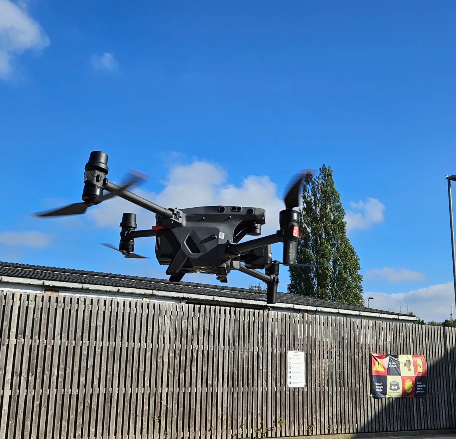
As specialists in industrial-grade disaster assessment and structural monitoring since 2016, we provide the actionable condition data you need for critical recovery decision-making.
Used By Top UK Businesses

👇Fill Out The Form For Same-Day Drone Survey Quote 👇
Why Leading UK Businesses Choose Our Drone Survey Services:
✅ We’re Fully Licensed, Insured Drone Pilots
✅ We Cover the UK with Fast Response Times
✅ We Only Use Top-Quality Drone Equipment
✅ We Customize Solutions for Your Industry
✅ We Handle All the Paperwork and Permissions
✅ We Have Worked with Hundreds of Happy Customers


What Is Drone Storm Damage Inspection
Drone storm damage inspection uses UAVs to quickly assess and document damage to buildings, infrastructure, and landscapes after severe weather events like storms, hurricanes, or floods. Equipped with high-resolution cameras and sometimes thermal sensors, drones capture detailed aerial images and videos of affected areas.
This allows for fast, safe, and accurate evaluation without putting inspectors at risk. Drones can reach hazardous or inaccessible locations, such as rooftops or downed power lines, providing a complete overview of the damage.
The data collected helps insurance companies, emergency responders, and property owners make informed decisions on repairs and claims. This method speeds up recovery efforts and ensures thorough damage assessments.
How Our Drone Storm Damage Inspections Work
Our storm damage inspection process begins with rapid drone deployment following severe weather events, utilizing specialized imaging systems to capture comprehensive aerial documentation of affected areas. We then apply advanced image processing to thoroughly assess damage patterns, identify structural weaknesses, and detect issues invisible from ground level. Finally, we deliver detailed reports with prioritized action items, allowing property owners and insurance adjusters to make informed decisions based on accurate visual evidence.

Rapid deployment following weather events
As soon as severe weather clears, we mobilize our rapid-response team to assess your property damage. Our fleet of storm-ready drones can be on-site within hours of safe conditions being declared, dramatically reducing response times compared to traditional inspection methods.
We maintain a network of certified drone pilots strategically positioned throughout the region, allowing us to reach your location quickly regardless of where the storm hit. Our team monitors weather forecasts continuously, preparing equipment and personnel before storms even end.
Unlike conventional inspectors who may be delayed by road closures or debris, our drones can access your property from above, providing immediate documentation of damage for insurance claims. This rapid assessment helps you secure emergency repairs faster and begin the recovery process when every hour counts.
Specialized drone deployment with imaging systems
The specialized imaging systems that power our storm damage inspections represent a technological breakthrough for property owners. We deploy drones equipped with 4K ultra-high-definition cameras, thermal imaging sensors, and LiDAR technology to capture comprehensive data about your property’s condition.
Our drones systematically scan rooftops, siding, and structural elements, detecting issues invisible to the naked eye. The thermal sensors identify water intrusion and heat loss areas, while LiDAR creates precise 3D models that measure structural displacement down to the millimeter.
We’ve invested in stabilization technology that ensures clear imaging even in post-storm winds, and our fleet includes specialized drones for confined spaces like attics or crawl spaces. All imaging data is processed through our proprietary AI system that highlights damage patterns consistent with storm impacts.


Comprehensive aerial documentation of affected areas
When storm damage strikes your property, comprehensive aerial documentation becomes our top priority. We deploy our drones to capture high-resolution imagery of your entire property from multiple angles and elevations. This aerial perspective reveals damage patterns that remain invisible from ground level.
Our pilots systematically map your property using GPS-guided flight paths, ensuring complete coverage of roofs, landscaping, outbuildings, and surrounding areas. We document all visible damage through 4K video and still photography, creating a thorough digital record that insurance companies prefer.
We’ll identify subtle issues like missing shingles, damaged gutters, fallen trees, and structural compromises. This comprehensive approach means nothing gets overlooked, giving you complete documentation to support your insurance claims and repair planning.
Advanced image processing and damage assessment
Our proprietary image processing technology transforms raw drone footage into actionable intelligence for your storm damage assessment. We use AI-powered algorithms to analyze thousands of high-resolution images, identifying subtle damage patterns that human eyes might miss.
The system automatically tags critical issues like compromised roof structures, damaged siding, or downed power lines. We overlay these findings with thermal imaging data to detect water intrusion and hidden structural weaknesses not visible to the naked eye.
We’ll deliver a comprehensive digital report with color-coded severity ratings, precise measurements, and 3D modeling of your property. This detailed assessment helps expedite insurance claims, prioritize repairs, and reduce inspection costs. Our damage reports are accepted by all major insurance carriers and provide the documentation you need to fast-track your recovery process.

Detailed reporting with prioritized action items
Following our comprehensive damage assessment, you’ll receive a meticulously organized report that transforms complex data into clear actions. Our reports categorize damage by severity, location, and estimated repair costs, helping you make informed decisions quickly.
We prioritize issues that pose structural risks or could lead to further damage, ensuring you address critical problems first. Each action item includes high-resolution images, GPS coordinates, and detailed descriptions of the damage observed.
For insurance claims, we provide documentation that meets industry standards, including all necessary measurements and comparative analysis. We’ll also highlight potential hidden damage that might require professional inspection.
Our reports are available in digital format for easy sharing with contractors, insurance adjusters, and other stakeholders, streamlining your recovery process.
Benefits of Drone Storm Damage Inspections
Our drone inspection technology offers five crucial advantages during storm aftermath: immediate access to affected areas without risking personnel safety. We provide comprehensive documentation that expedites insurance claims while quickly identifying critical structural vulnerabilities. You’ll save significantly on inspection costs compared to traditional manual methods while receiving more detailed and accurate assessments.


Immediate access to disaster-affected areas
When disaster strikes and roads become impassable, drones provide immediate access to storm-damaged areas that would otherwise remain isolated for days. Our UAVs can navigate over fallen trees, flooded streets, and debris-strewn landscapes to quickly assess damage and identify urgent safety concerns.
We’re often able to deploy our drones within hours of a storm passing, while traditional inspection teams may be delayed by cleanup efforts or safety protocols. This rapid response means you’ll have critical information about your property’s condition when you need it most.
For insurance claims, this immediate access translates to faster documentation and processing. We can provide you with high-resolution imagery and detailed assessment reports while conventional inspectors are still planning their approach, giving you a valuable head start on recovery.
Safe assessment without endangering personnel
Damaged structures and hazardous conditions following severe storms create significant risks for traditional inspectors, which is why our drone technology provides a crucial safety advantage. We keep your personnel safely on the ground while our drones navigate compromised roofs, unstable buildings, and areas with downed power lines.
Our remote pilots can thoroughly examine dangerous areas that would typically require harnesses, ladders, or scaffolding. We’ll identify potential collapse zones, structural weaknesses, and other hazards before anyone needs to enter these spaces. This approach eliminates slip-and-fall risks and exposure to harmful materials like asbestos that storms may have disturbed.

Comprehensive documentation for insurance claims
Beyond safety benefits, drone technology revolutionizes the insurance claims process through superior documentation capabilities. Our drones capture high-resolution photos and 4K video evidence that insurers demand, providing unprecedented detail of storm damage across your entire property.
We’ll deliver comprehensive documentation packages that include georeferenced imagery, precise measurements, and annotated damage reports. These materials significantly streamline the claims process by eliminating disputes about damage extent or location. Many insurance companies now prefer drone-collected evidence because it offers complete property assessment from multiple angles.
Our thermal imaging capabilities can also detect hidden water damage that’s invisible to the naked eye—often a critical factor in storm damage claims. With our thorough documentation, you’ll have compelling evidence to support your claim and help secure fair compensation without lengthy delays.
Rapid identification of critical damage points
Following a severe storm event, our drone inspection teams can rapidly identify the most critical damage points requiring immediate attention. Our high-resolution cameras detect compromised structural elements, water intrusion points, and potential safety hazards that might go unnoticed in traditional ground-based assessments.
We’ll prioritize these critical areas in our comprehensive report, allowing you to address the most urgent repairs first. This targeted approach prevents secondary damage that often occurs when water continues to infiltrate your property through undetected entry points.
Our thermal imaging capabilities can also reveal hidden moisture behind walls or under roofing materials, identifying problems before they become visible. When time is of the essence, our drone technology delivers the crucial information you need to make informed decisions about emergency repairs and mitigation.


Cost-effective alternative to manual inspections
While traditional manual inspections often require extensive equipment, personnel, and time commitments, our drone inspection service delivers comprehensive storm damage assessments at a fraction of the cost.
We’ve eliminated the need for costly scaffolding, lifts, and multiple site visits that typically inflate your inspection budget. Our drones can survey large properties in a single session, reducing labor hours by up to 80%.
You’ll also avoid the hidden expenses of manual inspections – worker compensation risks, liability insurance increases, and repeated visits for missed areas. We provide high-resolution documentation of all damage in one efficient flight, allowing your insurance claims to proceed faster and with better supporting evidence. This streamlined process translates to significant savings while delivering superior inspection quality.
Drone Storm Damage Inspection Services We Offer
Our comprehensive drone inspection services include crucial roof damage assessment and structural integrity verification following severe weather events. We’ll document flooding impacts with precision while identifying potentially hazardous tree damage across your property. Our drones also capture detailed imagery of property boundary and fence damage, providing you with complete documentation for insurance claims and repair planning.

Roof Damage Assessment
Thunderstorms, hailstorms, and hurricanes can leave devastating roof damage that’s difficult to assess from ground level. Our drone inspection service provides a comprehensive evaluation of your roof’s condition without the safety risks of ladder climbing.
We’ll capture high-resolution imagery of missing shingles, damaged flashing, dented vents, and compromised structural elements. Our thermal imaging technology can even detect water infiltration and hidden damage beneath the surface.
You’ll receive a detailed report with annotated photos highlighting all damage areas, which serves as valuable documentation for insurance claims. We can identify issues that might be missed during traditional inspections, especially in hard-to-reach areas.
Don’t wait until small problems become major leaks. Our drone roof assessment offers the quick, accurate evaluation you need after severe weather events.
Structural Integrity Verification
Beyond roof assessment, structural integrity verification represents a cornerstone of our post-storm drone inspection services. We utilize advanced imaging technology to identify compromised load-bearing elements that may not be visible from ground level.
Our drones capture high-definition footage of wall buckling, foundation shifts, and structural misalignments caused by storm pressure or flooding. We’ll identify leaning walls, sagging roof lines, and damaged support beams that could lead to catastrophic failure if left unaddressed.
Insurance companies often require verification of structural integrity before processing claims. Our comprehensive reports include thermal imaging to detect hidden water intrusion that might compromise structural elements over time. This documentation accelerates your claim process while ensuring no potential safety hazards are overlooked.
We’re committed to providing you with actionable data about your property’s structural condition following severe weather events.


Flooding Impact Documentation
Floods devastate properties in ways often invisible from ground level, making aerial documentation essential for comprehensive damage assessment. Our drones capture the full scope of water inundation, tracking flow patterns, pooling areas, and property boundaries affected by rising waters.
We’ll document water height markers on structures, debris fields, and erosion patterns that may compromise foundations or landscaping. Our high-resolution imagery identifies hidden water damage to roofs, siding, and surrounding infrastructure that traditional inspections might miss.
These aerial records provide critical evidence for insurance claims, showing the true extent of flooding damage with timestamp verification. We’ll deliver comprehensive flood impact reports with annotated images highlighting affected areas, helping you secure proper compensation and develop effective remediation plans for your property.
Tree Damage and Hazard Identification
While storms ravage landscapes, they often leave behind dangerous tree damage that threatens property and safety long after winds subside. Our drones capture high-resolution imagery of compromised trees, identifying hanging limbs, split trunks, and root exposure that ground crews might miss.
We’ll identify trees with structural damage that pose immediate collapse risks to buildings, power lines, or high-traffic areas. Our thermal imaging can detect internal decay that’s invisible to the naked eye, revealing trees that appear stable but could fail during the next storm.
You’ll receive a comprehensive report documenting each hazard’s location, severity, and recommended action. This allows you to prioritize removal and trimming based on risk level, creating a strategic approach to cleanup that protects your property and everyone on it.

Property Boundary and Fence Damage
Powerful storms often devastate property boundaries and fencing systems that define and secure your land. Our drones quickly assess the full extent of damage to your perimeter barriers, providing comprehensive documentation that’s invaluable for insurance claims.
We’ll identify displaced fence posts, collapsed sections, and damaged gates with high-resolution imagery that pinpoints exact locations of damage. Our advanced mapping capabilities allow us to overlay property lines onto current footage, highlighting any encroachment issues created by the storm.
This aerial perspective helps prioritize repairs based on security vulnerabilities and saves you from trudging through difficult terrain to inspect remote boundary sections. We’ll deliver a detailed report showing all compromised areas, helping you restore your property’s security perimeter efficiently and completely.
Commercial Property Assessment
For commercial properties, our drone inspection services deliver critical post-storm damage assessments that minimize business disruption while maximizing insurance recovery. We understand that every day of business interruption directly impacts your bottom line.
Our drones quickly survey extensive commercial rooftops, warehouses, and multi-building complexes that would take days to inspect manually. We’ll provide comprehensive documentation of all structural damage, HVAC system impacts, and solar panel arrays—all without shutting down your operations.
The high-resolution imagery and thermal scanning capabilities allow us to detect water intrusion and hidden structural weaknesses that might otherwise go unnoticed. This thorough assessment gives you powerful leverage when filing commercial property claims and helps prioritize repairs based on business-critical needs.


Agricultural Crop Damage Evaluation
Agricultural storm damage extends beyond buildings to the lifeblood of our economy—crops. Our drone technology provides farmers with rapid assessment capabilities following destructive weather events like hail, wind, floods, or tornados.
We fly systematic grid patterns over fields to capture high-resolution imagery that identifies affected areas, evaluates crop loss percentages, and documents damage severity. This comprehensive data supports insurance claims with objective evidence rather than estimates.
Our specialized agricultural sensors detect plant stress indicators invisible to the human eye, revealing problems before they’re visually apparent. We can survey hundreds of acres daily, delivering detailed damage maps within 24 hours.
For seasonal clients, we offer comparative analysis using historical imagery to track recovery and make informed replanting decisions. We’ll help you quantify losses and expedite your claim process when every day counts.
Infrastructure Damage Documentation
When severe weather strikes essential public infrastructure, our specialized drone teams rapidly mobilize to document critical damage across roads, bridges, utility networks, and water systems. We provide comprehensive aerial surveys that identify structural weaknesses, collapsed sections, and flood damage that might be inaccessible by ground crews.
Our drones capture high-resolution images and video footage that engineering teams can immediately analyze to prioritize repairs and allocate resources efficiently. We’ll deliver detailed 3D models showing displacement patterns and stability concerns that help expedite insurance claims and FEMA assistance applications. With thermal imaging capabilities, we can detect hidden water infiltration and electrical system failures before they become catastrophic. We’re committed to helping communities restore vital infrastructure quickly and safely while providing the documentation needed for proper reconstruction funding.

Technology We Use for Drone Storm Damage Inspections
Our drone inspection service employs cutting-edge technology to deliver comprehensive storm damage assessments with unmatched precision and efficiency. We utilize state-of-the-art UAVs equipped with 4K cameras, thermal imaging sensors, and LiDAR technology to capture detailed imagery from multiple angles.
Our drones feature obstacle avoidance systems and GPS stabilization, allowing them to navigate safely around damaged structures. We’ve integrated specialized software that creates detailed 3D models and identifies structural issues through AI analysis. This technology can detect subtle damage that’s invisible to the naked eye.
The data we collect is instantly processed through our cloud platform, where our certified inspectors can review findings and generate reports within hours instead of days. This rapid response helps expedite insurance claims and emergency repairs.
Applications Across Storm Events
Our drone inspection services cover the full spectrum of storm events, from capturing the extensive structural damage of hurricanes and tornados to precisely documenting flood impacts across large areas. We’ve refined our techniques to identify subtle hail damage patterns on roofs and verify wind-related destruction that might be missed by ground-level assessments. These comprehensive capabilities ensure insurance claims are properly supported with detailed visual evidence regardless of which type of storm has affected your property.


Hurricane and tropical storm damage
Amid the devastation that follows hurricanes and tropical storms, our drone inspection services provide critical assessment capabilities when ground access becomes impossible. Our drones quickly identify collapsed structures, flooding extent, and infrastructural failures that might otherwise remain undetected for days.
We’re able to survey entire neighborhoods in hours rather than days, capturing high-resolution imagery of damaged roofs, downed power lines, and compromised foundations. This data helps insurance adjusters process claims faster and allows emergency services to prioritize resources effectively.
Our thermal imaging capabilities also detect water intrusion behind walls and under roofing materials—damage that’s invisible to the naked eye but critical to address before mold develops. We deliver comprehensive reports with georeferenced data that becomes invaluable for reconstruction planning and future storm preparedness efforts.
Tornado aftermath assessment
When tornadoes carve destructive paths through communities, rapid damage assessment becomes essential for effective response and recovery. Our drones quickly access tornado-damaged areas that might be unsafe or unreachable by ground crews, providing critical aerial perspectives.
We deploy specialized drones equipped with high-resolution cameras and thermal imaging to identify structural compromises, debris hazards, and people who may need immediate assistance. Our flight teams can map entire damage swaths in hours rather than days, allowing emergency management to prioritize resources effectively.
Our detailed tornado damage reports include severity classifications, GPS-tagged imagery, and 3D models that insurance companies and disaster relief organizations can use immediately. We’re often on-site within hours of a tornado event, providing the visual data needed for swift community recovery.

Flood impact documentation
Floodwaters present unique challenges that differ significantly from tornado damage, requiring specialized documentation techniques for accurate assessment. Our drones can safely navigate over flooded areas, capturing precise water level measurements and documenting the extent of inundation across properties and infrastructure.
We’re able to identify water entry points in structures, document erosion patterns, and track debris flow that might cause secondary damage. Our thermal imaging capabilities detect moisture trapped in walls and foundations that’s invisible to the naked eye. We’ll provide comprehensive before-and-after comparisons if pre-flood imagery exists, helping insurance adjusters and restoration teams understand the full scope of damage.
Unlike ground teams, our drones won’t disturb evidence of water lines or contribute to cross-contamination in flood-affected areas, preserving critical documentation for your claims process.
Hail damage verification
Although hailstorms often leave behind subtle damage that’s difficult to identify from ground level, our drones provide the perfect solution for comprehensive hail damage verification. We’ll capture high-resolution imagery of your entire roof and property, documenting even minor dents and impacts that might worsen over time.
Our specialized inspection protocols detect patterns consistent with hail strikes, providing conclusive evidence for insurance claims. We’ll identify damaged areas on roofs, siding, gutters, and other vulnerable surfaces that adjusters might miss during standard walk-throughs.
After inspection, you’ll receive a detailed damage map highlighting affected areas with GPS coordinates and measurements. This documentation significantly improves claim approval rates and helps contractors target repairs precisely. We’ll deliver these results within 48 hours, accelerating your recovery process.


Wind damage evaluation
Strong winds can devastate properties in ways that aren’t immediately visible to untrained observers. Our drones capture comprehensive imagery of roof lifting, partial detachments, and structural warping that might escape ground-level inspections.
We’re able to identify subtle indicators of wind damage including loosened shingles, displaced flashing, and compromised seals around vents and chimneys. Our thermal imaging technology detects air leaks where wind has created gaps in your home’s envelope.
We’ll document all wind-related damage with precise coordinates and measurements, providing you with irrefutable evidence for insurance claims. This detailed assessment helps distinguish between pre-existing conditions and storm-specific damage, significantly improving claim outcomes and helping you secure the repairs your property needs.
Lightning strike assessment
When lightning strikes a property, the resulting damage often extends far beyond visible burn marks or charred materials. Our drones systematically scan the entire structure, detecting thermal anomalies that indicate hidden electrical damage or smoldering materials that could lead to fires.
We’ll identify compromised electrical systems, damaged roof components, and structural weaknesses using high-resolution thermal imaging and specialized sensors. This comprehensive assessment reveals issues invisible to the naked eye, like damaged wiring within walls or roof systems with compromised integrity.

Why Choose Our Drone Storm Damage Inspection Team
After a devastating storm hits, selecting the right inspection team becomes critical for timely and accurate damage assessment. We bring over a decade of specialized experience in drone-based storm damage inspections across residential and commercial properties.
Our certified drone pilots are equipped with advanced thermal imaging cameras and 4K video technology to capture detailed documentation of roof, siding, and structural damage. We’re fully insured and FAA-compliant, ensuring your inspection meets all regulatory requirements.
Unlike traditional methods, our drone inspections deliver comprehensive reports within 24 hours, accelerating your insurance claims process. We’ve partnered with major insurance providers nationwide, understanding exactly what documentation they require.
Our team stands ready 24/7 for emergency response, typically arriving on-site within hours of your call. Choose us for safety, speed, and superior documentation that protects your property investment.
Contact Us For Your Drone Storm Damage Inspection Needs
Ready for rapid assessment of storm impacts to your property? Our specialized drone storm damage inspection services provide immediate aerial documentation, detailed damage analysis, and comprehensive visual evidence to support insurance claims and repair planning.
Reach out today through our dedicated emergency response line at +44 7368 537499 or email us at Jamie@skykam.co.uk. We’ll respond within 24 hours—often much sooner for urgent situations.
When contacting us, please share details about your property location, damage type, and specific documentation needs. This helps us prioritize and prepare for your inspection. We serve residential, commercial, and industrial clients throughout the UK and can deploy quickly following weather events.
Let’s work together to document storm damage comprehensively and expedite your recovery process with our advanced drone inspection technology.