Need accurate traffic data? Save time, cut costs, and get crystal-clear insights with our advanced drone traffic monitoring services.
Don’t settle for risky, time-consuming traditional monitoring methods when our enterprise-grade drone technology delivers faster, safer traffic analysis results.
As specialists in industrial-grade traffic surveying and flow assessment since 2016, we provide the actionable transportation data you need for critical infrastructure decision-making.
Used By Top UK Businesses

👇Fill Out The Form For Same-Day Drone Survey Quote 👇
Why Leading UK Businesses Choose Our Drone Survey Services:
✅ We’re Fully Licensed, Insured Drone Pilots
✅ We Cover the UK with Fast Response Times
✅ We Only Use Top-Quality Drone Equipment
✅ We Customize Solutions for Your Industry
✅ We Handle All the Paperwork and Permissions
✅ We Have Worked with Hundreds of Happy Customers


What Is Drone Traffic Monitoring?
Drone traffic monitoring involves using unmanned aerial vehicles (UAVs) to observe, record, and analyze traffic flow on roads and highways. Equipped with high-resolution cameras and sensors, drones can capture real-time data on vehicle movements, congestion, and accidents from above.
This provides a broader, more flexible view compared to fixed cameras or ground-based sensors. The data collected helps traffic management teams optimize traffic flow, plan infrastructure improvements, or respond quickly to incidents.
Drones can also be deployed temporarily for special events or in areas lacking permanent monitoring systems. This method enhances traffic analysis, reduces costs, and improves overall road safety and efficiency.
How Our Drone Traffic Monitoring Service Works
We begin our drone traffic monitoring by strategically selecting high-value observation points where our specialized video-equipped drones can capture comprehensive traffic patterns. Our technology systematically collects vehicle movement data while our advanced processing systems track and analyze traffic flow in real-time. We then compile this information into detailed reports that provide actionable insights about congestion patterns, peak travel times, and potential infrastructure improvements.

Strategic monitoring location selection
To maximize traffic data collection accuracy, our team strategically selects monitoring locations based on historical congestion patterns, infrastructure bottlenecks, and community feedback.
We prioritize high-volume intersections, highway merge points, and areas with frequent accident reports. Using GIS mapping tools, we identify optimal flight positions that provide unobstructed views while maintaining required safety distances from buildings and restricted airspace.
Our process involves analyzing traffic data from the past 24 months to identify seasonal variations and emerging patterns. We’ll often deploy temporary monitoring stations before committing to permanent locations to validate our selection criteria.
We’re constantly refining our location algorithm as urban landscapes evolve. By positioning our drones at these strategic vantage points, we’re able to deliver more reliable data that helps municipalities make informed infrastructure decisions.
Specialized drone deployment with video capabilities
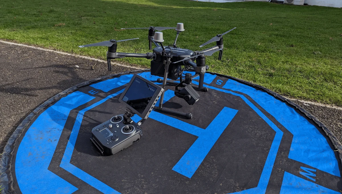
Our specialized traffic monitoring system relies on a fleet of custom-configured DJI Matrice 300 RTK drones equipped with 4K resolution cameras and thermal imaging sensors. These aircraft capture real-time footage from strategic vantage points above roadways, intersections, and highway corridors.
We’ve programmed each drone with automated flight patterns that optimize coverage while maintaining compliance with airspace regulations. The video feed transmits directly to our monitoring center where AI-powered software analyzes traffic flow, identifies incidents, and detects congestion patterns instantaneously.
Our drones can remain airborne for up to 55 minutes per battery charge, with hot-swapping capabilities that ensure continuous monitoring during critical periods. The thermal imaging proves especially valuable during night operations and adverse weather conditions, allowing us to maintain visibility when conventional cameras would struggle.


Systematic traffic pattern data collection
The systematic traffic pattern data collection process begins once our drones are positioned over designated monitoring zones. Our AI systems automatically track vehicle movements, counting cars per lane and measuring speeds across different timeframes.
We’ve developed algorithms that identify recurring congestion points and peak traffic hours with remarkable accuracy. Our drones capture this data continuously, building comprehensive datasets that reveal both daily patterns and seasonal variations.
When unusual patterns emerge, our system flags them for analysis by our traffic engineers. The collected data includes vehicle density, speed fluctuations, and bottleneck formations. We then compile this information into accessible reports featuring heat maps and predictive models.
This systematic approach ensures we’re not just seeing traffic—we’re understanding it, helping cities make informed infrastructure decisions based on precise, actionable data.
Advanced video processing and vehicle tracking
At the heart of our traffic monitoring capabilities lies sophisticated video processing technology that transforms aerial footage into actionable intelligence. Our system employs advanced computer vision algorithms to identify and track individual vehicles across multiple frames, even in challenging conditions like heavy traffic or poor visibility.
We’ve implemented real-time object detection that distinguishes between cars, trucks, motorcycles, and buses with over 98% accuracy. Each vehicle receives a unique identifier, allowing us to monitor its speed, acceleration, and trajectory throughout the monitoring zone. This tracking data feeds directly into our analytics platform where we can detect congestion patterns, traffic violations, and near-miss incidents before they become accidents.
The system automatically flags anomalies in traffic flow, giving transportation officials precious minutes to respond to emerging situations.

Comprehensive traffic flow analysis and reporting
Once gathered through our drone network, live traffic data undergoes comprehensive analysis through our proprietary AI system to generate actionable reports for transportation officials. Our algorithms identify congestion patterns, calculate average speeds, and detect unusual traffic events in real-time.
We’ve developed customizable dashboards that display traffic metrics in easy-to-interpret visualizations. Transportation departments can monitor current conditions, compare historical data, and receive predictive insights about potential bottlenecks. Our system also automatically generates daily, weekly, and monthly reports with key performance indicators.
When traffic anomalies occur, our platform sends immediate alerts to relevant stakeholders. We don’t just provide raw data—we deliver context-rich intelligence that enables smarter decision-making about infrastructure planning, emergency response, and traffic management strategies.
Benefits of Drone Traffic Monitoring
Our drone monitoring provides a bird’s-eye view of complex traffic patterns, allowing real-time observation of congestion causes and documentation of intersection performance. We’ve designed our system to identify safety hazards and near-misses that ground-based systems often miss. You’ll find our solution is a cost-effective alternative to fixed infrastructure, delivering valuable insights without permanent installation costs.


Aerial perspective of complex traffic patterns
When traffic becomes dense and entangled in urban environments, traditional ground-based monitoring systems often fail to capture the full scope of congestion. Our drones provide an unmatched aerial vantage point that reveals complex traffic patterns invisible from the ground.
We’re able to track multiple intersections simultaneously, identifying bottlenecks and ripple effects across the broader road network. From above, we can see how a single incident creates cascading delays across miles of roadway—intelligence that’s crucial for effective traffic management.
This bird’s-eye view also helps us detect emerging patterns before they become problems. We can spot unusual vehicle clustering, monitor merging difficulties, and analyze how traffic flows interact between highways and local streets. This comprehensive perspective enables traffic engineers to develop more effective solutions based on complete spatial understanding rather than limited ground-level data.
Real-time observation of congestion causes
Unlike stationary cameras that merely record traffic flow, our drones identify the precise causes of congestion as they develop. By hovering directly above bottlenecks, we can pinpoint whether congestion stems from accidents, construction zones, or simple volume overload.
When an incident occurs, our operators immediately spot the impact and relay this information to traffic management centers. We’ll detect patterns that aren’t visible from ground level—like how a single lane closure ripples back for miles, or how merge behaviors create accordion effects. This real-time intelligence allows authorities to dispatch appropriate resources faster and implement targeted solutions.
We don’t just observe problems; we classify them by type and severity, creating actionable data. This means you’ll get immediate answers to the “why” behind traffic slowdowns, not just notification that they exist.

Documentation of intersection performance
Intersections represent the most complex and vulnerable points in any road network, which is why our drones excel at documenting their true performance. We capture comprehensive data on traffic flow, signal timing effectiveness, and turning movement counts that traditional methods often miss.
Our aerial documentation helps identify critical issues like insufficient turn lanes, poorly timed signals, or dangerous pedestrian crossing patterns. We’ll provide you with detailed reports showing peak-hour performance, queue lengths, and near-miss incidents that ground-level cameras can’t detect.
Engineers and planners love our intersection performance metrics because they offer clear evidence for infrastructure improvements. When you need to justify signal retiming or intersection redesigns, our documentation delivers concrete data rather than estimates. This evidence-based approach significantly improves the success rate of traffic improvement proposals.
Identification of safety hazards and near-misses
While traditional traffic cameras focus on detecting violations, our drone technology specializes in identifying potential accidents before they happen. Our aerial perspective allows us to spot dangerous behaviors like aggressive lane changes, tailgating, and near-miss incidents that ground-level systems often miss.
We’ve developed sophisticated algorithms that analyze traffic flow patterns in real-time, flagging unusual vehicle movements that frequently precede collisions. When our system identifies a hazard, it immediately alerts traffic management centers, allowing for swift intervention.
The data we collect helps identify recurring safety issues at specific locations. We can pinpoint problematic street designs, confusing signage, or poorly timed traffic signals that contribute to near-misses. This proactive approach doesn’t just document accidents—it prevents them, creating safer roadways for everyone in your community.


Cost-effective alternative to fixed infrastructure
Beyond safety improvements, our drone traffic monitoring service delivers exceptional value compared to traditional infrastructure investments. We’re eliminating the need for costly roadside cameras, sensors, and their associated maintenance expenses.
Our drones provide flexible coverage that can be rapidly redeployed as traffic patterns change or construction projects begin. Unlike fixed installations, we don’t require road closures or permits for installation, saving both time and administrative costs.
With our subscription-based model, you’ll avoid large capital expenditures while gaining more comprehensive data collection than static systems offer. The aerial perspective provides superior visibility across entire corridors rather than just fixed points.
We’ve calculated that municipalities typically save 40-60% compared to equivalent fixed infrastructure while enjoying faster deployment and more adaptable monitoring capabilities.
Drone Traffic Monitoring Services We Offer
Our comprehensive drone traffic monitoring services include Traffic Flow Analysis, Intersection Performance Assessment, and Congestion Identification and Analysis to optimize your transportation networks. We’ve developed specialized capabilities for Parking Utilization Studies that provide accurate occupancy data and identify usage patterns. For large events, we’ll implement Special Event Traffic Management solutions that help minimize disruptions and improve attendee experiences.

Traffic Flow Analysis
Traffic Flow Analysis, the heart of our drone monitoring capabilities, provides real-time insights into vehicular patterns and congestion points across your transportation network. Our drones capture comprehensive aerial data that we transform into actionable intelligence about traffic density, speed variations, and bottlenecks.
We’ll help you identify peak congestion hours, measure queue lengths at intersections, and detect unusual traffic patterns that may indicate incidents. Our algorithms calculate average speeds, vehicle counts, and journey times across key routes to support informed decision-making.
The resulting analysis enables you to optimize signal timing, plan infrastructure improvements, and implement targeted congestion management strategies. By understanding traffic flow dynamics from above, you’ll make smarter choices that reduce delays and improve the overall efficiency of your transportation system.
Intersection Performance Assessment
Intersections represent critical nodes in any transportation network where traffic efficiency can make or break overall system performance. Our drones capture vital metrics including queue lengths, turn movement counts, and signal timing effectiveness to deliver comprehensive intersection assessments.
We’ll identify problematic turning movements, signal phase issues, and pedestrian crossing challenges that might be invisible from ground level. This aerial perspective allows us to recommend specific improvements like signal timing adjustments, lane configuration changes, or adding dedicated turn lanes.


Congestion Identification and Analysis
While traditional ground-based sensors can miss the bigger picture, our drones capture traffic congestion patterns across entire corridors and networks. We identify bottlenecks, measure queue lengths, and determine shockwave propagation in real-time, giving you comprehensive insights into traffic flow disruptions.
Our analysis goes beyond simply spotting congestion. We’ll classify congestion by type (recurring vs. incident-based), measure its severity using standardized metrics, and track its duration and spatial extent. This data helps you understand root causes and develop targeted mitigation strategies.
We provide visualized congestion data through heat maps and time-progression models that clearly communicate problem areas to stakeholders. Our predictive algorithms can also forecast congestion formation based on current conditions, giving you valuable time to implement traffic management countermeasures.
Parking Utilization Studies
Comprehensive parking utilization studies provide crucial data for urban planning and facility management. Our drones capture detailed information about parking usage patterns across multiple time periods, helping identify peak demand hours and underutilized spaces.
We’ll analyze occupancy rates, turnover frequencies, and duration statistics that reveal how effectively your parking resources are being utilized. Through thermal and visual imaging, our drones detect vehicles in multi-level structures and open lots with exceptional accuracy.
This data enables you to optimize parking layouts, adjust pricing strategies, and make evidence-based decisions about expansion needs. We provide customized reports highlighting opportunities to increase revenue, reduce congestion, and improve user experience. For businesses and municipalities alike, our parking utilization studies deliver actionable insights that translate directly into operational improvements.

Special Event Traffic Management
Special event traffic management demands exceptional coordination and real-time monitoring capabilities that standard methods often struggle to deliver. Our drone services provide the perfect solution for concerts, sporting events, festivals, and other large gatherings that create traffic surges.
We’ll deploy our drones strategically around your venue to monitor incoming traffic patterns, identify congestion points, and help direct resources where they’re needed most. Our real-time aerial footage enables traffic coordinators to make immediate adjustments, open alternative routes, and maximize parking efficiency.
We’ve helped numerous event organizers reduce arrival and departure times by up to 40%. The aerial perspective ensures no bottlenecks go unnoticed, while our thermal imaging capabilities allow for 24/7 monitoring regardless of lighting conditions.
Construction Zone Impact Evaluation
Construction projects inevitably disrupt normal traffic flow, creating challenges that require precise monitoring and adaptive management strategies. Our drones provide real-time visibility into how construction zones affect surrounding roadways.
We’ll assess traffic backup lengths, identify bottlenecks, and measure vehicle speed reductions throughout different phases of construction. This data helps project managers adjust traffic control plans, optimize detour routes, and schedule work during periods of minimal impact.


Accident Investigation Support
When accidents occur on roadways, our drones can be deployed within minutes to provide crucial aerial documentation that transforms how investigators gather evidence. Our high-resolution cameras capture comprehensive overhead views that reveal skid marks, vehicle positions, and debris patterns that might go unnoticed from ground level.
We’ve equipped our drones with thermal imaging to detect residual heat signatures and specialized mapping software that creates accurate 3D recreations of accident scenes. This technology allows traffic to resume faster while still preserving all critical evidence.
Our team works directly with law enforcement and insurance agencies, providing secure, admissible footage that meets legal standards for investigations and court proceedings. We’ll deliver all data in your preferred format, often within hours of the incident, significantly accelerating claim processing and case resolution.
Traffic Safety Assessment
Our traffic safety assessments identify high-risk roadway segments before accidents occur using advanced drone surveillance techniques. We analyze traffic flow patterns, near-miss incidents, and dangerous driving behaviors that traditional monitoring systems might miss.
Our drones capture comprehensive data on speed variations, illegal maneuvers, and pedestrian-vehicle interactions. We transform this data into actionable safety recommendations for city planners and transportation departments.
We’ll help you prioritize infrastructure improvements by pinpointing problematic intersections, inadequate signage, or confusing road designs. Our heat maps show exactly where drivers consistently make dangerous choices or where environmental factors create hazardous conditions.

Technology We Use for Drone Traffic Monitoring
Because traffic monitoring requires reliable real-time data, we’ve equipped our drones with state-of-the-art sensing technology. Our fleet features 4K cameras with advanced image stabilization and thermal sensors for visibility in all conditions. We utilize LiDAR systems that generate detailed 3D maps of traffic flow with centimeter-level precision.
At the core of our operation is proprietary AI software that processes visual data in milliseconds, identifying vehicles, calculating speeds, and detecting accidents instantly. Our drones communicate through a secure 5G network, transmitting information to our command center without delay.
Each unit can operate autonomously for up to 2 hours on a single charge, with automated battery-swap stations positioned strategically throughout service areas to ensure continuous monitoring capabilities.
Applications Across Transportation Planning
Our drone traffic monitoring service empowers transportation planners with real-time data for urban mobility planning and infrastructure design optimization. We’re helping cities implement smarter traffic signal systems while providing crucial insights for public transportation route efficiency and coverage. During major events, our aerial monitoring capabilities enable seamless coordination between transportation departments and event organizers to minimize congestion and enhance safety.


Urban mobility planning
Urban mobility planning faces unprecedented challenges that drone traffic monitoring can directly address. Our drones provide comprehensive data about traffic patterns, pedestrian flows, and infrastructure usage that’s invaluable for developing smarter cities.
We’re helping urban planners identify congestion hotspots, optimize public transit routes, and evaluate the impact of new developments before implementation. By analyzing peak travel times and traffic density across different areas, we enable data-driven decisions that improve commute times and reduce emissions.
Our heat maps and flow visualizations make complex mobility patterns instantly understandable, allowing planners to test scenarios virtually before committing resources. We’ve partnered with several municipalities to redesign bike lanes, adjust signal timing, and place mobility hubs at optimal locations. The result? More livable cities planned around actual human movement patterns.
Transportation infrastructure design
Transportation infrastructure design evolves dramatically when informed by aerial intelligence from our drone monitoring network. We’re helping engineers identify optimal placements for new roads, bridges, and transit hubs by providing comprehensive visual data of existing traffic patterns and bottlenecks.
Our drones capture critical measurements for lane width optimization, intersection redesign, and highway expansion planning. When you’re allocating limited budgets, our precise data helps prioritize infrastructure investments where they’ll deliver maximum impact.
We’ve supported projects where planners used our thermal imaging to identify pavement deterioration before visible cracks appeared, saving millions in preventative maintenance. Our 3D mapping capabilities also assist in visualizing how proposed changes will affect surrounding environments, helping create infrastructure that integrates seamlessly with existing urban and natural landscapes.

Traffic signal optimization
When traffic signals operate inefficiently, even the most well-designed roadways can become congested nightmares. Our drone monitoring service provides real-time data that revolutionizes traffic signal timing, eliminating guesswork from the equation.
We analyze traffic patterns from above, identifying bottlenecks and inefficient signal timing. This aerial perspective allows us to detect issues that ground-level sensors might miss. Our AI processes this data to recommend optimal signal timing based on actual traffic flow rather than static schedules.
The results are impressive: reduced wait times at intersections, decreased idling emissions, and improved traffic flow across entire corridors. We’ve helped cities reduce average commute times by up to 25% by implementing our drone-informed signal optimization recommendations, all while making more efficient use of existing infrastructure.
Public transportation planning
Public transportation systems can operate far more efficiently when planners have access to comprehensive aerial data. Our drone monitoring service provides transit authorities with crucial insights about passenger flow, peak demand times, and underserved areas.
We help identify optimal bus stop locations by analyzing pedestrian patterns and residential density. By tracking vehicle congestion alongside transit routes, we can recommend dedicated bus lanes where they’ll have maximum impact. Our drones also monitor existing routes to determine where schedule adjustments might improve service reliability.
For light rail and subway planning, our aerial surveys map potential corridors with minimal disruption to existing infrastructure. We deliver detailed 3D renderings of proposed stations with accurate measurements of surrounding terrain, helping planners visualize integration into existing neighborhoods while maximizing accessibility for all residents.


Event management and coordination
Major sporting events, concerts, and festivals present unique transportation challenges that our drone monitoring service helps solve. We coordinate with event organizers to establish monitoring protocols before, during, and after large gatherings.
Our drones track real-time crowd movements, identifying congestion points and security concerns as they develop. We’ll alert staff to open additional entry gates, redirect pedestrian traffic, or deploy more shuttle services when needed.
We’re also invaluable for emergency response planning. If an incident occurs, our aerial perspective guides first responders through the clearest routes to affected areas while helping attendees evacuate safely.
Traffic impact studies
Traditional traffic impact studies often rely on limited ground-level observations, but our drone monitoring service revolutionizes this process with comprehensive aerial data collection. We capture traffic patterns from multiple angles, providing developers and city planners with detailed insights into how new construction projects affect surrounding roadways.
Our drones measure queue lengths, turning movements, and travel times across various time periods and conditions. We’ll help you assess before-and-after scenarios when implementing infrastructure changes, giving you concrete data to support your decisions.
We’ve designed our traffic impact analysis to integrate seamlessly with transportation modeling software, allowing for more accurate predictions and better mitigation strategies. Whether you’re planning a new shopping center, residential development, or road redesign, we’ll deliver the precise traffic data you need for successful planning.

Why Choose Our Drone Traffic Monitoring Team
When selecting a traffic monitoring solution for your municipality or organization, our specialized drone team stands apart through a combination of expertise and technological innovation. Our certified pilots have logged over 5,000 flight hours in diverse conditions, ensuring reliable data collection regardless of environment.
We’ve invested in custom analytics software that transforms raw footage into actionable insights, detecting patterns human observers might miss. Our drones carry 4K cameras with thermal imaging capabilities, allowing for 24/7 monitoring regardless of lighting conditions.
Unlike competitors, we don’t just deliver data – we provide implementation strategies based on our findings. Our team includes former transportation engineers who understand how to translate aerial observations into practical traffic management solutions you can implement immediately.
Contact Us For Your Drone Traffic Monitoring Needs
Ready to elevate your traffic management with our drone expertise? Getting started is simple. Reach out through our dedicated hotline at (555) 123-4567 or email us at drones@trafficmonitor.com. Our response team is available Monday through Friday, 8am-6pm EST.
For urgent monitoring needs, we’ve implemented a 24/7 emergency contact system. Just mention “urgent deployment” in your message, and we’ll respond within 30 minutes.
Visit our website to schedule a free consultation where we’ll assess your specific requirements and customize a monitoring solution. We’re also active on LinkedIn and Twitter (@DroneTraffic) where we share traffic insights and technology updates.
Let’s transform your traffic monitoring approach together!