Need accurate 3D terrain data? Save time, cut costs, and get crystal-clear insights with our advanced drone photogrammetry mapping services.
Don’t settle for risky, time-consuming traditional surveys when our enterprise-grade drone technology delivers faster, safer 3D modeling results.
As specialists in industrial-grade photogrammetric assessment and spatial analysis since 2016, we provide the actionable mapping data you need for critical project decision-making.
Used By Top UK Businesses

👇Fill Out The Form For Same-Day Drone Survey Quote 👇
Why Leading UK Businesses Choose Our Drone Survey Services:
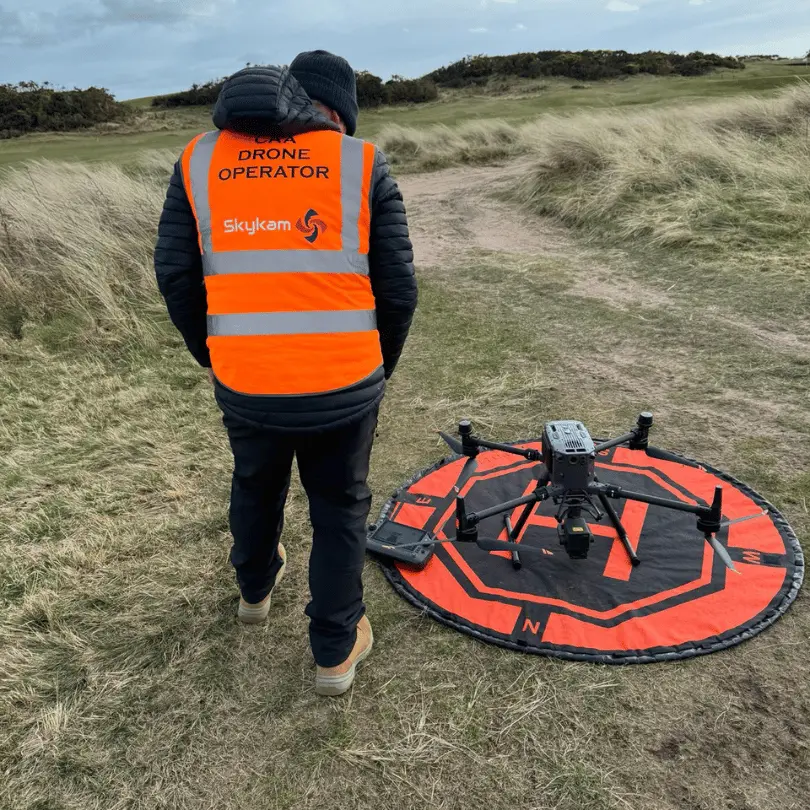
✅ We’re Fully Licensed, Insured Drone Pilots
✅ We Cover the UK with Fast Response Times
✅ We Only Use Top-Quality Drone Equipment
✅ We Customize Solutions for Your Industry
✅ We Handle All the Paperwork and Permissions
✅ We Have Worked with Hundreds of Happy Customers


What Is Drone Photogrammetry Mapping
Drone photogrammetry mapping combines aerial imaging technology with sophisticated software to create detailed, measurable models of terrain and structures. We use unmanned aerial vehicles (UAVs) equipped with high-resolution cameras to capture hundreds of overlapping images from different angles.
These images are then processed through specialized software that identifies common points across multiple photos. This process, called photogrammetric reconstruction, creates accurate 3D models, orthomosaic maps, digital elevation models (DEMs), and contour maps.
Unlike traditional surveying methods, drone photogrammetry delivers results faster and more cost-effectively while maintaining centimeter-level accuracy. It’s particularly valuable for sites with difficult terrain or hazardous conditions where ground access is limited. The output data provides comprehensive visual documentation that can be measured, analyzed, and integrated directly into CAD or GIS systems.
How Our Drone Photogrammetry Mapping Works
Our drone photogrammetry mapping begins with a thorough site assessment and strategic flight planning to ensure optimal coverage of your project area. We then deploy specialized drones equipped with survey-grade cameras to systematically capture high-resolution aerial images with precise overlap parameters. The collected imagery undergoes advanced photogrammetric processing to generate accurate point clouds, which we transform into detailed 3D models and orthomosaic maps for your analysis and decision-making needs.

Comprehensive site assessment and flight planning
Before any drone takes flight, we conduct a thorough site assessment to ensure optimal mapping results. Our team analyzes topography, identifies potential obstacles, and evaluates environmental conditions that might affect data collection.
We’ll assess ground control point placement opportunities to maximize accuracy and create a detailed flight plan including altitude, camera settings, and flight paths. Our software calculates the ideal image overlap—typically 70-80% frontlap and 60-70% sidelap—to generate precise 3D models.
Weather planning is crucial; we monitor forecasts for ideal conditions with minimal wind and consistent lighting. We’ll also secure necessary airspace permissions and notify relevant authorities about our operations.
This comprehensive planning phase eliminates surprises during execution and ensures we capture high-quality data that meets your specific mapping requirements.
Specialized drone deployment with survey-grade cameras
With planning complete, we deploy our specialized aerial fleet equipped with industry-leading photogrammetry technology. Our drones carry survey-grade cameras featuring high-resolution sensors that capture images with millimeter-level precision. Each aircraft is configured with RTK/PPK positioning systems to ensure geometric accuracy across all data points.
We’ve customized our flight parameters to optimize image overlap, maintaining 70-80% frontal and 60-70% side overlap for comprehensive coverage. Our pilots monitor environmental conditions in real-time, adjusting flight patterns to compensate for wind or lighting changes that might affect image quality.
For specialized projects, we employ multispectral or thermal imaging sensors when needed. Our technology stack allows us to capture both nadir (straight-down) and oblique images, creating robust datasets that reveal terrain features, elevation changes, and vertical structures with exceptional clarity.


Systematic aerial image capture with precise overlap
The systematic capture phase represents the core of our photogrammetry process. We program our drones to fly in precise grid patterns, capturing hundreds of high-resolution images with 70-80% forward overlap and 60-70% side overlap between adjacent photos. This redundancy ensures every terrain feature appears in multiple images from different angles.
Our flight plans account for topography variations, maintaining consistent ground sampling distance (GSD) throughout the survey area. We carefully monitor weather conditions, since wind and changing light can affect image quality. During capture, we use real-time monitoring to verify proper execution of the flight plan and image quality.
This methodical approach to image acquisition creates the robust dataset necessary for accurate 3D reconstructions and enables our software to identify precise matching points across multiple photographs.
Advanced photogrammetry processing and point cloud generation
Once we’ve collected the comprehensive aerial imagery dataset, our advanced photogrammetry processing begins transforming these raw photos into actionable spatial data. We utilize specialized algorithms that identify common points across multiple images, establishing the precise position from which each photo was taken.
Our software then generates a dense point cloud—a three-dimensional representation composed of millions of data points. Each point contains exact XYZ coordinates and RGB color values, creating an incredibly detailed digital twin of your site. This point cloud serves as the foundation for all subsequent deliverables including 3D models, contour maps, and volumetric calculations.
We’re particularly meticulous during this phase, employing ground control points to ensure absolute positional accuracy of 1-3cm—critical for engineering-grade applications and decision-making processes.

Accurate 3D model and orthomosaic creation
From dense point clouds, we transform your site data into incredibly accurate 3D models and high-resolution orthomosaic maps. Our specialized software stitches together thousands of individual images, creating textured models with millimeter-level precision that capture every detail of your terrain.
These 3D models provide comprehensive volumetric measurements, elevation profiles, and contour analysis that traditional surveys can’t match. Meanwhile, our orthomosaic maps deliver a seamless, distortion-free aerial view perfect for planning and analysis.
We’ll deliver these assets in industry-standard formats compatible with CAD, GIS, and BIM software. Whether you’re tracking construction progress, conducting environmental assessments, or planning infrastructure, our models offer the accuracy and detail you need for confident decision-making without the guesswork.
Benefits of Drone Photogrammetry Mapping
Our drone photogrammetry mapping delivers centimeter-level accuracy while rapidly collecting data across vast areas, providing comprehensive visual documentation of your site conditions. We’ll supply the results in multiple formats tailored to your specific applications, whether you need 3D models, orthomosaic maps, or elevation profiles. You’ll find our service offers a cost-effective alternative to traditional survey methods, saving you both time and money without sacrificing precision.


Centimeter-level accuracy for precise measurements
When precision is paramount to your project’s success, drone photogrammetry mapping delivers exceptional centimeter-level accuracy that traditional surveying methods often can’t match. Our drones capture thousands of overlapping high-resolution images with embedded GPS coordinates, creating point clouds with accuracy down to 1-3 centimeters.
We achieve this precision through ground control points (GCPs) strategically placed throughout the survey area and verified with RTK GPS systems. These reference points calibrate the final model, ensuring measurements you can trust for critical decisions.
This level of accuracy is ideal for volumetric calculations, elevation profiling, and detecting subtle landscape changes over time. Whether you’re planning infrastructure, monitoring construction progress, or analyzing terrain, our drone photogrammetry provides the precise spatial data your projects demand.
Rapid data collection of large areas
Unlike traditional surveying methods that can take weeks to complete, drone photogrammetry dramatically reduces field time by capturing hundreds of acres in a single day. Our drone systems collect high-resolution imagery efficiently, allowing us to map extensive properties, construction sites, or infrastructure projects without sacrificing quality.
We’ve optimized our flight planning to ensure maximum coverage with minimal time on site. This rapid data collection translates directly to cost savings for your projects while providing comprehensive datasets faster than ever before. When weather conditions are favorable, we can quickly mobilize our team and equipment to capture time-sensitive changes or progress.
The speed of our drone operations means you’ll receive actionable data and deliverables in days rather than months, accelerating your decision-making process and project timelines.

Comprehensive visual documentation of site conditions
Drone photogrammetry provides unparalleled comprehensive visual documentation of your entire site, capturing every detail from multiple angles and elevations. We deliver high-resolution orthomosaic maps that offer a complete visual record of existing conditions – from terrain features to structures and vegetation.
Unlike traditional ground surveys, our drone mapping creates a permanent visual baseline you can reference for planning, monitoring changes over time, or addressing potential disputes. We’ll document hard-to-reach areas that would otherwise remain unrecorded, ensuring nothing is overlooked.
These detailed visuals serve as powerful communication tools when discussing site challenges with stakeholders or contractors. They’re particularly valuable for construction progress tracking, environmental monitoring, and legal documentation. When combined with our 3D modeling capabilities, you’ll gain both aerial perspectives and precise measurements in one comprehensive package.
Multiple deliverable formats for different applications
Our comprehensive mapping service transforms collected data into a variety of deliverable formats tailored to your specific needs. We provide 2D orthomosaic maps for accurate overhead views, 3D models for detailed visualization, and point cloud data for precise measurements and analysis.
Need to integrate with your existing CAD or GIS systems? We deliver georeferenced files that seamlessly import into AutoCAD, ArcGIS, QGIS, and other industry-standard software. For stakeholder presentations, we can produce high-resolution imagery, video fly-throughs, and interactive visualizations that showcase your project from any angle.
All deliverables come in standard formats (TIFF, LAS, OBJ, DWG) with custom options available to match your workflow requirements. We’ll help you determine which formats best serve your project goals.


Cost-effective alternative to traditional survey methods
When compared to traditional surveying methods, drone photogrammetry mapping delivers substantial cost savings while significantly reducing project timelines. We’ve found that projects requiring weeks of field work can often be completed in just days using our drone technology.
The cost efficiency comes from multiple factors: fewer personnel needed on-site, reduced equipment requirements, and minimized site disruption. For large properties or difficult terrain, these savings become even more pronounced as our drones easily access areas that would require extensive manpower to survey conventionally.
We’re also able to pass operational efficiencies directly to you. Our clients typically see 30-50% cost reduction compared to traditional survey methods while receiving more comprehensive data sets and faster turnaround times—making drone photogrammetry the smart economic choice for modern mapping needs.
Drone Photogrammetry Mapping Services We Offer
We provide comprehensive drone photogrammetry services including topographic mapping with precise contour generation and volumetric calculations for accurate material measurements. Our specialized offerings extend to digital terrain modeling, orthomosaic map creation, and detailed 3D visualization that transforms raw data into actionable insights. Each service leverages cutting-edge drone technology to deliver high-resolution visual data that supports informed decision-making for your projects.

Topographic Mapping and Contour Generation
Comprehensive topographic mapping forms the foundation of intelligent land development and engineering projects. Our drone photogrammetry service delivers accurate elevation data across your entire site, generating high-resolution contour maps at intervals as precise as 0.5-foot increments.
We transform drone-captured imagery into detailed 3D terrain models that reveal every subtle grade change and surface feature. These topographic maps integrate seamlessly with CAD and GIS software, allowing your engineers to make informed decisions about drainage, earthwork volumes, and site layout.
Unlike traditional ground surveys, our drone approach captures full-site data in a single flight, reducing both costs and timelines. We’ll deliver your topographic maps in whatever format your team requires, including AutoCAD, GIS shapefiles, or georeferenced PDFs.
Volumetric Calculations and Analysis
Precise volumetric calculations transform how industries manage and monitor stockpiles, excavations, and material movements. Our drone photogrammetry delivers accurate measurements of material volumes for quarries, construction sites, and mining operations.
We create detailed 3D models that calculate volumes to within 1-3% accuracy, eliminating costly estimation errors. You’ll receive comprehensive reports showing cut/fill analyses, stockpile inventories, and earthwork progress over time.
Our technology excels at tracking material depletion rates and planning extraction sequences. By comparing sequential surveys, we help you optimize resource allocation and verify contractor billing.
With our volumetric analysis, you can make data-driven decisions that reduce operational costs and improve project efficiency. We’ll deliver actionable insights in formats compatible with your existing workflows.


Digital Terrain Modeling
Digital Terrain Models (DTMs) provide the foundation for effective land management and development projects. Our drone technology captures precise ground-level data, filtering out vegetation and structures to reveal the bare earth surface with remarkable accuracy.
We create highly detailed DTMs that enable you to visualize landforms, slopes, and drainage patterns that might otherwise remain undetected through traditional surveying methods. These models serve as crucial tools for flood analysis, road design, pipeline planning, and erosion control.
Our DTMs integrate seamlessly with CAD and GIS software, allowing your team to immediately incorporate this data into your existing workflows. With accuracy levels reaching 2-5cm, we deliver terrain models that support confident decision-making for your most challenging engineering and environmental projects.
Orthomosaic Map Creation
Our cutting-edge orthomosaic maps transform thousands of aerial images into seamless, geometrically corrected visual representations of your project area. We create these high-resolution composites by stitching together precisely aligned drone photographs, ensuring accurate scale and positioning across the entire mapped region.
Unlike standard aerial photos, our orthomosaics eliminate perspective distortion, producing true-to-scale measurements that enable precise distance, area, and volume calculations. We deliver these maps in various formats compatible with GIS software, CAD systems, and web platforms.
You’ll receive orthomosaics with resolution as fine as 1cm/pixel, allowing you to identify minute details critical for infrastructure inspection, construction monitoring, and land management. We can also enhance these maps with specialized overlays for vegetation analysis, thermal imaging, or elevation data.

3D Visualization and Rendering
Transforming raw photogrammetry data into immersive 3D models allows you to experience your project from any angle or perspective. We create photorealistic visualizations that bring your site to life with remarkable detail and accuracy.
Our team uses advanced rendering techniques to highlight specific features, simulate lighting conditions, and generate fly-through animations that showcase your project’s key elements. These visualizations serve as powerful communication tools for stakeholders, clients, and team members.
We’ll deliver your 3D models in various formats compatible with popular design and presentation software. Whether you need detailed terrain models for engineering analysis or visually stunning representations for marketing materials, our 3D visualization services turn complex spatial data into intuitive visual assets you can easily share and manipulate.
BIM Integration and Support
Seamlessly integrating drone photogrammetry data with Building Information Modeling (BIM) workflows elevates your project management capabilities to new heights. Our team converts high-resolution drone imagery and point clouds into BIM-compatible formats that work directly with platforms like Revit, ArchiCAD, and Navisworks.
We provide comprehensive support for integrating aerial data into your existing BIM processes, including custom data classification, automated object recognition, and intelligent model linking. This integration enables real-time construction progress monitoring, clash detection, and accurate as-built documentation.
Our BIM specialists work closely with your team to establish proper data exchange protocols, ensuring smooth information flow between photogrammetric models and your BIM environment. We’ll help you leverage this integrated approach to improve decision-making, enhance collaboration, and reduce costly errors throughout your project lifecycle.


As-Built Documentation
When construction projects reach completion, accurate as-built documentation becomes essential for facility management and future modifications. Our drone photogrammetry services create comprehensive as-built records that capture the final state of your project with millimeter precision.
We’ll fly our drones to document your completed structures, generating detailed 3D models and orthomosaic maps that show exactly what was built versus what was designed. These digital twins serve as invaluable references for maintenance teams, renovation planners, and compliance verification.
Our as-built documentation includes:
- High-resolution imagery of completed structures
- Precise measurements of final dimensions
- Detailed 3D models for virtual walkthroughs
- Annotated plans highlighting variances from original designs
- Cloud-accessible archives for easy reference by all stakeholders
Change Detection Analysis
By combining regular drone surveys over time, our change detection analysis identifies and quantifies physical alterations to your site with remarkable precision. We track volumetric changes in stockpiles, monitor erosion patterns, and detect unauthorized modifications that might otherwise go unnoticed.
Our specialized software compares sequential datasets to generate comprehensive reports highlighting exactly what’s changed and by how much. This temporal monitoring proves invaluable for construction progress verification, environmental compliance, and dispute resolution.
When you need to understand landscape evolution or document gradual changes, our detection capabilities offer clear visual evidence through heat maps and differential models. We’ll establish a monitoring schedule tailored to your project timeline, ensuring you have documented evidence of all site transformations—whether expected or unforeseen.

Technology We Use for Drone Photogrammetry Mapping
Our cutting-edge technology forms the backbone of our drone photogrammetry mapping services. We deploy professional-grade UAVs equipped with high-resolution RGB cameras, multispectral sensors, and LiDAR systems to capture detailed terrain data in various light conditions.
For processing, we utilize industry-leading software like Pix4D and Agisoft Metashape that transform raw images into accurate 3D models through automated photogrammetry algorithms. These platforms enable us to deliver orthomosaics, digital elevation models, and point clouds with centimeter-level precision.
Our workflow incorporates RTK/PPK GPS technology for enhanced geolocation accuracy without excessive ground control points. We’ve also developed custom data management systems to efficiently handle terabytes of imagery while maintaining strict quality control standards throughout the mapping process.
Applications Across Industries
Our drone photogrammetry mapping services benefit multiple sectors including construction, mining, agriculture, environmental monitoring, and urban planning. We’ve helped developers track site progress, miners calculate stockpile volumes, farmers assess crop health, conservationists monitor ecological changes, and city planners create accurate urban models. These industry-specific applications demonstrate how aerial mapping transforms raw data into actionable insights for better decision-making across diverse fields.


Construction and development
In the rapidly evolving construction industry, drone photogrammetry has revolutionized how developers plan, monitor, and complete projects. We provide comprehensive aerial mapping solutions that transform construction workflows from groundbreaking to completion.
Our drones capture detailed topographic data for accurate site planning, helping you identify potential issues before breaking ground. During construction, we deliver regular progress documentation through orthomosaic maps and 3D models that allow precise volume calculations for earthwork and materials management.
We’ve helped developers reduce survey time by 80% while increasing measurement accuracy. Project managers use our weekly aerial updates to verify contractor work, track timeline adherence, and make data-driven decisions. The bird’s-eye perspective provides stakeholders with compelling visuals that traditional ground-based photography simply cannot match.
Mining and aggregates
Mining operations face unique challenges that demand precision measurement and continuous monitoring. Our drone photogrammetry services provide accurate volumetric calculations of stockpiles, helping you track inventory and optimize resource management without the safety risks of manual surveys.
We’ll capture high-resolution imagery of your mining sites to create detailed topographic maps, identifying optimal extraction areas and monitoring site changes over time. Our drones can quickly survey large quarries and pits, delivering accurate measurements of excavation progress and remaining reserves.
The data we collect helps you comply with regulatory requirements by documenting environmental impact and reclamation efforts. With regular drone surveys, you’ll make more informed decisions about equipment deployment, extraction strategies, and site development while reducing operational costs.

Agriculture and land management
Modern agriculture and land management benefit tremendously from the precision that aerial data provides. Our drone photogrammetry services help farmers monitor crop health through multispectral imaging that reveals issues invisible to the naked eye. We deliver vegetation indices that highlight areas of stress, enabling targeted interventions before problems spread.
For land managers, our accurate elevation models and orthomosaics provide essential data for irrigation planning, erosion control, and resource allocation. We can map large properties quickly, creating digital twins that support informed decision-making about land use and conservation efforts.
Environmental monitoring
Ecosystems and habitats require constant monitoring to protect against human impact and ensure effective conservation. Our drone photogrammetry services provide environmental scientists and conservation teams with detailed aerial data that transforms how they track ecosystem changes.
We capture high-resolution imagery of wetlands, forests, and coastal areas to monitor erosion, vegetation health, and wildlife patterns. Our drones can access remote locations without disturbing sensitive habitats, delivering precise measurements that would be impossible to gather on foot.


Urban planning and development
As cities continue to expand and evolve, urban planners face complex challenges in creating sustainable, efficient environments. Our drone photogrammetry services provide crucial data for informed decision-making throughout the development process.
We help urban planners visualize existing infrastructure, identify potential development zones, and simulate growth scenarios with precise 3D models. These detailed maps allow stakeholders to assess traffic patterns, analyze population density, and plan utilities more effectively.
Our drones capture comprehensive data that’s invaluable for zoning decisions, transportation planning, and public space optimization. By quickly producing accurate digital twins of urban areas, we enable planners to communicate proposals clearly to the public and evaluate environmental impacts before breaking ground.
With our help, cities can grow thoughtfully, balancing development needs with quality of life concerns.
Archaeological documentation
Archaeological sites require meticulous documentation to preserve our cultural heritage, which is why we’ve adapted our drone photogrammetry services to revolutionize this field. Our drones capture detailed imagery of excavation sites, creating precise 3D models that archaeologists can analyze without disrupting delicate artifacts.
We’re helping teams document ancient structures, burial grounds, and settlements with centimeter-level accuracy. These digital records serve as invaluable backups against natural disasters, vandalism, or erosion. Researchers can track site changes over time, identify new features through elevation models, and share discoveries globally without physical site access.
Our thermal imaging capabilities even detect buried structures not visible to the naked eye, revealing hidden walls, pathways, and chambers beneath the surface—all while minimizing ground disturbance.

Why Choose Our Drone Photogrammetry Mapping Team
When you partner with our drone photogrammetry mapping team, you’re choosing industry-leading expertise backed by years of field experience. Our certified pilots and photogrammetry specialists deliver consistently accurate data across diverse environments and challenging terrains.
We’ve invested in cutting-edge equipment, including high-resolution sensors and precision GPS systems that capture millimeter-level details. Our processing workflow transforms raw imagery into actionable deliverables faster than traditional methods.
We’re committed to transparent pricing with no hidden fees, and we tailor solutions to your specific project requirements. Our team prioritizes clear communication throughout every project phase, ensuring you receive exactly what you need. We also maintain comprehensive insurance coverage and strictly adhere to all FAA regulations, giving you complete peace of mind.
Contact Us For Your Drone Photogrammetry Mapping Needs
Ready to transform your project planning with precise 3D terrain models and detailed orthomosaic maps? Our specialized drone photogrammetry services provide centimeter-accurate measurements, volumetric calculations, and comprehensive site visualization for engineering, construction, and land development projects.
Reach out today through our dedicated mapping line at +44 7368 537499 or email us at Jamie@skykam.co.uk. We’ll respond within 24 hours to schedule your free consultation.
When contacting us, please include information about your site location, project area size, and specific mapping deliverables required. This helps us prepare the appropriate equipment and flight plans for optimal data capture. We serve architects, engineers, developers, and land managers throughout the UK with efficient turnaround times.
Let’s collaborate to enhance your project planning and execution with high-precision photogrammetric data from our advanced drone mapping technology.