Need accurate terrain data? Save time, cut costs, and get crystal-clear terrain modeling with our advanced digital terrain model (DTM) services.
Don’t settle for risky, time-consuming traditional surveying methods when our enterprise-grade DTM technology delivers faster, safer results.
As specialists in industrial-grade surveying and geospatial analysis since 2016, our drone service provides the actionable terrain data you need for critical decision-making.
Used By Top UK Businesses

👇Fill Out The Form For Same-Day Drone Survey Quote 👇
Why Leading UK Businesses Choose Our Drone Survey Services:
✅ We’re Fully Licensed, Insured Drone Pilots
✅ We Cover the UK with Fast Response Times
✅ We Only Use Top-Quality Drone Equipment
✅ We Customize Solutions for Your Industry
✅ We Handle All the Paperwork and Permissions
✅ We Have Worked with Hundreds of Happy Customers

Drone LiDAR Digital Terrain Model
While traditional surveying methods have their place, Drone LiDAR Digital Terrain Models represent a revolutionary advancement in topographical mapping. Our drone-mounted LiDAR sensors emit millions of laser pulses per second, penetrating vegetation to capture true ground surface data with centimeter-level accuracy.
We’ve optimized our workflow to deliver high-precision terrain models that reveal subtle topographic features invisible to conventional methods. These models provide crucial data for infrastructure planning, flood risk assessment, mining operations, and environmental monitoring.
Unlike photogrammetry, our LiDAR technology works effectively in any lighting conditions and densely vegetated areas. We process the collected point cloud data using proprietary algorithms that filter out non-ground points, ensuring you receive clean, accurate terrain models ready for immediate implementation in your projects.


What Is Drone LiDAR Digital Terrain Modeling
Drone LiDAR Digital Terrain Modeling represents the process of creating accurate 3D representations of the Earth’s bare surface without vegetation, buildings, or other objects. Unlike other mapping techniques, our drone-mounted LiDAR sensors emit laser pulses that penetrate vegetation to measure ground elevation with remarkable precision.
We process millions of data points to filter out non-ground elements, revealing the true topography underneath. The resulting Digital Terrain Model (DTM) shows contours, slopes, and drainage patterns that would otherwise remain hidden.
These models serve critical functions in flood analysis, infrastructure planning, forestry management, and archaeological investigations. They provide invaluable insights for land developers, engineers, and environmental scientists who need to understand the fundamental terrain characteristics before making important decisions about site development or natural resource management.
How Our Drone LiDAR Digital Terrain Modeling Works
Our drone LiDAR surveys for terrain modeling process begins with a thorough site assessment and strategic flight planning tailored to your project requirements. We deploy specialized drones equipped with advanced LiDAR sensors to collect high-density point cloud data, capturing the terrain with remarkable precision. Following collection, our team utilizes sophisticated processing software to classify ground points and generate accurate bare-earth models that reveal the true topography beneath vegetation and structures.

Comprehensive site assessment and flight planning
Before any drone takes flight, we conduct a thorough site assessment and develop a detailed flight plan to ensure optimal data collection. We analyze topography, vegetation density, and existing infrastructure to identify potential challenges that might affect data quality.
Our team evaluates weather forecasts, airspace restrictions, and local regulations to determine the ideal flight window. We then establish the drone survey flight parameters including altitude, speed, and overlap percentage based on the required resolution and accuracy specifications.
We’ll identify ground control points (GCPs) strategically across your site to enhance georeferencing precision. These crucial steps minimize the need for resource-intensive reflights while maximizing the accuracy of your final terrain model. By planning comprehensively before deployment, we’re able to deliver superior results efficiently.
Specialized drone deployment with LiDAR sensors
When the carefully planned flight day arrives, we deploy our specialized UAV fleet equipped with state-of-the-art LiDAR sensors capable of penetrating vegetation and capturing ground details with remarkable precision. Our certified pilots conduct operations following established flight plans while monitoring real-time data collection quality.
We utilize multiple flight patterns—grid, contour, and cross-hatch—to ensure comprehensive coverage with sufficient overlap between flight lines. For complex terrain, we’ll adjust flight altitudes and speeds to maintain consistent point density. Our LiDAR systems capture up to 500,000 points per second with vertical accuracy within 3cm.
Throughout each mission, we monitor atmospheric conditions and make tactical adjustments if necessary. This meticulous approach guarantees we collect the high-quality raw data essential for creating accurate digital terrain models.


High-density point cloud data collection
The heart of our terrain modeling service lies in the high-density point cloud data we collect during each flight mission. Our LiDAR sensors emit hundreds of thousands of laser pulses per second, capturing terrain details with unprecedented accuracy—often achieving point densities of 50-400 points per square meter.
This dense data collection allows us to detect subtle topographic features that traditional survey methods might miss. We’re able to penetrate vegetation canopies and capture ground surfaces below, making our service ideal for densely forested areas. The resulting point clouds contain millions of precisely georeferenced data points that represent your terrain’s true characteristics.
We process this raw data through sophisticated algorithms that filter out noise and classify points based on their return characteristics, ensuring you receive only the highest quality terrain information for your projects.
Advanced processing and ground classification
Once we’ve collected the raw point cloud data, our advanced processing workflow transforms these millions of data points into actionable terrain information. We use sophisticated algorithms to classify points as ground, vegetation, structures, or noise, isolating bare-earth features with centimeter-level precision.
Our proprietary filtering techniques effectively remove non-ground elements while preserving critical terrain features like slopes, ravines, and embankments. This classification accuracy is crucial for creating reliable Digital Terrain Models that truly represent the underlying landscape without vegetation interference.
We’ve fine-tuned our processing parameters to handle challenging environments including dense forests, steep terrain, and complex urban settings where traditional classification methods struggle. The result? Exceptionally clean ground data that supports detailed topographic analysis, earthwork calculations, and accurate volumetric measurements for your project needs.

Precise bare-earth model generation
After completing ground classification, we transform the filtered point cloud into high-resolution Digital Terrain Models (DTMs) through our precision bare-earth generation process. Our algorithms interpolate between classified ground points to create continuous surface representations with centimeter-level accuracy.
We’ll optimize point density and distribution to capture subtle topographic features while eliminating noise and artifacts. This ensures your DTMs accurately represent slopes, channels, and elevation changes critical for engineering applications.
Our bare-earth models remove all vegetation, structures, and above-ground objects completely, exposing true terrain characteristics impossible to capture with traditional surveying methods. We’re able to detect microtopography beneath dense canopy cover, revealing hidden features like drainage patterns and archaeological remnants.
These precise DTMs serve as foundational datasets for flood modeling, construction planning, and volumetric calculations where terrain accuracy directly impacts project success.
Benefits of Drone LiDAR Digital Terrain Models
Our drone LiDAR Digital Terrain Models offer unprecedented accuracy beneath vegetation, providing centimeter-level precision for your most demanding projects. We’ll rapidly collect comprehensive data across large, complex topographies that traditional methods simply can’t match. You’ll benefit from a cost-effective solution that delivers superior results in a fraction of the time required by conventional surveying techniques.


Accurate terrain representation beneath vegetation
When dense vegetation covers the landscape, traditional surveying methods often fall short in capturing accurate ground data. Our drone LiDAR technology excels in these challenging environments by penetrating through foliage to reach the ground surface below.
Unlike photogrammetry that only captures visible surfaces, our LiDAR sensors emit multiple laser pulses that filter through gaps in vegetation. These pulses bounce back from the ground, enabling us to create precise bare-earth models even in heavily forested areas. We’re able to detect subtle terrain features, drainage patterns, and archaeological remnants hidden beneath dense canopy.
This capability is invaluable for forestry management, flood modeling, and infrastructure planning where understanding the true ground surface—not just the top of vegetation—is critical for informed decision-making.
Centimeter-level vertical accuracy for critical applications
Precision is the cornerstone of engineering-grade terrain modeling, and our drone LiDAR systems deliver exceptional vertical accuracy of 2-5 centimeters across diverse landscapes. This level of detail is essential for critical applications like flood modeling, infrastructure design, and construction planning where millimeters matter.
We’ve optimized our data acquisition and processing workflow to maintain this accuracy even in challenging environments. Our sensors capture millions of data points per acre, creating detailed terrain representations that surpass traditional surveying methods.
For projects requiring absolute precision, we integrate ground control points and perform rigorous quality control checks. This ensures our deliverables meet the strictest engineering standards. When you need terrain data you can trust for mission-critical decisions, our centimeter-accurate LiDAR models provide the reliable foundation your project demands.

Comprehensive coverage of complex topography
Drone LiDAR technology excels in capturing complete terrain data across challenging landscapes where traditional methods fall short. Our systems penetrate dense vegetation, map steep slopes, and document complex terrain features that satellite imagery or photogrammetry often miss.
We’ve designed our service to handle the most difficult topographic challenges, including ravines, cliffs, and heavily forested areas. The high-density point clouds we generate (often exceeding 100 points per square meter) ensure we document even subtle terrain variations.
Unlike traditional surveys that might require multiple visits or different technologies for comprehensive coverage, our drone LiDAR captures everything in a single flight. This comprehensive approach eliminates data gaps and boundary issues between different survey methods, providing you with a complete, accurate terrain model that truly represents the full complexity of your site.
Rapid data collection of large areas
Our LiDAR-equipped drones can survey hundreds of acres in a single day, dramatically reducing field time compared to traditional ground-based methods. This efficiency translates directly to cost savings for your projects while maintaining exceptional data quality.
We’re able to capture comprehensive terrain data of vast properties in just hours, not weeks. This rapid collection is crucial for time-sensitive projects like pre-construction surveys, environmental assessments, and disaster response mapping.
The speed advantage doesn’t compromise accuracy—our drone LiDAR systems collect millions of precise data points regardless of area size. For large infrastructure projects, land development, or forestry management, we’ll deliver complete terrain models faster than you thought possible, giving you more time to analyze and implement your findings.


Cost-effective alternative to traditional methods
When compared to traditional surveying methods, drone LiDAR technology delivers substantial cost savings across every phase of terrain modeling projects. We’ve eliminated the need for extensive ground crews and heavy equipment, reducing labor costs by up to 70%.
Our drone operations require minimal setup time and can be deployed quickly, cutting project timelines from weeks to days. This efficiency translates directly to your bottom line, with total project costs typically 30-50% lower than conventional methods.
Unlike traditional surveys that may need additional site visits for missing data, our comprehensive drone LiDAR captures everything in one session. We’re also able to access hazardous or difficult terrain without risking personnel safety or incurring specialty equipment fees—providing accurate data while maintaining budget-friendly operations.
Drone LiDAR Digital Terrain Model Services We Offer
Our comprehensive drone LiDAR services include bare earth terrain modeling, contour generation, and hydrological flow analysis to meet your environmental planning needs. We’ll calculate precise cut and fill volumes for your construction projects, saving you time and reducing costly estimation errors. Our team also delivers detailed slope and aspect analysis to identify optimal building locations and potential hazard zones on your property.

Bare Earth Terrain Modeling
Beneath the vegetation and surface obstacles lies the true shape of the land, which we capture with exceptional precision through our Bare Earth Terrain Modeling services. Using advanced LiDAR filtering algorithms, we systematically remove vegetation, structures, vehicles, and other non-ground objects from the dataset.
The result is a clean, accurate representation of the bare earth surface that’s essential for applications like flood modeling, watershed analysis, and soil erosion studies. Our terrain models reveal subtle topographical features often invisible to the naked eye or conventional survey methods.
We deliver these models in various formats compatible with all major GIS and CAD platforms. Whether you’re planning infrastructure projects, conducting environmental assessments, or analyzing historical landscape changes, our bare earth terrain models provide the solid foundation you need for informed decision-making.
Contour Generation and Analysis
Elevation contours transform complex terrain data into intuitive visual representations that make topographical variations immediately comprehensible. Our drone LiDAR services generate highly accurate contour lines at customizable intervals—from 0.5-foot contours for detailed site planning to 5-foot intervals for broader terrain analysis.
We deliver contours in industry-standard CAD formats compatible with all major engineering and GIS software platforms. Each contour set undergoes rigorous quality control to eliminate artifacts and ensure smooth, reliable representations of the actual terrain.
Beyond basic generation, we offer advanced contour analysis services including slope calculation, watershed delineation, and volume estimation between contour levels. This analysis proves invaluable for identifying potential drainage issues, determining optimal building locations, and calculating earthwork volumes for construction and grading projects.


Hydrological Flow Modeling
High-precision terrain data creates a foundation for sophisticated hydrological flow modeling—a capability that extends naturally from contour analysis into comprehensive water management solutions. We leverage our detailed LiDAR-derived DTMs to map how water moves across landscapes, identifying accumulation areas, flow directions, and potential flood zones with centimeter-level accuracy.
Our hydrological modeling services help clients visualize watershed boundaries, calculate runoff volumes, and simulate storm events before they occur. This predictive capability proves invaluable for engineers designing drainage systems, environmental consultants assessing erosion risk, and municipal planners developing flood mitigation strategies. We can model scenarios ranging from typical rainfall events to extreme weather conditions, providing actionable insights that protect infrastructure and natural resources while optimizing water management decisions.
Cut and Fill Volume Calculations
When planning earthwork operations, accurate volumetric analysis becomes essential for project budgeting and logistics management. Our drone LiDAR terrain modeling delivers precise cut and fill calculations that eliminate estimation guesswork.
We create detailed before-and-after surface comparisons, calculating exact volumes of material to be moved, added, or removed. This precision helps you determine optimal equipment needs, labor requirements, and material costs. Our volumetric reports include color-coded visual maps showing cut and fill zones, making it easy to identify high-impact areas.

Slope and Aspect Analysis
Understanding terrain gradient and directional orientation transforms site planning and risk assessment. Our drone LiDAR slope analysis quantifies the steepness of your terrain with precision accuracy, identifying areas of potential erosion, stability concerns, or drainage issues.
We deliver comprehensive aspect analysis that reveals which directions your slopes face, critical for determining sunlight exposure, wind patterns, and moisture retention. This information proves invaluable for agricultural planning, solar panel installation optimization, and ecological assessments.
Our deliverables include color-coded slope maps with customizable gradient classifications, aspect direction maps with cardinal and intercardinal orientations, and specialized analytics for project-specific requirements. We’ll help you interpret these results to identify optimal building locations, plan effective erosion control, and make data-driven decisions that minimize environmental impact.
Site Suitability Assessment
Comprehensive site evaluation demands more than basic topographical data—it requires intelligent terrain analysis that integrates multiple environmental factors. Our site suitability assessments combine LiDAR-derived terrain models with additional GIS datasets to identify optimal locations for your project.
We’ll analyze slope constraints, drainage patterns, solar exposure, vegetation density, and accessibility to create weighted suitability maps that highlight prime development zones. These assessments help you avoid costly surprises like unstable soils, flood-prone areas, or environmentally sensitive habitats.


Flood Risk Modeling
Flood risk represents one of the most significant threats to property development and infrastructure projects. Our drone LiDAR digital terrain models deliver precise elevation data essential for accurate flood simulation and risk assessment.
We create detailed hydrological models that identify potential water accumulation areas, flow paths, and watershed boundaries with centimeter-level accuracy. This allows us to predict how your site will respond to various precipitation scenarios, from common rainfall events to 100-year storms.
Our flood risk modeling helps you make critical decisions about site grading, drainage system placement, and structural protection measures. We’ll identify vulnerable areas before construction begins, saving you from costly modifications later. These insights enable compliance with flood regulations while optimizing your development plan for maximum resilience against water-related hazards.
Earthwork Planning and Design
When planning major earthwork operations, precision and foresight can mean the difference between project success and costly overruns. Our drone LiDAR terrain modeling delivers the accuracy you need for efficient cut and fill calculations, optimized equipment routing, and material volume estimation.
We’ll provide you with centimeter-level accuracy on your existing topography, allowing your design team to precisely calculate earthmoving requirements before breaking ground. This data helps you determine optimal staging areas, haul roads, and material stockpile locations.
Our models also support phased construction planning by enabling you to visualize the transformation of your site over time. You’ll reduce fuel consumption, minimize equipment wear, and lower labor costs through more efficient earthwork strategies—all while maintaining compliance with environmental regulations and erosion control requirements.

Technology We Use for Drone LiDAR Digital Terrain Models
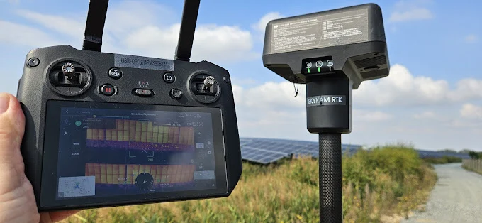
At the core of our precision mapping capabilities lies cutting-edge drone LiDAR technology that delivers unparalleled accuracy for digital terrain modeling. We utilize industry-leading DJI Zenmuse L1 and RIEGL miniVUX systems paired with RTK GPS positioning for centimeter-level precision.
Our drones carry lightweight yet powerful LiDAR sensors capable of emitting up to 240,000 pulses per second, penetrating vegetation to capture true ground surfaces. We’ve integrated high-resolution RGB cameras that simultaneously collect visual data, enhancing our terrain models with photographic detail.
Data processing occurs through specialized software like Terrasolid and GlobalMapper, where our technicians apply rigorous calibration and filtering algorithms. This comprehensive technology suite ensures we deliver highly accurate, classified point clouds that transform into the detailed digital terrain models your projects demand.
Applications Across Industries
Our Drone LiDAR technology serves critical functions across numerous industries including construction, civil engineering, forestry, mining, and environmental conservation. We’ve helped construction teams optimize site planning while enabling civil engineers to design safer infrastructure through precise terrain visualization. In the natural resource sector, our terrain models assist forestry professionals with inventory management, mining operations with volume calculations, and conservation efforts with habitat monitoring.


Construction and development
Because modern construction projects demand precision and efficiency at every stage, drone LiDAR has revolutionized how developers approach site planning and management. Our technology delivers accurate topographical data for better earthwork calculations, significantly reducing costly estimation errors that plague traditional methods.
We’ve helped developers identify optimal building locations, assess drainage patterns, and calculate precise cut-and-fill volumes—all before breaking ground. During construction, our regularly updated terrain models track progress, ensuring adherence to design specifications and enabling quick adjustments when necessary.
Our clients appreciate how our detailed elevation maps assist with infrastructure planning, revealing the most efficient routes for utilities and drainage systems. By providing comprehensive insights into existing terrain conditions, we’re enabling smarter decisions, faster timelines, and ultimately more successful construction projects.
Civil engineering and infrastructure
Civil engineers and infrastructure planners have embraced drone LiDAR technology as a powerful resource for designing resilient public works. Our DTM services provide precise measurements for highway alignments, bridge clearances inspection, and slope stability analyses—critical data that prevents costly design errors.
We’ve helped municipalities map stormwater systems, identifying drainage patterns invisible to traditional surveys but crucial for flood prevention. Our terrain models reveal subtle topographical features that influence water flow, enabling more effective culvert and retention pond placement.
For transportation projects, we deliver volumetric calculations for cut-and-fill operations, optimizing earthwork costs. The millimeter-level accuracy of our LiDAR captures existing infrastructure conditions, supporting both new construction and rehabilitation planning.

Forestry and land management
The sustainable management of forest resources depends heavily on accurate terrain data, which our drone LiDAR systems deliver with unprecedented detail. We help forestry professionals monitor tree growth, identify diseased vegetation, and plan selective harvesting with minimal environmental impact.
Our LiDAR technology penetrates dense canopy cover to create precise understory maps, revealing subtle variations in terrain that affect watershed dynamics and wildlife habitats. This data enables better fire management through fuel load assessment and identification of natural firebreaks.
For land managers, we’re providing essential tools for conservation planning, habitat restoration, and invasive species monitoring. By comparing sequential scans, you’ll track changes over time, ensuring your management practices achieve desired outcomes while maintaining biodiversity and ecosystem health.
Mining and resource extraction
Mining operations face three critical challenges where our drone LiDAR terrain modeling delivers exceptional value. First, we provide accurate volumetric measurements of stockpiles and extraction sites, helping you track inventory and production rates with precision. Second, our models enable efficient mine planning by revealing optimal excavation paths and identifying potential hazards before equipment deployment.
Third, we support environmental compliance by monitoring erosion, watershed impacts, and restoration progress. Our high-resolution terrain models capture subtle topographical changes that affect drainage patterns and stability assessments.
We’ve helped mining companies reduce survey costs by up to 60% while increasing data accuracy. Whether you’re managing an active quarry, planning a new extraction site, or monitoring reclamation efforts, our drone LiDAR services provide the detailed terrain intelligence you need.


Environmental conservation
Environmental conservation efforts benefit tremendously from our drone LiDAR terrain modeling, which captures precise data for habitat monitoring and restoration projects. Our technology identifies subtle topographical features critical for species preservation, tracks vegetation growth patterns, and maps invasive species spread.
We’re particularly proud of our work with conservation teams mapping wetland boundaries and monitoring endangered habitats. By creating baseline terrain models and conducting regular scans, we help track environmental changes over time, providing invaluable data for evidence-based conservation decisions.
Our LiDAR systems can penetrate dense canopies to reveal forest floor characteristics without disturbing delicate ecosystems. This non-invasive approach makes it ideal for studying protected areas where minimal human intervention is essential. We’ll help you understand your conservation area’s complete ecological profile with unprecedented accuracy.
Flood mitigation planning
When flooding threatens communities and infrastructure, precise terrain data becomes the foundation of effective mitigation planning. Our drone LiDAR terrain models provide the centimeter-level accuracy needed to identify flood-prone areas, simulate water flow patterns, and design effective drainage systems.
We’ve helped municipalities develop comprehensive flood management strategies by mapping critical watersheds and floodplains with unprecedented detail. This enables engineers to design retention ponds, levees, and stormwater infrastructure that protect vulnerable areas. The high-resolution data also supports hydraulic modeling to predict inundation depths during various storm scenarios.

Why Choose Our Drone LiDAR Digital Terrain Model Team
With decades of combined experience in geospatial technology, our team stands at the forefront of drone LiDAR terrain modeling excellence. We’ve assembled certified drone pilots, GIS specialists, and data analysts who deliver unmatched accuracy in every project.
Our equipment includes industry-leading LiDAR sensors with precision down to 2cm, ensuring your terrain models exceed industry standards. We’re committed to rapid turnaround—typically delivering processed data within 48-72 hours of collection.
Unlike competitors who offer generic solutions, we customize each project to your specific requirements. We’re fully insured, CAA-compliant, and maintain rigorous quality control protocols. Our team’s technical expertise is matched only by our commitment to client satisfaction, with 97% of clients returning for additional services.