Need accurate spatial data? Save time, cut costs, and get crystal-clear insights with our advanced drone point cloud survey services.
Don’t settle for risky, time-consuming traditional surveys when our enterprise-grade drone technology delivers faster, safer 3D point cloud results.
As specialists in industrial-grade spatial data collection and precision modeling since 2016, we provide the actionable point cloud data you need for critical engineering decision-making.
Used By Top UK Businesses

👇Fill Out The Form For Same-Day Drone Survey Quote 👇
Why Leading UK Businesses Choose Our Drone Survey Services:
✅ We’re Fully Licensed, Insured Drone Pilots
✅ We Cover the UK with Fast Response Times
✅ We Only Use Top-Quality Drone Equipment
✅ We Customize Solutions for Your Industry
✅ We Handle All the Paperwork and Permissions
✅ We Have Worked with Hundreds of Happy Customers


What Is A Drone Point Cloud Survey?
A drone point cloud survey uses UAVs equipped with LiDAR sensors or photogrammetry techniques to capture detailed spatial data of a site. This data is processed into a point cloud, which is a 3D collection of millions of georeferenced points representing the exact shape and features of the surveyed area.
Each point contains precise X, Y, and Z coordinates, allowing for accurate modeling of terrain, structures, and vegetation. Point cloud surveys are widely used in construction, mining, forestry, and infrastructure projects for tasks like volume calculations, site analysis, and progress monitoring.
Using drones for this process is faster, safer, and more efficient than traditional ground-based methods. The resulting 3D models provide engineers and planners with highly detailed, accurate data for decision-making and project planning.
How Our Drone Point Cloud Surveys Work
We begin each drone point cloud survey with a thorough site assessment and custom flight planning to ensure optimal data collection. Our specialized drones, equipped with state-of-the-art LiDAR or photogrammetry systems, capture high-density data from multiple angles to generate comprehensive spatial information. This raw data undergoes advanced processing to create precisely classified 3D models that accurately represent your site’s features and topography.

Comprehensive site assessment and flight planning
The first critical step in our survey process involves thorough site assessment and strategic flight planning. We begin by analyzing your site’s topography, identifying potential obstacles, and determining optimal flight paths to ensure comprehensive coverage.
Our team considers environmental factors like weather conditions, lighting, and airspace restrictions that might affect data quality. Using specialized software, we calculate the precise altitude, speed, and camera settings needed to achieve your desired resolution.
We’ll establish ground control points to enhance accuracy and create a detailed flight mission that maximizes battery efficiency while capturing adequate overlap between images. This meticulous planning phase is crucial for collecting high-quality data that will generate precise 3D point clouds of your site.
Each flight plan is customized to your specific project requirements and site constraints.
Specialized drone deployment with LiDAR or photogrammetry systems
Once planning is complete, our specialized aerial equipment takes flight to execute the carefully designed mission. We deploy high-precision drones equipped with either advanced LiDAR sensors or photogrammetry camera arrays, depending on your project requirements.
Our LiDAR-equipped drones emit laser pulses that penetrate vegetation and capture detailed terrain features with centimeter-level accuracy. For projects requiring visual data, our photogrammetry systems use overlapping high-resolution images to generate detailed 3D models.
During flight, our technicians monitor data quality in real-time, adjusting parameters if necessary. We maintain consistent altitude, speed, and flight paths to ensure uniform data collection across your entire site. We’ll complete multiple passes when needed to capture complex areas from different angles, maximizing data completeness.


High-density data capture from multiple perspectives
During the aerial survey, our drones systematically capture millions of data points from multiple angles, creating comprehensive point clouds that reveal every detail of your site. We fly precise flight patterns at various altitudes to ensure complete coverage, even in complex terrain or structures.
Our advanced sensors collect up to 500 points per square meter, capturing fine details that traditional surveys miss. This high-density approach eliminates data gaps and shadow zones that plague single-perspective methods.
We’re able to differentiate between vegetation, structures, and ground surfaces with remarkable clarity. The multi-perspective technique also enhances accuracy by cross-referencing overlapping data points. When combined with our georeferencing systems, this approach delivers sub-centimeter precision that you can confidently use for critical planning decisions and design work.
Advanced processing and point cloud generation
After collecting millions of data points in the field, we transform raw imagery into precise 3D point clouds through our multi-stage processing pipeline. Our proprietary algorithms first align and stitch overlapping images using photogrammetry techniques that identify common features across multiple frames.
We then apply advanced noise filtering and outlier detection to clean the data, ensuring exceptional accuracy. Our calibration process corrects for lens distortion and atmospheric variables that might otherwise compromise measurement integrity.
The final processing stage assigns precise XYZ coordinates to each point, creating a dense, measurable digital replica of your site. We’ll deliver colorized point clouds that include RGB values from source imagery, making it easy to distinguish between different materials and structures within your dataset.

Precise 3D model creation with classifications
The rich point cloud data serves as the foundation for our next step: creating detailed 3D models with comprehensive classifications. We transform billions of points into precisely structured 3D representations that accurately reflect your site’s reality.
Our classification system categorizes each element—buildings, vegetation, terrain, power lines, and infrastructure—with distinct color coding and attributes. This segmentation enhances usability, allowing you to isolate specific features or remove unwanted elements.
We’ll refine these models to your specifications, whether you need bare-earth terrain models for flood analysis, building-only models for urban planning, or complete site representations for presentations. The classified models integrate seamlessly with CAD, GIS, and BIM workflows, providing measurement-ready data that’s immediately actionable for your engineering, planning, or construction teams.
Benefits of Drone Point Cloud Surveys
Our drone point cloud surveys deliver millimeter-level accuracy for your critical measurements while capturing comprehensive spatial data of even the most complex environments. We’ve developed systems that can penetrate vegetation to create true ground modeling, allowing you to extract multiple valuable products from a single dataset. You’ll find our approach offers a cost-effective alternative to traditional survey methods without sacrificing precision or detail.


Millimeter-level accuracy for critical measurements
When precision is paramount in your engineering or construction projects, drone point cloud surveys deliver exceptional millimeter-level accuracy that traditional methods simply cannot match. We’re able to capture millions of data points that create highly detailed 3D models of your site with accuracy down to 2-3mm.
This precision is critical for projects requiring exact measurements, such as structural inspections, retrofit designs, and complex architectural features. We achieve this through a combination of high-resolution cameras, advanced LiDAR sensors, and sophisticated post-processing algorithms that filter noise and refine data.
The result? You’ll have confidence in measurements that previously required time-consuming manual verification. We can detect even the slightest structural deformations, ensuring compliance with the strictest engineering standards and regulations.
Comprehensive spatial data of complex environments
Beyond precision measurement, drone point cloud surveys excel at capturing comprehensive spatial data in environments too complex for traditional surveying methods. We’ve successfully mapped intricate industrial facilities, densely vegetated areas, and challenging terrain that would be impractical or unsafe to survey on foot.
Our drones collect data from multiple angles, documenting every corner, crevice, and vertical surface in your environment. This creates a complete digital twin that’s invaluable for planning renovations, expansions, or maintenance in complex settings. You’ll get a holistic view that includes not just the ground but also elevated structures, equipment, and surrounding features.
For sites with restricted access or safety concerns, our comprehensive spatial mapping provides crucial visibility without putting personnel at risk or disrupting operations.

Ability to penetrate vegetation for true ground modeling
Dense vegetation has traditionally posed one of the greatest challenges in ground mapping, but our drone point cloud technology effectively overcomes this obstacle through specialized sensors that penetrate foliage. By using LiDAR systems that emit multiple returns per pulse, we’re able to capture ground data even beneath thick canopies.
This penetration capability allows us to create highly accurate digital terrain models (DTMs) that represent the true ground surface rather than just the top of vegetation. We can differentiate between vegetation and terrain, giving you comprehensive topographic information for projects in heavily wooded areas, rainforests, or overgrown sites.
The resulting models help with precise volume calculations, drainage analysis, and engineering design where understanding the actual ground conditions is critical, despite dense vegetative cover.
Multiple derivable products from single dataset
One of the most compelling advantages of our drone point cloud surveys is the ability to generate multiple professional deliverables from a single collected dataset. Once we’ve captured the area, we can produce contour maps, digital elevation models (DEMs), 3D meshes, volumetric calculations, and orthomosaic imagery without additional field work.
This versatility saves you significant time and money. Need to measure stockpile volumes today but realize you need slope analysis next week? No problem. The data’s already collected. We can also extract specific features like buildings, vegetation, or infrastructure elements for specialized analysis or BIM integration.
The point cloud serves as your project’s digital twin, allowing for continuous reference and multiple derivative products throughout your project lifecycle without repeating field surveys.


Cost-effective alternative to traditional methods
While traditional survey methods often require extensive manpower and equipment, our drone point cloud surveys deliver comparable or superior results at a fraction of the cost. We’ve eliminated the need for multiple field visits by capturing comprehensive data in a single flight, reducing labor expenses by up to 70%.
Our drones access difficult terrain without safety risks or specialized equipment, avoiding costs associated with traffic management, scaffolding, or aerial lifts. The automated data processing workflow minimizes human error and manual calculation time.
For larger sites, the cost advantage becomes even more significant. What might take weeks with conventional surveying can be completed in days with our drone solution. You’ll receive more accurate data faster while enjoying substantial budget savings – without compromising on quality or precision.
Drone Point Cloud Survey Services We Offer
Our comprehensive drone point cloud survey services include high-definition 3D modeling, feature extraction and classification, and precise mesh and surface generation. We create detailed cross-sections and profiles that reveal crucial topographical and structural insights for your projects. Through seamless BIM and CAD integration, we transform complex point cloud data into actionable deliverables that enhance your planning, design, and analysis capabilities.

High-Definition 3D Modeling
How precisely can a drone capture your world? Our high-definition 3D modeling transforms billions of data points into photo-realistic digital twins of your site with millimeter accuracy. These models aren’t just visually impressive—they’re working documents that enable virtual measurements, inspections, and analysis without returning to the field.
We process raw point cloud data through sophisticated software that identifies surfaces, textures, and spatial relationships. The result is a comprehensive 3D model you can rotate, section, and annotate. Engineering teams use these models to plan infrastructure modifications, while preservation specialists rely on them to document historical structures exactly as they exist.
Our 3D models integrate seamlessly with BIM software and CAD applications, ensuring your digital assets remain valuable throughout your project’s lifecycle.
Feature Extraction and Classification
Raw data becomes actionable intelligence through our feature extraction and classification services. We transform complex point clouds into clearly identified assets by automatically detecting and categorizing buildings, vegetation, power lines, roads, and terrain features.
Our AI-powered algorithms precisely identify critical infrastructure elements and separate them from surrounding environments. This classification enables targeted analysis for specific applications like vegetation encroachment monitoring, structural inspections, or land use planning.
We’ll deliver your classified data in industry-standard formats compatible with CAD, GIS, and BIM software. Each feature is tagged with relevant metadata including dimensions, elevation, and classification confidence scores. This seamless integration means you can immediately incorporate our extracted features into your existing workflows without time-consuming manual processing.


Mesh and Surface Generation
Point cloud data transforms into immersive 3D visualizations through our mesh and surface generation services. We convert raw point clouds into detailed triangular meshes that accurately represent terrain, structures, and objects with precise geometry and texturing.
Our process begins with noise filtering and point cloud optimization before applying advanced meshing algorithms. We’ll create watertight models with proper topology for engineering applications or textured meshes for visualization purposes.
Whether you need Digital Terrain Models (DTMs) for earthwork calculations, Digital Surface Models (DSMs) including vegetation and structures, or BIM-ready 3D assets, we’ve got you covered. Our meshes support format compatibility with CAD, GIS, and visualization software, ensuring seamless integration into your existing workflows.
Cross-Section and Profile Creation
Extracting valuable insights from complex terrain requires precise cross-sectional analysis, which we deliver through our comprehensive profile creation service. We transform dense point cloud data into clear, actionable cross-sections that reveal the true nature of your site’s topography.
Our team creates detailed profiles along any vector or alignment you need, helping you visualize elevation changes, terrain features, and structural relationships. These cross-sections prove invaluable for corridor mapping, road design, pipeline routes, and volume calculations.
We’ll generate profiles in multiple formats compatible with your CAD or GIS software, allowing seamless integration into your existing workflows. Each cross-section includes precise measurements and can be delivered at custom intervals to match your project specifications, giving you the exact level of detail required for informed decision-making.

BIM and CAD Integration
Our seamless BIM and CAD integration services transform complex drone point cloud data into precision-engineered digital assets ready for your design platform of choice. We convert raw point clouds into compatible file formats for Revit, AutoCAD, MicroStation, and other leading design software.
Our team specializes in creating intelligent BIM models that incorporate real-world spatial accuracy with parametric object data. We’ll extract key architectural and structural elements from your point cloud, ensuring they’re accurately positioned and dimensioned in your 3D model.
We don’t just deliver data—we deliver workflow-ready deliverables. Whether you need LOD 200, 300, or 350 BIM models, 2D CAD drawings, or hybrid deliverables, we’ll tailor our integration approach to match your project requirements and enhance your design process.
Digital Twin Development
When deploying our advanced digital twin development services, we transform your drone-captured point cloud data into comprehensive virtual replicas that mirror your physical assets with exceptional fidelity. These digital twins serve as dynamic models that update in real-time as conditions change.
We integrate IoT sensors with point cloud data to create twins that don’t just represent static geometry but also monitor operational parameters. This allows you to visualize asset performance, predict maintenance needs, and test scenarios virtually before implementing them physically.
Our development process includes detailed metadata attachment, system integration, and customized dashboards for intuitive interaction with your digital twin. We’ll help you leverage this technology to reduce operational costs, extend asset lifecycles, and make data-driven decisions across your organization’s infrastructure portfolio.


Clearance and Clash Detection
Through sophisticated analysis of drone-acquired point clouds, we identify potential collisions and clearance issues before they become costly problems in your projects. Our clash detection services highlight where building elements, utilities, or infrastructure components might interfere with each other, allowing for preemptive design modifications.
We’re experts at detecting insufficient clearances for mechanical systems, identifying spatial conflicts between structural elements, and verifying compliance with safety regulations. By processing millimeter-accurate measurements from our drone surveys, we deliver comprehensive reports that pinpoint exact locations of potential clashes.
This proactive approach significantly reduces on-site rework, minimizes change orders, and accelerates project timelines. You’ll receive visual documentation of all identified issues, complete with measurement data and recommended solutions for seamless project execution.
Deformation Monitoring
Detecting subtle structural changes over time requires sophisticated monitoring techniques that our drone point cloud surveys deliver with exceptional precision. We capture millimeter-level deformations in buildings, bridges, dams, and slopes by conducting regular drone surveys and comparing sequential point cloud datasets.
Our deformation monitoring service identifies structural movement, settlement, and material degradation before they become visible to the human eye. We’ll establish a baseline survey, then perform scheduled follow-up scans at intervals tailored to your project requirements.
The resulting comparative analysis provides color-coded visualization of changes, comprehensive measurement data, and actionable reports that highlight areas of concern. This proactive approach allows you to address potential structural issues early, reducing safety risks and preventing costly emergency repairs.

Technology We Use for Drone Point Cloud Surveys
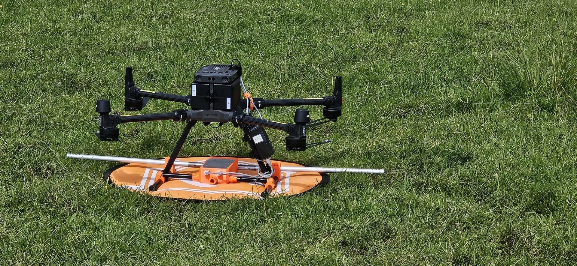
To create highly accurate 3D point clouds, we’ve invested in cutting-edge drone and LiDAR technology that delivers exceptional results for our clients. Our fleet includes DJI Matrice 300 RTK drones equipped with Zenmuse L1 LiDAR sensors capable of collecting up to 240,000 points per second with centimeter-level accuracy.
We complement our hardware with industry-leading software solutions including Pix4D and Agisoft Metashape for photogrammetry processing, and CloudCompare for point cloud analysis. Our specialized RGB cameras capture high-resolution imagery that we integrate with LiDAR data to produce colorized point clouds.
For projects requiring enhanced precision, we employ ground control points surveyed with our Trimble R12i GNSS receivers. This multi-layered approach ensures we deliver deliverables that meet or exceed industry accuracy standards.
Applications Across Industries
Our drone point cloud survey services span multiple sectors including architecture, engineering, mining, forestry, and cultural heritage preservation. We’ve helped construction teams monitor progress, mining operations calculate volumetrics, and environmental managers assess forest health—all with centimeter-level accuracy. These applications demonstrate how aerial point cloud technology transforms data collection across industries, making previously complex measurements both accessible and affordable.


Architecture and construction
The architecture and construction industry has transformed dramatically through drone point cloud surveys. We provide architects and builders with highly detailed 3D representations of sites, enabling precise measurements and spatial analysis before breaking ground.
Our drones capture comprehensive data that helps identify structural issues in existing buildings, monitor construction progress, and verify that work meets design specifications. This technology significantly reduces costly errors and rework while accelerating project timelines.
We’ve helped clients create accurate as-built documentation for renovation projects, perform volumetric calculations for earthwork, and generate BIM-compatible models. By integrating our point cloud data directly into design software, your team can make informed decisions faster and collaborate more effectively across disciplines, ultimately delivering better projects with less risk.
Engineering and infrastructure
When assessing critical infrastructure, engineers increasingly rely on our drone point cloud survey services to attain millimeter-level precision for inspections and maintenance planning. Our technology enables comprehensive monitoring of bridges, tunnels, dams, and power lines without service disruption or safety risks.
We’re helping infrastructure managers detect subtle structural deformations, material degradation, and potential failure points that might be missed in traditional visual inspections. By creating detailed 3D models of existing infrastructure, we provide essential data for retrofit projects and expansion planning.
Our point clouds integrate seamlessly with CAD/BIM software, allowing engineers to perform accurate measurements, stress analyses, and simulations. This integration dramatically reduces design errors and helps optimize resource allocation for maintenance budgets across aging infrastructure networks.

Mining and quarrying
Mining operations across the globe have been revolutionized by our drone point cloud surveying capabilities, which transform dangerous manual stockpile measurements into precise, automated calculations. Our services enable quarry managers to accurately track material volumes, optimize extraction processes, and monitor site changes with centimeter-level precision.
We’ve helped mining companies reduce survey costs by up to 80% while providing more comprehensive data than traditional methods. Our drones capture inaccessible areas that would pose significant safety risks to ground surveyors, while delivering detailed 3D models of pits, stockpiles, and tailings.
These point cloud surveys support better planning, regulatory compliance, and environmental monitoring. By integrating our data with your mining software, we’re enabling smarter decision-making throughout the entire extraction lifecycle.
Forestry and environmental management
Beyond extraction industries, our point cloud survey services offer tremendous value in forestry and environmental management. We help forestry companies accurately measure tree heights, canopy density, and trunk diameters to optimize timber harvesting and replanting strategies.
Our drones rapidly survey large woodland areas, creating detailed 3D models that identify diseased trees, invasive species, and fire hazards before they become critical issues. Forest managers use our data to monitor growth rates and calculate precise biomass volumes across their territories.
Environmental agencies partner with us to track habitat changes, measure erosion patterns, and assess the impact of natural disasters. We’re also supporting conservation efforts by mapping biodiversity hotspots and monitoring protected areas, providing the detailed spatial data needed for effective environmental stewardship.


Cultural heritage documentation
Our point cloud survey technology has revolutionized cultural heritage documentation by capturing intricate details of historical structures with unprecedented accuracy. We’re helping archaeologists, historians, and preservationists create comprehensive digital records of monuments, archaeological sites, and historic buildings.
Using our drone-based point cloud surveys, we can document hard-to-access features like rooftops, towers, and deteriorating structures without scaffolding or risk to personnel. The millimeter-precise 3D models we generate allow for detailed analysis of architectural elements and deterioration assessment.
These digital archives serve as valuable baselines for monitoring changes over time, supporting restoration projects, and preserving cultural heritage for future generations. When disaster strikes, our previous documentation can provide crucial reference data for rebuilding historically significant structures.
Utilities and transportation
The utilities and transportation sectors have embraced drone point cloud technology to transform infrastructure inspection and management. We’ve helped companies monitor power lines, pipelines, railways, and roadways with unprecedented precision and safety.
Our drone surveys identify potential issues like vegetation encroachment on power lines or structural weaknesses in bridges before they become critical failures. For transportation authorities, we deliver detailed models of highways, helping them plan maintenance and expansion projects without disrupting traffic.
What sets us apart is our ability to integrate this data with existing GIS systems, creating a seamless workflow for infrastructure managers. We’ll help you reduce inspection costs by up to 70% while improving safety by keeping workers away from hazardous environments like high-voltage areas and busy transportation corridors.

Why Choose Our Drone Point Cloud Survey Team
Five key advantages set our drone point cloud survey team apart in an industry where precision and expertise make all the difference. We’re certified FAA Part 107 pilots with specialized training in photogrammetric techniques and point cloud processing. Our equipment includes the latest RTK/PPK-enabled drones and LiDAR sensors that capture millimeter-accurate data.
We’ve successfully completed over 500 projects across diverse environments, from urban infrastructure to remote terrain. Our turnaround time beats traditional methods by up to 70%, delivering processed data within days rather than weeks. Most importantly, we’re committed to customizing each solution to your specific project requirements.
When you’re investing in aerial survey data, you need a team that combines technical excellence with practical field experience and customer responsiveness.
Contact Us For Your Drone Point Cloud Survey Needs
Ready to elevate your project with highly detailed 3D point cloud data? Our specialized drone point cloud survey services deliver precise spatial information, capturing millions of data points to create accurate digital twins of your site, structures, and terrain.
Reach out today through our dedicated LiDAR and photogrammetry line at +44 7368 537499 or email us at Jamie@skykam.co.uk. We’ll respond within 24 hours to arrange your free consultation.
When contacting us, please share details about your project location, required level of detail, and specific output formats needed. This information helps us configure our equipment and processing workflows to deliver exactly what your project requires. We serve architects, engineers, preservationists, and developers throughout the UK with efficient data collection and processing.
Let’s work together to create rich, detailed point cloud datasets that drive better design decisions and project outcomes with our advanced drone survey technology.