Need accurate roadway data? Save time, cut costs, and get crystal-clear insights with our advanced drone road survey services.
Don’t settle for risky, time-consuming traditional surveys when our enterprise-grade drone technology delivers faster, safer road analysis results.
As specialists in industrial-grade infrastructure assessment and pavement monitoring since 2016, we provide the actionable road condition data you need for critical maintenance decision-making.
Used By Top UK Businesses

👇Fill Out The Form For Same-Day Drone Survey Quote 👇
Why Leading UK Businesses Choose Our Drone Survey Services:
✅ We’re Fully Licensed, Insured Drone Pilots
✅ We Cover the UK with Fast Response Times
✅ We Only Use Top-Quality Drone Equipment
✅ We Customize Solutions for Your Industry
✅ We Handle All the Paperwork and Permissions
✅ We Have Worked with Hundreds of Happy Customers


What Is A Drone Road Survey?
A drone road survey uses unmanned aerial vehicles (UAVs) to capture high-resolution images and data of roads and surrounding infrastructure. These drones are equipped with cameras, LiDAR, or other sensors to map road conditions, measure distances, and detect defects like cracks or potholes.
The data collected is processed into detailed maps, 3D models, or reports for planning, maintenance, or construction purposes. Compared to traditional ground surveys, drone surveys are faster, safer, and more cost-effective, especially in hard-to-reach or dangerous areas.
They provide accurate insights for engineers and planners to make informed decisions. This technology is widely used for road inspections, upgrades, and new construction projects.
How Our Drone Road Surveys Work
Our drone road survey process begins with meticulous route planning followed by high-resolution aerial data capture using specialized equipment. We then process the collected imagery and sensor data through advanced algorithms to analyze road conditions and create detailed digital maps.

Comprehensive route planning and assessment
At the heart of our road survey services lies a meticulous route planning and assessment process. We begin by analyzing your specific requirements and site conditions, including road dimensions, traffic patterns, and potential obstacles.
Our team uses advanced mapping software to create optimized flight paths that maximize efficiency while ensuring complete coverage. We’ll identify key inspection points and areas requiring special attention, whether it’s bridge structures, drainage systems, or surface degradation.
Before deployment, we conduct thorough risk assessments, checking for hazards like power lines, tall structures, or restricted airspace. We’ll also factor in weather patterns to select ideal survey windows.
This comprehensive planning stage eliminates surprises during execution, reduces costs, and guarantees high-quality data collection. It’s why our clients trust us to deliver actionable insights for their road infrastructure projects.
Aerial data capture with specialized equipment
When it comes to gathering comprehensive road data, we employ state-of-the-art drone technology equipped with specialized sensors and imaging systems. Our drones carry high-resolution cameras that capture detailed imagery at various angles, revealing surface conditions that might go unnoticed from ground level.
We’ve integrated LiDAR sensors for precise elevation mapping and thermal cameras to detect subsurface issues like water infiltration. Our multispectral imaging capability identifies material differences across road segments, while GPS-enabled flight paths ensure consistent coverage with centimeter-level accuracy.
Each drone mission collects terabytes of structured data that’s automatically tagged with location markers for seamless integration into our analysis software. This advanced equipment allows us to survey miles of roadway in hours rather than days, without disrupting traffic flow or endangering personnel.


Advanced processing of imagery and sensor data
Once captured, raw drone data undergoes sophisticated processing through our AI-driven analysis pipeline. We transform aerial imagery into actionable intelligence using photogrammetry techniques that create detailed 3D road models accurate to within 2cm.
Our proprietary algorithms automatically detect and classify surface defects—potholes, cracks, rutting—while measuring their severity. We’ve trained our systems on thousands of road conditions to ensure reliable identification in varying lighting and weather conditions.
For infrastructure clients, we extract precise measurements of roadway dimensions, drainage systems, and adjacent structures. All data integrates seamlessly with GIS platforms and asset management systems, providing both visual and analytical outputs.
This comprehensive processing eliminates manual inspection errors and delivers consistent, objective assessment reports that prioritize maintenance needs based on safety and structural concerns.
Detailed condition analysis and mapping
Our analysis culminates in comprehensive condition maps that transform complex data into visual decision-making tools. We identify and categorize defects like cracks, potholes, rutting, and drainage issues with precise geolocation and severity ratings.
These maps highlight priority areas through color-coding and provide measurement data for each identified problem. We’ll deliver both high-level overview maps for strategic planning and detailed section analyses for maintenance crews.
Our mapping interfaces with GIS systems and asset management software, allowing you to track deterioration over time with sequential surveys. This historical data enables predictive maintenance scheduling and budget optimization. For comprehensive understanding, we include both 2D orthomosaic maps and 3D digital terrain models that reveal subtle elevation changes and drainage patterns critical to infrastructure health.

Comprehensive reporting with prioritized recommendations
After collecting and analyzing extensive survey data, we transform our findings into actionable intelligence through comprehensive reports tailored to your specific needs. Each report clearly identifies and categorizes road defects with severity ratings and GPS coordinates for precise localization.
We prioritize maintenance recommendations based on urgency, safety impact, and cost-effectiveness. Our reports include visual documentation, interactive maps, and trend analysis to help you understand deterioration patterns. This enables you to make informed decisions about resource allocation and maintenance scheduling.
For transportation departments and contractors, we provide integration-ready data formats compatible with your existing management systems. We’ll walk you through the findings during a detailed presentation, answering questions and discussing implementation strategies to maximize your maintenance budget while ensuring public safety.
Benefits of Drone Road Surveys
Our drone road surveys deliver five key benefits that transform traditional inspection processes. We’ll rapidly assess extensive networks while minimizing traffic disruption, all while providing comprehensive documentation that enables early detection of developing issues. You’ll find our approach offers a cost-effective alternative to conventional methods without sacrificing quality or thoroughness.


Rapid assessment of extensive road networks
Traditional road inspections often consume weeks or months when evaluating large-scale networks, while drones revolutionize this process through rapid assessment capabilities. Our drones can survey hundreds of miles of roadway in just days, capturing high-resolution imagery and data that would take ground teams significantly longer to collect.
We’ve optimized our flight plans to systematically cover entire highway systems, county roads, or municipal streets with efficient routing that maximizes coverage while minimizing flight time. The aerial perspective allows us to quickly identify problem areas that require immediate attention, from emerging potholes to deteriorating shoulders.
This speed translates directly to cost savings for our clients. You’ll receive comprehensive road condition assessments in a fraction of the time, enabling faster decision-making and more responsive maintenance planning.
Minimal traffic disruption during inspections
One of the most significant advantages of drone road surveys is their ability to operate without disrupting the flow of traffic. Unlike traditional inspection methods that often require lane closures or complete road shutdowns, our drones work entirely above the traffic.
We’re able to capture detailed imagery and data while vehicles continue to move normally below. This means no frustrating detours for drivers, no lost productivity for businesses that rely on these routes, and no costly traffic management systems. Even during rush hour, we can collect the information you need without adding to congestion.
For government agencies and transportation departments, this translates to substantial cost savings and prevents public criticism that typically accompanies road closures. It’s road inspection that happens without most people ever realizing it’s taking place.

Comprehensive documentation of road conditions
Whereas traditional surveys often miss critical details, drone technology captures an exhaustive profile of road conditions from multiple angles and elevations. Our drones document every crack, pothole, erosion point, and drainage issue with millimeter precision.
We’ll provide you with high-resolution orthomosaic maps showing the entire survey area, accompanied by 3D models that highlight elevation changes and structural concerns. These comprehensive datasets include timestamps and GPS coordinates for every documented defect, creating an indisputable record of road conditions.
The documentation we deliver isn’t just thorough—it’s actionable. We categorize issues by severity, helping you prioritize repairs efficiently. This meticulous approach ensures nothing is overlooked, resulting in better maintenance planning and more effective budget allocation. You’ll have complete visual evidence to support funding requests and demonstrate accountability to stakeholders.
Early detection of developing issues
By spotting subtle road deterioration signs before they escalate into major failures, our drone surveys dramatically reduce long-term maintenance costs. Our high-resolution imaging can identify hairline cracks, minor depressions, and early drainage issues that human inspectors often miss during traditional surveys.
We’re particularly effective at detecting subsurface problems through thermal imaging, revealing potential voids or moisture intrusion before they manifest visibly. This early warning system allows maintenance teams to implement preventative repairs—applying crack sealants, patching small potholes, or addressing drainage issues—when they’re still minor concerns.
The data we collect creates a predictive maintenance schedule based on actual conditions rather than arbitrary timelines. By addressing problems at their inception, we’ve helped municipalities extend pavement life by up to 30% while significantly reducing emergency repair costs.


Cost-effective alternative to traditional methods
Traditional road inspection methods typically cost three times more than our drone survey service, making us the financially prudent choice for municipalities and transportation departments operating with limited budgets. We eliminate expensive personnel hours and specialized equipment rentals while reducing traffic disruption costs.
Our drones complete surveys in a fraction of the time required by manual inspections. A five-mile stretch that might take a team three days to assess can be thoroughly documented by our drones in just hours. This efficiency translates directly to your bottom line.
We’ve also structured our pricing to be transparent and scalable. You’ll pay only for the area surveyed with no hidden fees for processing or reporting. The comprehensive data we deliver helps you prioritize repairs strategically, further optimizing your maintenance budget through smarter resource allocation.
Drone Road Survey Services We Offer
Our comprehensive drone road survey services include pavement condition assessment, road marking evaluation, and thorough drainage system inspection. We provide detailed pothole and crack mapping that pinpoints exact locations and severity levels for efficient repairs. Our roadside vegetation management service helps maintain clear sightlines and prevent plant encroachment onto roadways.

Pavement Condition Assessment
Three essential metrics define comprehensive pavement evaluation: surface distress, structural integrity, and ride quality. Our drones capture high-resolution imagery that identifies cracks, potholes, rutting, and raveling with millimeter precision. This detailed surface analysis helps prioritize maintenance needs effectively.
We use thermal imaging to detect subsurface issues like moisture infiltration and structural weaknesses that aren’t visible to the naked eye. Combined with GPR technology, we can assess pavement thickness and layer composition without invasive testing.
Our drones also measure longitudinal profiles to evaluate ride quality and comfort. We’ll provide you with International Roughness Index (IRI) scores and comprehensive condition ratings that meet DOT standards. This data enables you to develop targeted maintenance strategies that maximize your budget while extending pavement life.
Road Marking Evaluation
Road markings serve as the silent language of our highways, conveying critical navigation and safety information to drivers. Over time, these essential guides fade, crack, or become obscured, diminishing their effectiveness and compromising safety.
Our drone survey system evaluates road marking quality with precision and efficiency. We capture high-resolution aerial imagery that detects fading, retroreflectivity issues, and compliance with regulatory standards. Our AI-powered analysis identifies markings that require immediate attention, generating detailed reports with georeferenced data points.
We’ll help you prioritize maintenance based on severity, traffic volume, and accident history. Unlike traditional ground-based inspections, our drones cover extensive road networks in a fraction of the time, allowing for systematic monitoring that ensures your road markings remain visible and effective year-round.


Drainage System Inspection
While roadways themselves often capture our attention, the underlying drainage infrastructure remains critical to preventing water damage and extending pavement life. Our drone survey service excels at thoroughly examining these vital systems without disrupting traffic flow.
We capture high-resolution imagery of culverts, ditches, and stormwater infrastructure to identify blockages, erosion, structural damage, and vegetation encroachment. Our specialized thermal imaging can detect subsurface water issues like leaks or pooling beneath the roadbed before they cause pavement failure.
After collecting comprehensive drainage system data, we’ll provide a detailed report highlighting areas of concern with precise GPS coordinates. We prioritize issues based on urgency and recommend maintenance actions to protect your road investment and ensure public safety during rainfall events.
Pothole and Crack Mapping
Beyond hidden drainage issues, the most visible road deterioration comes in the form of potholes and cracks that plague drivers daily. Our drones rapidly identify and catalog these surface defects with millimeter precision that traditional surveys can’t match.
We’ve developed proprietary AI software that automatically classifies damage types, measures dimensions, and assigns severity ratings to each defect. This comprehensive data creates detailed deterioration maps, helping you prioritize repairs based on urgency and budget constraints.
The aerial perspective allows us to survey miles of roadway without disrupting traffic or endangering personnel. You’ll receive actionable reports with GPS-tagged imagery and measurements that your maintenance crews can immediately implement. By addressing problems early, you’ll prevent minor issues from becoming costly reconstruction projects later.

Roadside Vegetation Management
Maintaining clear sightlines and preventing encroachment on roadways requires consistent vegetation management that traditional ground crews struggle to perform efficiently. Our drone surveys transform this challenge by providing comprehensive aerial vegetation assessments.
We’ll identify overgrown areas, invasive species, and potential hazards like leaning trees before they become safety issues. Our multispectral imaging can distinguish between healthy and diseased vegetation, allowing for targeted treatment plans that reduce unnecessary clearing.
The data we collect helps optimize maintenance schedules and resource allocation, ensuring crews address the most critical areas first. We’ll deliver detailed vegetation maps with prioritized action items that help you stay ahead of growth patterns throughout seasonal changes.
This proactive approach reduces maintenance costs while maximizing road safety and visibility.
Traffic Pattern Analysis
Traffic congestion costs billions annually in wasted time, fuel, and productivity, yet conventional traffic studies only provide limited snapshots of traffic flow. Our drone-based traffic pattern analysis delivers comprehensive aerial data that traditional methods simply can’t match.
We capture real-time traffic movement across entire road networks, identifying bottlenecks, unusual congestion points, and peak flow times. Our high-resolution footage tracks vehicle counts, speeds, lane changes, and turning movements at intersections.
The data we collect helps transportation planners optimize signal timing, redesign problematic intersections, and plan infrastructure improvements. We can analyze traffic patterns during special events, construction periods, or seasonal changes to provide actionable insights.


Construction Progress Monitoring
Road construction projects demand vigilant oversight, which is where our drone monitoring services excel. We capture daily or weekly aerial imagery of your construction sites, giving you a comprehensive view of progress from above.
Our drones document each phase of development, from initial ground clearing to final paving. We’ll create time-lapse sequences that compress months of work into minutes, allowing stakeholders to visualize the entire project evolution. These visual records help verify contractor compliance with schedules and specifications.
We also provide volumetric measurements of materials like gravel, asphalt, and dirt, helping you track resource usage and prevent shortages. Our thermal imaging can identify potential structural issues before they become costly problems. With our construction monitoring, you’ll reduce site visits while maintaining complete project awareness.
Post-Weather Event Damage Assessment
When severe weather strikes transportation networks, our rapid-response drone teams deploy to assess the resulting damage comprehensively. Our drones capture high-resolution imagery of flooded roadways, collapsed structures, landslides, and other hazards that might impede traffic flow or pose safety risks.
We’ll deliver detailed damage reports within hours, not days, allowing transportation departments to prioritize repairs based on severity and impact. Our thermal imaging capabilities can detect underlying structural weaknesses invisible to the naked eye, while our AI analysis identifies potential failure points.

Technology We Use for Road Surveys
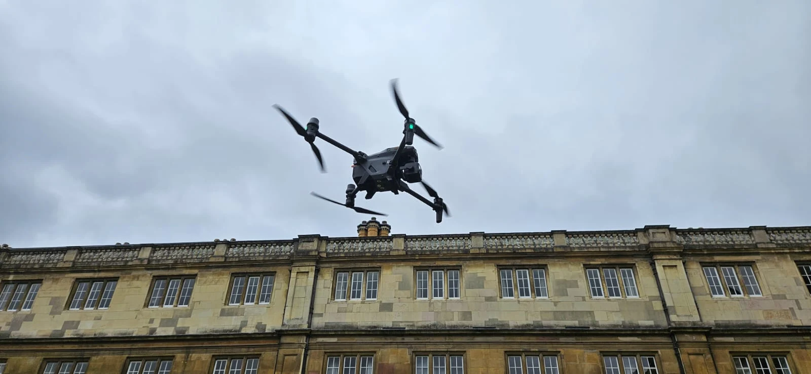
Our cutting-edge drone technology forms the backbone of our road survey operations. We employ DJI Matrice 300 RTK drones equipped with high-resolution RGB cameras, LiDAR sensors, and thermal imaging capabilities for comprehensive data collection. These UAVs can cover up to 30 miles of roadway in a single day—far outpacing traditional survey methods.
Our fleet integrates real-time kinematic (RTK) positioning, enabling centimeter-level accuracy in all weather conditions. We’ve also customized our drones with specialized software that automatically identifies potholes, cracks, and surface degradation.
The data we collect is processed through our proprietary AI algorithms, which generate detailed 3D models and actionable reports within 24 hours. This combination of advanced hardware and software delivers unprecedented speed and precision to road assessment projects.
Types of Road Infrastructure We Survey
Our comprehensive drone survey capabilities cover diverse road infrastructure including highways, urban streets, and rural unpaved roads. We’re equipped to assess bridges and overpasses from angles impossible with traditional survey methods. Our specialized technology also allows us to map tunnels and underpasses, providing complete infrastructure insights to our clients.


Highways and major roadways
Highways and major roadways form the backbone of our national transportation infrastructure, requiring constant monitoring to maintain safety and functionality. Our drones excel at surveying these extensive networks, capturing high-resolution imagery and data across long stretches without disrupting traffic flow.
We’re equipped to assess pavement conditions, identify emerging cracks, potholes, and deteriorating markings before they become hazardous. Our thermal imaging identifies subsurface issues that aren’t visible to the naked eye, helping prevent future failures.
During construction projects, we provide aerial progress monitoring and assist with traffic pattern analysis. This data helps transportation departments optimize maintenance schedules and prioritize repairs based on urgency and budget constraints.
We maintain all necessary FAA clearances for highway corridors, including special authorizations for surveying high-traffic areas and complex interchanges.
Urban street networks
While highways provide regional connectivity, urban street networks present unique challenges due to their density, complexity, and constant activity. Our drones excel in these environments, capturing comprehensive data on intricate street layouts, intersections, and traffic patterns without disrupting daily urban life.
We’ve optimized our urban surveys to identify critical issues like pothole clusters, deteriorating crosswalks, faded lane markings, and damaged traffic signage. Our high-resolution imaging allows us to assess sidewalk conditions, ADA compliance at crossings, and bicycle lane integrity.
Unlike traditional methods, we can complete urban street assessments during off-peak hours, minimizing traffic disruption while providing actionable data. City planners and maintenance crews particularly value our ability to create detailed maintenance priority maps based on both infrastructure condition and traffic volume analysis.

Rural and unpaved roads
Rural and unpaved roads often represent the most neglected segments of transportation infrastructure, yet they’re vital lifelines for agricultural communities and remote populations. Our drones excel at surveying these challenging environments, capturing detailed data that ground teams would struggle to collect efficiently.
We identify erosion patterns, drainage issues, and surface degradation that typically plague unpaved roads. Our thermal imaging can detect subsurface water accumulation that threatens structural integrity, while our AI algorithms measure rutting depth and aggregate displacement with millimeter precision.
We’ll provide comprehensive reports highlighting priority maintenance areas, helping you stretch limited rural infrastructure budgets. During emergencies, we can quickly assess flood damage or identify impassable sections, ensuring emergency services maintain access to isolated communities when they’re needed most.
Bridges and overpasses
Critical infrastructure like bridges and overpasses demand specialized inspection protocols that our drone systems are uniquely equipped to deliver. We can access difficult-to-reach structural elements without closing traffic lanes or deploying expensive lift equipment.
Our drones capture high-resolution imagery of support columns, expansion joints, bearings, and deck surfaces, detecting early signs of deterioration that might escape ground-level inspections. We’ll identify hairline cracks, spalling concrete, corroded steel, or water damage before they become serious problems.
We’re also equipped with thermal imaging to reveal hidden structural issues like delamination or moisture intrusion within the concrete. This comprehensive approach provides you with detailed documentation for maintenance planning and regulatory compliance while significantly reducing inspection costs and eliminating safety risks for personnel.


Tunnels and underpasses
Tunnels and underpasses present unique inspection challenges that our specialized drone solutions effectively address. These confined spaces often suffer from moisture infiltration, structural fatigue, and limited visibility that traditional inspection methods struggle to detect.
Our drones utilize advanced thermal imaging and LiDAR technology to identify water leakage, concrete deterioration, and substrate issues before they become critical failures. We’ve equipped our fleet with powerful lighting systems that illuminate even the darkest passages, capturing high-definition footage of ceiling conditions, drainage systems, and ventilation infrastructure.
We’ll navigate through these enclosed environments with precision, documenting critical maintenance needs while minimizing traffic disruption. This approach delivers comprehensive data about your tunnel’s structural integrity without the safety risks and logistical complications of manual inspections.
Highway interchanges
Complex highway interchanges demand comprehensive surveying due to their intricate network of ramps, flyovers, and merging lanes that experience high traffic volumes and accelerated wear. Our drones capture these multilevel structures from optimal angles that ground-based teams simply can’t achieve.
We’ll identify structural stress points where vehicles brake and accelerate frequently, document erosion around support pillars, and highlight drainage issues that could compromise interchange stability. Our high-resolution imaging also detects pavement deterioration at merge points where traffic patterns create unique pressure zones.

Why Choose Our Drone Road Survey Team
When you partner with our drone road survey team, you’re choosing expertise backed by years of specialized experience. Our certified pilots and engineers understand the complex challenges of road infrastructure assessment and deliver accurate, actionable data.
We’ve invested in cutting-edge drone technology that captures high-resolution imagery and precise measurements that traditional surveys simply can’t match. Our equipment operates in diverse weather conditions and challenging terrains without disrupting traffic flow.
We pride ourselves on quick turnaround times—typically delivering comprehensive reports within days, not weeks. Our data integration seamlessly works with your existing systems, making implementation straightforward.
Most importantly, our safety record is impeccable. We maintain strict compliance with FAA regulations while adhering to all local permitting requirements for aerial surveys.
Contact Us For Your Drone Road Survey Needs
Ready to revolutionize your road inspection and maintenance planning? Our specialized drone road survey services provide comprehensive condition assessments, precise measurements, and detailed visual documentation to optimize your highway management decisions.
Reach out today through our dedicated infrastructure line at +44 7368 537499 or email us at Jamie@skykam.co.uk. We’ll respond within 24 hours to schedule your free consultation.
When contacting us, please include information about your road network location, length of sections requiring assessment, and specific inspection priorities. This helps us prepare the most effective survey approach for your needs. We serve highway authorities, local councils, and private road managers throughout the UK with minimal traffic disruption.
Let’s work together to enhance your road maintenance strategy with data-driven insights from our advanced drone survey technology.