
LiDAR survey costs in the UK typically range from £2,000 to £5,000 for a 10-hectare site as of 2025. You’ll find prices vary based on factors like area size, terrain complexity, and required accuracy. While it might seem pricey, LiDAR is often more cost-effective than traditional methods, especially for larger projects.
To keep costs down, clearly define your project scope, choose deliverables wisely, and consider collaborating with other entities. Don’t forget to compare providers and their equipment.
By planning carefully and optimizing data collection, you can make the most of your LiDAR investment.
There’s more to uncover about maximizing the value of your lidar survey.

Average Price Of LiDAR Survey In The UK In 2024
In 2024, you’ll typically find LiDAR drone surveys in the UK starting at around £2,000 for basic projects, with costs ranging from £2,600 to £3,000 for a 10-hectare site. These figures give you a good ballpark to work with, but remember, every project is unique.
Your actual cost might vary depending on several factors.

The size of your site is a big one, of course. Larger areas will naturally cost more to survey. But it’s not just about size. The complexity of the terrain can also impact the price. If you’ve got a lot of obstacles or tricky landscapes to navigate, that might bump up the cost a bit.
Don’t forget to consider what you need the survey for. Are you after basic topographical data, or do you need more detailed information? The more intricate the requirements, the higher the price tag.
It’s always a good idea to get quotes from a few different providers. They might offer different packages or have varying rates. Just make sure you’re comparing apples to apples when you look at those quotes.

Factors affecting Price Of A LiDAR Survey UK
When you’re looking to get a LiDAR survey done, you’ll find that several factors can influence the final price.
The size of the area and the complexity of the terrain are big players in determining cost, as larger or more challenging landscapes require more time and resources.
You’ll also need to consider the level of accuracy you need, the type of equipment used, and the extent of data processing required, as these can all significantly impact the overall expense of your LiDAR survey.
Size of the area to be surveyed
The survey area’s size plays a crucial role in determining your LiDAR project’s overall cost. It’s pretty straightforward: the bigger the area, the more you’ll likely pay.
Here’s why: larger areas mean more flight time, which translates to higher labor and equipment costs. Plus, you’re collecting more data, so processing times will be longer too.
But that’s not all.
If you’re dealing with a particularly large area, you might need multiple flights to cover it all. This means more fuel and operational expenses.
And don’t forget about accuracy – larger projects often require additional ground control points to ensure everything’s spot-on.
To give you a ballpark figure, a typical 10-hectare site might set you back £2,600-£5,000. Need to survey more? Each additional 10-hectare chunk could add another £1,300-£1,500 to your bill.

Complexity of the terrain and accessibility
Complexity and accessibility of your survey area can significantly impact your LiDAR project’s cost. If you’re dealing with rugged terrain or hard-to-reach locations, expect to shell out more for your survey.
Here’s why: tricky landscapes require extra flight planning and prep time.
You can’t just zip through these areas; slower flight speeds are often necessary to ensure you’re capturing quality data.
You might also need specialized equipment or additional team members to handle the challenges. In some cases, you’ll have to fly multiple passes from different angles to get comprehensive coverage.
And once you’ve got the data, processing time goes up when dealing with complex topography. It’s like putting together a 3D puzzle – the more intricate the pieces, the longer it takes.
Don’t forget about the logistics, either. If your survey site is in the middle of nowhere, you’ll likely face extra travel and accommodation expenses for your survey team. They can’t just pop in for a quick scan and head home.

Level LiDAR of accuracy required
Zeroing in on accuracy levels for your LiDAR survey can significantly impact your project’s bottom line. It’s like choosing between a regular camera and a high-end professional one – the more precise you want your results, the more it’ll cost you.
If you’re aiming for sub centimeter-level accuracy, you’ll need to buckle up for higher expenses. You might find yourself needing fancier equipment that doesn’t come cheap. Plus, you’ll likely have to fly lower and slower, which means more time in the air and a bigger bill for flight hours.
Don’t forget about those pesky ground control points – you’ll need more of them, and they take time and manpower to set up.
But here’s the kicker: it’s not just about collecting the data. The real work begins once you’ve got it. Higher accuracy means more intensive data processing and quality control.
It’s like sifting through sand to find gold – the finer the sieve, the more time and effort it takes. So, before you decide on your accuracy requirements, think hard about what you really need. Sometimes, good enough is, well, good enough.
Equipment used
Moving from accuracy to hardware, you’ll find that the equipment used in your LiDAR survey plays a major role in determining its cost.
First up, there’s the LiDAR sensor itself. High-end models can set you back a cool £35,000 or more.
Sure, they’re pricey, but they often deliver top-notch accuracy and data quality. It’s like buying a luxury car – you’re paying for performance.
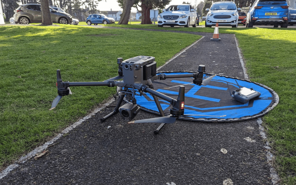
Then there’s the drone to consider. If you’re using a hefty LiDAR sensor, you’ll need a specialized drone that can handle the weight. These aren’t your run-of-the-mill quadcopters, and they come with a heftier price tag.

Don’t forget about the extras! An RTK GPS system can boost your accuracy, but it’ll also boost your bill. It’s like adding leather seats to that luxury car – nice to have, but it’ll cost you.

Data processing and modeling can substantially affect the final LiDAR Survey cost
Once you’ve gathered your LiDAR data, you’ll find that processing and modeling can significantly impact your final bill. The complexity of your desired output plays a big role in determining the cost.
If you’re looking for a basic point cloud, you’re in luck – it’ll be much easier on your wallet than a fully classified, highly detailed 3D model with all the bells and whistles.
Keep in mind that more complex outputs require more time and expertise. It’s like ordering a custom cake – the fancier the design, the more you’ll pay.
Plus, if you need specialized software for data processing, those licenses can be pretty pricey. And let’s not forget about processing power and time – the higher the level of detail you’re after, the more your computer (and your patience) will be tested.
Want to add some extra features like 3D models, contour maps, or vegetation analysis? They’re cool, but they’ll bump up your labor costs.
How The Price Of LiDAR Surveys Compare To Traditional Surveys
When you’re weighing up LiDAR surveys against traditional methods, you’ll find some interesting cost comparisons. While LiDAR equipment can be pricey upfront, it’s often more cost-effective for larger areas and can save you significant time in the field.
You’ll need to consider the value proposition carefully, balancing the higher initial costs against potential long-term savings and the increased accuracy and detail that LiDAR can provide.
Cost efficiency for larger areas
LiDAR surveys become increasingly cost-effective as the project area expands, outpacing traditional survey methods in efficiency for larger sites.
When you’re dealing with areas over 10 hectares, you’ll find that drone-based LiDAR surveys offer a more attractive financial proposition.
For these larger projects, you might be looking at an additional cost of £1,300 to £1,500 for each extra area LiDAR surveyed.
Here’s where it gets interesting: traditional survey methods don’t scale as efficiently.
As your project area grows, you’ll notice the costs for conventional surveys climbing more steadily. It’s like comparing a staircase (traditional methods) to a gentle slope (LiDAR).
The larger your site, the more you’ll appreciate the economic advantages of LiDAR.
Time savings
Three key factors contribute to the significant time savings offered by LiDAR surveys compared to traditional methods.
First, you’ll find that drones can cover large areas much faster than ground-based teams. Instead of trudging through terrain on foot, a drone can zip over the site, collecting data in a fraction of the time.
Secondly, LiDAR technology allows for rapid data collection. It’s like having a super-powered scanner that can capture millions of data points in seconds. This means you’re not waiting around for manual measurements or time-consuming setups.
Lastly, the data processing is often quicker with LiDAR. Modern software can crunch those millions of points into usable information faster than you can say ‘topographic map.’ This speedier turnaround means you’ll get your results sooner, allowing you to move forward with your project without delay.

Equipment costs
At first glance, you might experience sticker shock when comparing the equipment costs of LiDAR surveys to traditional methods.
It’s true that high-end LiDAR sensors for drones can set you back a whopping £35,000 or more. That’s enough to make anyone’s wallet wince!
But before you write off LiDAR as too expensive, let’s put things into perspective. While the initial investment is hefty, it’s important to consider the bigger picture.
These advanced sensors offer a level of speed and efficiency in data collection that traditional methods simply can’t match.
Think of it like buying a top-of-the-line computer: it’s pricey upfront, but it’ll save you countless hours of frustration down the line.
The beauty of LiDAR is that it often pays for itself over time. The rapid data collection means you can complete more surveys in less time, potentially increasing your overall revenue. Plus, the precision and detail of LiDAR data can lead to better decision-making and fewer costly mistakes in projects.
Value considerations
Now that we’ve examined the equipment costs, let’s compare the overall value of LiDAR surveys to traditional methods.
You might be wondering if the higher upfront costs of drone LiDAR surveys are worth it. Well, in many cases, they absolutely are!
Here’s the deal: while you might shell out more initially for a LiDAR survey, you’re often getting a lot more bang for your buck. These high-tech surveys can provide you with incredibly detailed data, and they do it fast. We’re talking about comprehensive information about your project site in a fraction of the time it would take using traditional methods.
This speed and detail can be a game-changer, especially if you’re working on a time-sensitive project. You’ll get your hands on the data you need quickly, allowing you to make informed decisions and keep things moving.
Plus, the level of detail can help you spot potential issues early on, potentially saving you headaches (and money) down the line.

How LiDAR Survey Output Affects Costs
You’ll find that the output format of your LiDAR survey can significantly impact its cost. Common formats like LAS, LAZ, and ASCII each have their own pros and cons, affecting both processing time and storage requirements.
File Format
The file format you choose for your LiDAR survey output can significantly impact the overall project cost. When you’re considering your options, it’s essential to weigh the pros and cons of each format carefully.
More complex formats like LAS or LAZ might seem appealing due to their ability to store additional metadata and attributes. However, keep in mind that these fancy formats often require more processing time and storage space, which can drive up your costs.
Here’s a tidbit that might surprise you: producing multiple file formats for the same dataset isn’t just a matter of clicking a button. It can actually increase processing time and labor costs. So, if you’re thinking of offering your data in various formats, be prepared for a potential bump in your project expenses.
Oh, and here’s a heads-up about proprietary formats: they might look shiny and tempting, but they often come with a catch. Some require specific software licenses, which can add a not-so-pleasant surprise to your overall project cost.
Factors related to file formats that impact price
When diving into LiDAR survey output costs, you’ll find several file format-related factors that can significantly impact your bottom line.
First up, let’s talk about complexity. If you’re after more intricate outputs, be prepared to shell out a bit more. These complex formats often require extra time and expertise to produce, which naturally drives up the cost.
Next, consider the level of detail you need. Higher point density and additional attributes might sound great, but they come at a price. These factors increase file size and processing time, potentially adding to your expenses. It’s like ordering a pizza with all the toppings – delicious, but pricier.
Don’t forget about software compatibility. You’ll want to ensure the LiDAR data plays nice with your existing software. If it doesn’t, you might need to convert files, which can add to your costs. It’s like needing an adapter for your phone charger when traveling abroad – a small but necessary expense.
In a nutshell, when it comes to LiDAR file formats, remember that complexity, detail, and compatibility all play a role in determining your final bill.
Cost-saving strategies
Now that you’re aware of how file formats impact costs, let’s explore some savvy strategies to keep your LiDAR survey expenses in check.
One of the simplest yet most effective approaches is to have a chat with your survey provider about file formats right from the get-go. By discussing this upfront, you’ll dodge any surprise processing fees later on. It’s like checking the menu before ordering – you know what you’re getting into!
Another smart move is to opt for file formats that play well with others. Think of E57 or PLY as the social butterflies of the LiDAR world – they’re widely compatible and can save you a pretty penny on conversion costs. It’s like choosing a universal charger for all your devices instead of buying separate ones.
Lastly, when it comes to long-term storage, consider keeping both binary (like LAS) and ASCII (like XYZ) versions of your data. It’s a bit like having your cake and eating it too – you’ll balance efficiency with future accessibility. This way, you’re not just saving money now, but potentially avoiding headaches down the road.

How To Reduce The Price Of A LiDAR Survey
If you’re looking to cut costs on your LiDAR survey, there are several strategies you can employ.
Start by clearly defining your project scope and optimizing data collection to ensure you’re not gathering unnecessary information.
You’ll also want to consider your equipment options carefully, leverage the data you collect for multiple purposes, and streamline your processing methods to maximize efficiency.
Clearly define and limit the project scope
To cut costs on your LiDAR survey, you’ll need to clearly define and limit your project’s scope. Think of it like tailoring a suit – you want it to fit just right, not too big or small.
Start by identifying the specific areas you need scanned.
There’s no point in capturing data for the entire site if you only need a small portion. It’s like paying for a full-course meal when all you want is an appetizer.
Next, consider the level of accuracy you truly need. Higher accuracy often comes with a higher price tag, so be realistic about your requirements. If you’re mapping a large forest, you probably don’t need millimeter-level precision for every tree trunk.
On the other hand, if you’re surveying a historic building for restoration, that level of detail might be crucial.
Lastly, choose your deliverables wisely. Only request what you actually need for your project. Don’t ask for fancy 3D models if simple elevation data will do the trick. Remember, each additional output adds to the cost.
Optimize data collection
Optimizing your data collection methods can significantly slash the cost of your LiDAR survey. One of the most effective ways to do this is by embracing drone-mounted LiDAR systems. These nifty flying gadgets often prove more cost-effective than traditional aerial or terrestrial methods. It’s like getting a two-for-one deal on efficiency and savings!
But why stop there? You can squeeze even more value out of each flight by combining LiDAR with other sensors.
Think of it as the Swiss Army knife of surveying – photogrammetry, for instance, can tag along and collect additional data without breaking a sweat. It’s all about maximizing your return on investment.
Now, let’s talk strategy. Planning efficient flight paths is crucial. It’s like plotting the perfect road trip – you want to hit all the important spots without wasting time or fuel.
By carefully mapping out your drone’s journey, you’ll minimize the resources needed for your survey.

Consider equipment options
When it comes to equipment, you’ve got options that can significantly impact your LiDAR survey costs. One of the first decisions you’ll need to make is whether to rent or buy the LiDAR equipment. If you’re not planning on using it frequently, renting might be the more cost-effective choice.
It’s like borrowing a friend’s power tools for a one-time project – why buy when you can borrow? But here’s the kicker: don’t get caught up in the allure of high-end gear if you don’t need it.
Sure, top-of-the-line LiDAR equipment might sound impressive, but it’s like buying a sports car for your daily commute – overkill and expensive.
Instead, focus on choosing equipment that meets your project’s specific needs. You’ll want to consider factors like the required accuracy, range, and data collection speed. It’s all about finding that sweet spot between capability and cost-effectiveness.
Optimize processing
The hidden cost-cutter in your LiDAR survey lies in streamlining your data processing workflow. You might be surprised how much you can save by simply optimizing this often-overlooked aspect of your project.
Let’s dive into some practical tips that’ll help you trim those expenses without sacrificing quality.
First off, keep it simple. There’s no need to overcomplicate your scans or processing methods. Stick to what’s necessary for your project goals. You’ll save time and money by avoiding unnecessary complexity.
It’s like Marie Kondo for your LiDAR data – if it doesn’t spark joy (or serve a purpose), let it go!
Next, invest in efficient data processing and analysis tools. Sure, it might seem counterintuitive to spend money to save money, but trust me, it’s worth it. These tools can dramatically speed up your workflow, reducing labor costs and turnaround time. Think of it as upgrading from a bicycle to a sports car – you’ll get where you’re going much faster.

Collaborate and share costs
You’re missing out on significant savings if you’re not exploring collaborative opportunities for your LiDAR survey. Partnering with other organizations can be a game-changer when it comes to managing costs.
Think about it: by sharing equipment or splitting data acquisition expenses, you can dramatically reduce your overall expenditure.
One of the smartest moves you can make is to consider joining a consortium. These groups are designed to pool resources, making high-quality LiDAR surveys more accessible and affordable for everyone involved. It’s like carpooling, but for data collection!
You’ll not only save money but also benefit from shared expertise and potentially wider coverage areas.
Don’t be shy about reaching out to other businesses, research institutions, or government agencies that might have similar surveying needs.
You might be surprised at how many are open to collaboration. Remember, a little networking can go a long way in cutting costs. Plus, you’ll be building valuable relationships that could lead to future opportunities.
Timing and planning
While collaboration can slash costs, smart timing and meticulous planning are your next secret weapons for trimming that LiDAR survey budget. Let’s dive into how you can make these work for you.
First up, weather’s your friend – or foe. You’ll want to schedule your survey during optimal conditions. Why? Because bad weather can lead to delays, and delays mean more money out of your pocket. Keep an eye on the forecast and pick a time when Mother Nature’s likely to cooperate.
Next, think about site access. It might seem small, but clear communication about how to get to and around the survey site can save you big time.
When surveyors know exactly where to go and what to expect, they can work more efficiently. That means less time on-site and lower costs for you.
Don’t forget about seasonal considerations either. Some areas might be more accessible or have better visibility during certain times of the year.
By planning around these factors, you’re setting yourself up for a smoother, more cost-effective survey. Remember, in the world of LiDAR surveys, a little forethought goes a long way.
Compare providers
Savvy project managers know that comparing LiDAR service providers is a crucial step in reducing survey costs. Don’t just settle for the first quote you receive; shop around and get multiple bids. It’s like buying a car – you wouldn’t purchase the first one you see without checking out other dealerships, right?
When you’re comparing providers, remember that the lowest price isn’t always the best deal. Look at the overall value each company offers. A
re they using top-notch equipment? Do they’ve a solid track record of delivering accurate results?
Consider their experience in your specific industry, too. A provider who knows the ins and outs of your field might save you headaches down the road.
Don’t be shy about asking questions. Inquire about their data processing methods, turnaround times, and any additional services they offer. Sometimes, a slightly higher upfront cost can lead to significant savings in the long run if it means getting more comprehensive or higher-quality data.
Conclusion
You’ve now got a good grasp on LiDAR survey costs and what affects them. Remember, prices can vary widely based on project specifics.
While LiDAR might seem pricey upfront, it often saves money in the long run. To keep costs down, plan carefully, choose the right provider, and be clear about your needs.
Don’t forget to weigh the benefits against traditional surveys. With this knowledge, you’re better equipped to make informed decisions about your surveying needs.
