Need accurate coastal data? Save time, cut costs, and get crystal-clear insights with our advanced drone coastal survey services.
Don’t settle for risky, time-consuming traditional surveys when our enterprise-grade drone technology delivers faster, safer coastal analysis results.
As specialists in industrial-grade shoreline assessment and erosion monitoring since 2016, we provide the actionable coastal data you need for critical environmental decision-making.
Used By Top UK Businesses

👇Fill Out The Form For Same-Day Drone Survey Quote 👇
Why Leading UK Businesses Choose Our Drone Survey Services:
✅ We’re Fully Licensed, Insured Drone Pilots
✅ We Cover the UK with Fast Response Times
✅ We Only Use Top-Quality Drone Equipment
✅ We Customize Solutions for Your Industry
✅ We Handle All the Paperwork and Permissions
✅ We Have Worked with Hundreds of Happy Customers


What Is A Drone Coastal Survey?
A drone coastal survey uses unmanned aerial vehicles (UAVs) to capture high-resolution images and data along coastlines. These surveys help monitor shoreline changes, erosion, and environmental conditions over time. Equipped with cameras and sensors, drones can access hard-to-reach areas quickly and safely. The collected data is processed into detailed maps, 3D models, or orthophotos for analysis.
This method is faster and more cost-effective than traditional surveying techniques. Coastal surveys with drones support environmental monitoring, infrastructure planning, and disaster response efforts.
How Our Drone Coastal Surveys Work
We begin every coastal survey with comprehensive shoreline assessment and planning before deploying our specialized drones equipped with multiple sensors to collect data across challenging land-water interfaces. Our team processes the captured information using advanced techniques to create precise terrain models that reveal coastal dynamics. We deliver detailed reports featuring erosion and change analysis to help you make informed decisions about your coastal management strategies.

Comprehensive shoreline assessment and planning
Before launching any coastal survey operation, our team conducts a thorough shoreline assessment to develop a strategic flight plan. We analyze tide schedules, weather patterns, and potential obstacles to ensure optimal flight conditions and comprehensive data capture.
Our planning process identifies critical coastal features requiring detailed documentation—from erosion hotspots to sensitive habitats and infrastructure vulnerabilities. We’ll map flight paths that maximize coverage while minimizing environmental impact and battery consumption.
We also coordinate with local authorities and secure necessary permits before deployment. This preparation includes establishing ground control points for precise georeferencing and selecting appropriate sensors for your specific data needs. Whether you’re monitoring erosion, planning development, or assessing storm damage, our meticulous pre-flight planning ensures we deliver actionable, high-resolution coastal intelligence.
Specialized drone deployment with multiple sensors
When it comes to gathering comprehensive coastal data, our specialized fleet of drones carries multiple advanced sensor packages tailored to each project’s unique requirements. We deploy UAVs equipped with high-resolution RGB cameras, thermal sensors, multispectral imaging, and drone LiDAR systems to capture every detail of your shoreline.
Our pilots program precise flight paths that ensure optimal data collection while respecting environmental sensitivities and regulatory boundaries. We’re able to simultaneously capture topographic features, vegetation indices, erosion patterns, and infrastructure conditions in a single mission. This multi-sensor approach delivers detailed 3D models, orthomosaic maps, and specialized analytical outputs that traditional surveys simply can’t match.
Weather conditions and tidal schedules are factored into every deployment, ensuring we collect the most accurate and relevant data for your coastal management needs.


Data collection across land-water interfaces
Capturing comprehensive data where land meets water presents unique challenges that our specialized drone systems are specifically engineered to overcome. We’ve developed techniques to seamlessly transition between terrestrial and aquatic environments, collecting continuous datasets across these critical interfaces.
Our drones simultaneously capture high-resolution imagery, topographic measurements, and drone bathymetric data in a single flight. This eliminates the traditional gaps in coastal data collection, where boat-based surveys can’t access shallow waters and land-based methods stop at the shoreline.
We’re particularly proud of our tidal synchronization protocols that ensure data consistency regardless of water levels. By flying parallel transects at precise elevations relative to tidal conditions, we produce complete digital models that accurately represent dynamic coastal environments—from cliffs and beaches to intertidal zones and shallow marine habitats.
Advanced processing and terrain modeling
After collecting comprehensive coastal data, our advanced processing workflow transforms these raw inputs into accurate, actionable terrain models. We employ specialized drone photogrammetry software to stitch hundreds of aerial images into seamless orthomosaics and point clouds with centimeter-level precision.
Our team then applies rigorous quality control measures, correcting for tidal variations and validating against ground control points. We’re experts at filtering vegetation and noise to reveal true ground surfaces, especially in challenging marshy environments where land meets water.
The final deliverables include high-resolution digital elevation models (DEMs), 3D terrain visualizations, and volumetric calculations for erosion analysis. We can also generate cross-sections showing critical elevation changes over time. These sophisticated models support informed decision-making for coastal management, development planning, and environmental protection efforts.

Detailed reporting with erosion and change analysis
Our detailed reporting process transforms complex coastal data into clear, actionable insights for effective decision-making. We identify critical erosion patterns, sediment transport dynamics, and volumetric changes through sophisticated comparative analysis of temporal datasets.
Each report highlights vulnerable areas requiring immediate intervention, quantifies erosion rates, and provides predictive models for future coastal evolution. We include customized visualization tools—heat maps, cross-sectional profiles, and 3D models—that clearly communicate technical findings to both technical and non-technical stakeholders.
Our reports don’t just document changes; they explain them. We contextualize findings within local environmental conditions, storm impacts, and human interventions. This comprehensive approach ensures you’re equipped with both the what and why of coastal changes, enabling informed protection and management strategies.
Benefits of Drone Coastal Surveys
Our drone coastal surveys provide rapid assessment of large shoreline areas while effectively monitoring dynamic coastal environments. We’ll document comprehensive erosion patterns and detect coastal hazards early, giving you critical information before problems escalate. You’ll find our approach offers a cost-effective alternative to traditional survey methods without sacrificing quality or detail.


Rapid assessment of extensive shoreline areas
Countless miles of coastline can now be assessed in a fraction of the time needed for traditional ground surveys. Our drone fleet can cover up to 20 miles of shoreline daily, capturing high-resolution imagery and drone topographical survey data that would take weeks to gather on foot.
We’re able to rapidly deploy our drones when conditions are optimal, providing you with comprehensive shoreline mapping even in hard-to-reach areas. This speed becomes critical during post-storm assessments or when tracking seasonal erosion patterns.
The efficiency doesn’t sacrifice quality. Our automated flight paths ensure consistent data collection with centimeter-level accuracy. When you need to monitor extensive coastal regions, our rapid assessment capabilities deliver actionable data quickly, allowing for more timely decision-making and resource allocation in your coastal management projects.
Monitoring of dynamic coastal environments
Coastal environments constantly evolve through the interplay of waves, wind, and weather systems, making traditional monitoring methods inadequate for capturing these dynamic changes. Our drone survey service fills this gap by providing regular, high-frequency monitoring that tracks subtle environmental shifts over time.
We’ll capture erosion patterns, sediment transport, vegetation changes, and storm impacts with precision and consistency. Our drones document these processes through time-series imagery that reveals trends invisible to ground-based surveys.
This continuous monitoring helps coastal managers anticipate problems before they become critical. When you need to understand how your shoreline responds to seasonal variations or extreme weather events, our drone surveys deliver the comprehensive data needed for informed decision-making and adaptive management strategies.

Comprehensive documentation of erosion patterns
As erosion threatens coastal infrastructure and natural habitats, detailed documentation becomes essential for effective management strategies. Our drone surveys capture comprehensive erosion patterns by collecting high-resolution imagery over time, allowing us to precisely measure retreat rates and identify vulnerable areas.
We’re able to document subtle changes that ground surveys might miss, including undermining of structures, dune migration, and vegetation loss. By creating 3D models of shorelines, we can quantify volumetric changes in beach profiles and cliff faces.
These detailed records provide crucial evidence for planning applications, insurance claims, and environmental impact assessments. We’ll help you establish baseline conditions and monitor seasonal variations, creating a continuous data timeline that reveals both gradual changes and sudden impacts from storm events.
Early detection of coastal hazards
Drones equipped with advanced sensing technologies allow us to identify potential hazards before they become catastrophic failures. Our UAVs detect subtle changes in cliff stability, beach structure, and infrastructure integrity that often precede major events.
We’re able to spot warning signs like developing sinkholes, deteriorating sea walls, and emerging erosion channels while they’re still manageable problems. Through thermal imaging, we can even identify underground water seepage that weakens coastal foundations.
This early detection capability saves communities millions in emergency response costs and prevents potential loss of life. When we spot concerning changes, we’ll alert you immediately with precise location data and severity assessments, giving you valuable time to implement preventative measures rather than dealing with aftermath. It’s proactive coastal management at its most effective.


Cost-effective alternative to traditional methods
While traditional coastal survey methods typically require large teams and expensive equipment, our drone services deliver equivalent or superior results at a fraction of the cost. Clients typically see 40-60% savings when switching to our aerial survey solutions.
We’ve eliminated the need for boats, helicopters, and field crews that drive up expenses in conventional surveys. Our drones can be deployed quickly with minimal personnel, reducing labor costs significantly. The rapid deployment means we can complete projects faster, saving you valuable time.
Additionally, our technology allows for repeated surveys of the same area without increasing costs substantially, making regular monitoring financially viable. The high-resolution data we collect enables more precise analysis and better decision-making, maximizing the return on your investment while minimizing environmental impact.
Drone Coastal Survey Services We Offer
Our comprehensive drone coastal survey services include detailed shoreline erosion monitoring and precise beach profile assessments to track changes over time. We specialize in high-resolution dune system mapping and rapid storm damage documentation to support recovery efforts and insurance claims. Our advanced imaging technology also enables thorough coastal vegetation analysis, helping clients understand ecosystem health and biodiversity patterns along their shorelines.

Shoreline Erosion Monitoring
Three critical factors make shoreline erosion monitoring essential for coastal management: rising sea levels, increasing storm intensity, and human development impacts. Our drone surveys capture these changes with unprecedented precision, providing you with accurate data for informed decision-making.
We’ll document your coastline’s transformation through high-resolution orthomosaics and 3D models that track erosion rates, identify vulnerable areas, and measure sediment transport. Our drones cover extensive coastal stretches in a single day, capturing detailed imagery that would take weeks using traditional methods.
You’ll receive comprehensive reports with time-series analysis showing erosion patterns over months or years. This data proves invaluable for planning erosion control measures, determining setback requirements, and protecting critical infrastructure before catastrophic damage occurs.
Beach Profile Assessment
Beach profiles provide five essential data points that coastal managers need: sand volume, berm height, slope gradients, dune dimensions, and sediment distribution. Our drones capture this data efficiently through photogrammetry and LiDAR sensors, creating detailed 3D models of your shoreline.
We’ll fly systematic survey patterns to document seasonal changes in beach morphology, helping you track erosion hotspots and accretion areas. Our high-resolution imagery detects subtle changes in beach width and slope that ground surveys might miss.
You’ll receive digital elevation models (DEMs) that quantify sand movement and identify vulnerable sections before costly damage occurs. These profiles integrate seamlessly with coastal modeling software, allowing you to simulate storm impacts and plan effective beach nourishment projects. We deliver actionable data for evidence-based coastal management decisions.


Dune System Mapping
Dune systems serve as critical natural barriers that protect coastal communities from storm surges and flooding. Our drone mapping technology creates comprehensive 3D models that capture the complex topography of these fragile ecosystems with centimeter-level precision.
We’ll map your entire dune system to identify vulnerable areas, vegetation coverage, and sediment movement patterns. Our specialized algorithms can detect changes in dune volume, migration rates, and breach risks that aren’t visible from ground level.
These detailed assessments help coastal managers implement targeted conservation strategies, prioritize restoration efforts, and monitor the effectiveness of existing protective measures. We can schedule regular surveys to track seasonal changes and recovery following storm events, providing you with actionable data to safeguard your coastal infrastructure and natural resources.
Storm Damage Documentation
When devastating storms strike your coastal area, our rapid-response drone survey teams can document the full extent of damage with unparalleled detail and efficiency. We’ll deploy within 24 hours of safe weather conditions to capture comprehensive aerial footage of affected shorelines, structures, and infrastructure.
Our drones collect high-resolution imagery and precise measurements that quantify erosion, structural failures, and debris fields. This data proves invaluable for insurance claims, disaster relief applications, and restoration planning.
We create before-and-after comparisons using our baseline coastal surveys, helping you demonstrate storm impact objectively. Our documentation includes 3D models, orthomosaic maps, and detailed assessment reports delivered through our secure client portal. These resources support faster recovery funding and more accurate rebuilding priorities to help your community bounce back stronger.

Coastal Vegetation Analysis
Our advanced vegetation monitoring capabilities allow coastal communities to track the health of critical plant ecosystems that protect shorelines from erosion and storm damage. Using multispectral imaging, we can identify vegetation stress, invasive species encroachment, and habitat changes before they’re visible to the human eye.
We’ll provide you with detailed vegetation density maps, species identification data, and growth trend analysis that can inform conservation efforts and erosion control planning. Our seasonal monitoring packages track changes in dune grasses, marsh vegetation, and mangrove forests—all vital natural barriers against coastal degradation.
This data proves invaluable for environmental compliance reporting, restoration project management, and securing grants for habitat protection initiatives. We’ve helped dozens of communities implement targeted vegetation management strategies based on our precise aerial assessments.
Tidal Zone Mapping
Comprehensive tidal zone mapping reveals the dynamic interplay between land and sea in ways traditional surveys simply can’t capture. Our drones document multiple tidal stages, creating precise models of intertidal habitats, sediment transport patterns, and erosion-prone areas.
We’ll map your shoreline across several tidal cycles to identify critical zones where infrastructure may be vulnerable or where ecological restoration could be most effective. Our specialized sensors detect both exposed and submerged features with centimeter-level accuracy.
The data we collect helps coastal managers, environmental scientists, and property owners make informed decisions about beach nourishment projects, habitat conservation, and storm preparation. You’ll receive detailed 3D visualizations showing how water movements shape your coastline, enabling better planning for both immediate concerns and long-term coastal resilience.


Coastal Infrastructure Inspection
Traditional inspection methods often fall short when examining coastal infrastructure, which is why we’ve developed specialized drone survey techniques for seawalls, piers, jetties, and breakwaters. Our drones capture high-resolution imagery that reveals cracks, erosion, and structural weaknesses invisible to ground-based inspections.
We’ll identify vulnerable sections before they become critical failures. Using thermal imaging, we detect water infiltration and concrete deterioration beneath the surface. Our drone surveys reduce inspection costs by 60% compared to traditional methods, eliminating the need for scaffolding, boats, or rappelling equipment.
Safety risks to personnel are virtually eliminated, and we can complete comprehensive inspections in a fraction of the time. You’ll receive detailed 3D models and inspection reports highlighting areas requiring maintenance, helping you prioritize repairs and extend infrastructure lifespan.
Habitat Monitoring and Assessment
While ecological studies once required invasive fieldwork, our drone technology now enables non-disruptive habitat monitoring across coastal ecosystems. We capture high-resolution imagery to track vegetation changes, map wildlife distributions, and document critical habitats without disturbing sensitive species.
Our drones employ multispectral and thermal sensors to assess ecosystem health, detecting issues like vegetation stress before they’re visible to the naked eye. We’re particularly effective at monitoring hard-to-reach areas such as estuaries, mangroves, and protected shorelines.
Conservation organizations and government agencies rely on our detailed habitat maps and time-series data to make informed management decisions. We’ll help you establish baseline conditions and track changes over time, providing the quantitative evidence needed for effective coastal conservation and restoration projects.

Technology We Use for Drone Coastal Surveys
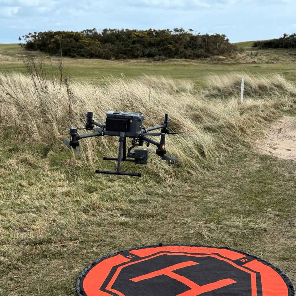
Our coastal survey operations rely on cutting-edge drone technology that combines precision, efficiency, and adaptability. We deploy a fleet of specialized UAVs including the DJI Matrice 300 RTK for its exceptional stability in coastal winds and the waterproof SwellPro Splash Drone for tidal zone surveys.
Each drone comes equipped with multispectral sensors, high-resolution cameras (up to 100MP), and LiDAR systems that capture centimeter-accurate topographical data. For underwater assessment, we’ve integrated ROV capabilities that seamlessly transmit data to our survey teams.
Our software suite includes AI-powered analysis tools that process coastal erosion patterns, vegetation health indices, and structural integrity metrics. We’ve recently added thermal imaging capabilities to detect subsurface water movement and pollution sources that aren’t visible to the naked eye.
Applications Across Drone Coastal Management
Coastal management agencies have dramatically transformed their environmental monitoring and planning capabilities by employing our drone survey services. We’ve helped municipalities track erosion patterns and develop targeted mitigation strategies with unprecedented precision.
Our drones assist in disaster response by mapping storm damage, identifying vulnerable infrastructure, and guiding emergency teams to critical areas. Conservation teams use our services to monitor sensitive habitats without physical disruption, tracking wildlife populations and vegetation changes over time.
Urban planners rely on our elevation data for climate change adaptation planning, while tourism departments benefit from stunning aerial imagery to promote coastal attractions. We’re also helping research institutions document archaeological sites threatened by rising sea levels and providing data for academic studies on coastal ecosystem health.


Why Choose Our Drone Coastal Survey Team
When selecting a coastal survey provider, expertise and equipment quality determine the caliber of results you’ll receive. Our team brings over 15 years of specialized coastal monitoring experience, combining marine science backgrounds with advanced drone piloting certifications.
We’ve invested in cutting-edge technology that outperforms industry standards—including 4K thermal imaging drones and centimeter-accurate LiDAR systems that function perfectly in harsh marine environments. Our proprietary data processing software translates complex coastal information into actionable insights within 48 hours.
We’re fully licensed for UAV operations in restricted airspaces and maintain comprehensive insurance coverage. Unlike competitors who provide raw data dumps, we deliver customized analysis tailored to your specific objectives, whether for environmental compliance, development planning, or erosion monitoring.

Contact Us For Your Drone Coastal Survey Needs
Ready to gain valuable insights about your coastal area? Our team specializes in comprehensive drone coastal surveys that provide detailed data for erosion monitoring, habitat assessment, and development planning.
Reach out today through our dedicated line at +44 7368 537499 or email us at Jamie@skykam.co.uk. We’ll respond within 24 hours to arrange your free consultation.
When contacting us, please include information about the coastal location, survey length, and specific objectives for your project. This helps us prepare a tailored proposal that meets your exact requirements. We serve clients throughout the UK coastline and can schedule surveys to accommodate tidal patterns and weather conditions.
Let’s collaborate to monitor, protect, and better understand your coastal environment with cutting-edge drone technology.